Ngulu (atoll)
| Ngulu | ||
|---|---|---|
| NASA satellite image in false colors with island names added | ||
| Waters | Pacific Ocean | |
| archipelago | Carolines | |
| Geographical location | 8 ° 27 ' N , 137 ° 29' E | |
|
|
||
| Number of islands | 9 | |
| Main island | Ngulu Island | |
| Land area | 40 ha | |
| Lagoon area | 382.56 km² | |
| total area | 438 km² | |
| Residents | 26 (2008) | |
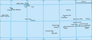
| Yap (state) with Ngulu in the far west | ||
The Ngulu Atoll (formerly: Matelotas Islands ) is located in the southwest of the state of Yap in the Federated States of Micronesia ; it is the westernmost land area of this Micronesian island state.
geography
Ngulu is located about 80 km southwest of the island of Yap . The atoll is 39 km long and up to 25 km wide, with a total area of 438 km² but only has a land area of 0.4 km² (40 hectares).
The nine flat coral islands are divided into two groups in the south and north of the atoll. The main islands are Ngulu Island and North Island. Only Ngulu Island, the southernmost and largest island, is permanently inhabited. The reef segments of the western edge of the atoll have only shallow water depths, with constantly breaking waves, while greater depths prevail on the eastern edge of the atoll, which means that the lagoon is unprotected against east winds.
In 2008, only 26 people lived on the atoll, all on Ngulu Island.
administration
The atoll is one of the smallest municipalities ( municipality ) of the State of Yap.
Ngulu belongs to the second electoral district in Yap state, one of the five electoral districts, along with Ulithi , Fais and Sorol .
natural reserve
Northeast Ngulu Conservation Area includes the islands (or Motu ) Taapuyappu, North, and Mesoran. The area focuses on the protection of sea birds and coconut crabs .
Web links
Individual evidence
- ^ Atoll Area, Depth and Rainfall, 2001 (PDF; 35kB), table from The Geological Society of America . Accessed January 6, 2010
- ↑ http://www.pacificworlds.com/yap/home/location.cfm
- ^ Yap State Code, Title 7, Elections, §111 Election districts
- ↑ The Federated States of Micronesia: National Biodiversity Strategy and Action Plan, 2003 (PDF; 1.1 MB)


