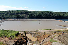
Novobureiski
| Urban-type settlement
Novobureiski
Novoburaysky
|
||||||||||||||||||||||||||||||||||
|
||||||||||||||||||||||||||||||||||
|
||||||||||||||||||||||||||||||||||
Novobureiski ( Russian Новобуре́йский ) is an urban-type settlement in the Amur Oblast ( Russia ) with 8,344 inhabitants (as of October 14, 2010).
geography
The place is about 175 km as the crow flies east-south-east of the Blagoveshchensk Oblast Administrative Center on the right bank of the Bureja . A few kilometers upstream (east) of Novobureiski, the Lower Bureja Dam with hydroelectric power plant (Nizhnebureiskaya GES), which was first planned in the 1930s, has been under construction since 2010 .
Nowobureiski is the administrative headquarters Rajons Bureiski and seat of the municipality (gorodskoje posselenije) Possjolok Nowobureiski, one of the next to the settlement nor the village Nikolaevka.
history
The place was created in 1900 as a resettlement of the village Malinowka a few kilometers downstream (southwest) and was therefore called Malinowski wysselok, later Pristan-Malinowka ("Jetty-Malinowka"), from the construction of the Amur railway in 1910 Pristan-Bureja . From 1935 the official name was Bureja-Pristan ("Bureja-Anlegestelle") and since the status of an urban-type settlement in 1949 finally Novobureiski (about "New Bureja-Siedlung"). Novobureiski has been the center of the Bureiski rajon founded in 1935 since 1963; previously the administrative center was in the settlement of Bureja, 5 km to the north-west .
Population development
| year | Residents |
|---|---|
| 1939 | 3197 |
| 1959 | 5972 |
| 1970 | 8741 |
| 1979 | 8649 |
| 1989 | 8988 |
| 2002 | 8892 |
| 2010 | 8344 |
Note: census data
traffic
To the east of Novobureiski, the M58 Amur road runs from Chita to Khabarovsk, part of the transcontinental road connection. Its 700 m long bridge over the Bureja above the village was built between 1998 and 2001. In Novobureiski the regional road R461 branches off , which continues via Bureja, Progress and Raitschichinsk through the central part of the Seja-Bureja plain via Tambowka to the Oblast center Blagoveshchensk.
Below the village, the Trans-Siberian Railway crosses the Bureja on two bridges, the older of which was completed in 1914 with the then Amur Railway . The closest station is at the Bureja settlement at kilometer 8030 from Moscow. From there a freight connecting railway leads to some companies in Novobureiski.
Individual evidence
- ↑ a b Itogi Vserossijskoj perepisi naselenija 2010 goda. Tom 1. Čislennostʹ i razmeščenie naselenija (Results of the All-Russian Census 2010. Volume 1. Number and distribution of the population). Tables 5 , pp. 12-209; 11 , pp. 312–979 (download from the website of the Federal Service for State Statistics of the Russian Federation)


