Soppe-le-Haut
| Soppe-le-Haut | ||
|---|---|---|

|
|
|
| local community | Le Haut Soultzbach | |
| region | Grand Est | |
| Department | Haut-Rhin | |
| Arrondissement | Thann-Guebwiller | |
| Coordinates | 47 ° 44 ' N , 7 ° 4' E | |
| Post Code | 68780 | |
| Former INSEE code | 68314 | |
| Incorporation | January 1, 2016 | |
| status | Commune déléguée | |
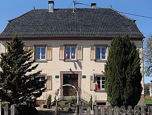
 former Mairie von Soppe-le-Haut |
||
Soppe-le-Haut (German Obersulzbach ) is a former French commune with 554 inhabitants (as of January 1, 2017) in the Haut-Rhin department in the Grand Est region (until 2015 Alsace ). It belonged to the Arrondissement Thann-Guebwiller and the community association Vallée de la Doller et du Soultzbach .
With effect from January 1, 2016, the former municipalities of Soppe-le-Haut and Mortzwiller were merged into a commune nouvelle called Le Haut Soultzbach .
geography
Soppe-le-Haut is located in the Soultzbachtal in the southeastern Vosges , about 20 kilometers west of Mulhouse and 20 kilometers northeast of Belfort . In the southwest, Soppe-le-Haut borders on the Bourgogne-Franche-Comté region , which also forms the Rhine-Rhône watershed here.
history
The originally German name and the river of the same name mean something like salty brook . It is assumed that there was already a settlement near a fort on the site of the village in Gallo-Roman times, which was on the Roman road from Mandeure to Artzenheim . Around the year 1100 the name of the place appears for the first time with the foundation of the priory of St. Morand in Altkirch and St. Nikolaus in Rougemont .
Population development
| year | 1962 | 1968 | 1975 | 1982 | 1990 | 1999 | 2007 | 2013 | |
| Residents | 258 | 259 | 257 | 336 | 442 | 517 | 571 | 567 | |
| Source: Cassini | |||||||||
Attractions
See also: List of the Monuments historiques in Le Haut Soultzbach
The Church of St. Margarethen ( Église Sainte-Marguerite ) dates from the 3rd quarter of the 18th century. It was built in place of a previous building while retaining the tower from 1469. Since 1995 the church has been classified as a monument historique .
Personalities
- Landolin Winterer (1832–1911), Catholic priest, writer and member of the German Reichstag .
- Joseph Remy (1857–1936), Member of Parliament and Mayor of Wattwiller
Transport links
The D 48 road from Lauw to Soppe-le-Bas leads through the village of Soppe-le-Haut . The D 483 trunk road and the A 36 autoroute run parallel to the southwest of the village (both from Belfort to Mulhouse ). The station in Sentheim , three kilometers north of Soppe-le-Haut, is the terminus of the Train Thur Doller Alsace museum railway line , which is mainly operated by steam locomotives from Cernay . In Cernay there is a connection to the Mulhouse – Vallée de la Thur tram-train .
literature
- Le Patrimoine des Communes du Haut-Rhin. Flohic Editions, Volume 1, Paris 1998, ISBN 2-84234-036-1 , pp. 747-748.
supporting documents
- ↑ Soppe-le-Haut on ot-masevaux-doller.fr. (doc; 1.9 MB) Retrieved May 5, 2011 (French).
- ↑ Soppe-le-Haut on cassini.ehess.fr
- ^ Entry in the Base Mérimée of the French Ministry of Culture. Retrieved May 5, 2011 (French).


