
Parañaque
|
City of Parañaque Lungsod ng Parañaque |
|||
| Location of Parañaque in the Philippines | |||
|---|---|---|---|

|
|||
| Basic data | |||
| Region : | Metro Manila | ||
| Barangays : | 16 | ||
| District: | 2. District of | ||
| PSGC : | 137604000 | ||
| Income class : | 1st income bracket | ||
| Households : |
May 1, 2000 census
|
||
| Population : | 665.822 August 1, 2015 census
|
||
| Population density : | 13,961 inhabitants per km² | ||
| Area : | 47.69 km² | ||
| Coordinates : | 14 ° 28 ′ N , 121 ° 1 ′ E | ||
| Postal code : | 1700 | ||
| Area code : | +63 2 | ||
| Mayor : | Edwin L. Olivarez | ||
| Website: | www.paranaque.gov.ph | ||
| Geographical location in the Philippines | |||
|
|||

Parañaque (officially: City of Parañaque ; Filipino : Lungsod ng Parañaque ) is a city in the metropolitan area of Manila in the Philippines . The population is 588,126 according to a 2010 survey. The city is surrounded by Pasay City in the north, Taguig City in the northeast, Muntinlupa City in the southeast, Las Piñas in the southwest and Manila Bay in the west.
Manila Airport (“Ninoy Aquino International Airport”) is located in the city area . There is a campus of the Polytechnic University of the Philippines in the community . The Baclaran Church in Barangay Baclaran is one of the most famous churches in the Metro Manila area .
Barangays
The city of Parañaque is politically divided into 2 districts, which in turn consist of 8 barangays each.
|
District 1 Barangays
|
District 2 Barangays
|
Sons and daughters
- Julito Buhisan Cortes (* 1956), Catholic clergyman and Bishop of Dumaguete
- Edward S. Hagedorn (* 1946), politician
- Emilio Layon Bataclan (* 1940), Catholic clergyman and auxiliary bishop emeritus in Cebu
- Francisco Mendoza de Leon (* 1947), Catholic clergyman and Bishop of Antipolo
- Chat Silayan (1959–2006), model and actress
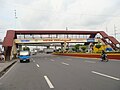
Images from Parañaque

Aerial view of Parañaque

Baclaran's Church
Parañaque City


