
Taguig
| Taguig | |||
| Location of Taguig in the Metro Manila Province | |||
|---|---|---|---|

|
|||
| Basic data | |||
| Region : | Metro Manila | ||
| Province : | Metro Manila | ||
| Barangays : | 28 | ||
| District: | 4. Metro Manila District | ||
| PSGC : | 137607000 | ||
| Income class : | 1st income bracket | ||
| Households : |
May 1, 2000 census
|
||
| Population : | 804.915 August 1, 2015 census
|
||
| Population density : | 17,804 inhabitants per km² | ||
| Area : | 45.21 km² | ||
| Coordinates : | 14 ° 32 ' N , 121 ° 4' E | ||
| Postal code : | 1630 to 1634 | ||
| Website: | The Taguig City website | ||
| Geographical location in the Philippines | |||
|
|||

Taguig , Tagalog : Lungsod ng Taguig , officially City of Taguig , is a Filipino Component City in the metropolitan area of Metro Manila . According to the 2015 census, Taguig had 804,915 residents who lived in 28 barangays . It is classified as the first income class community in the Philippines and highly urbanized .
geography
The city is located on the northwestern shore of the largest inland lake in the Philippines, the Laguna de Bay , in the southeast of the central Luzon Plain. Taguig neighboring communities are Makati City , Cainta and Taytay , Pateros and Pasig City in the north, Pasay City in the west, Parañaque City in the southwest and Muntinlupa City in the south. The topography of the city is characterized by flat land and the mountainous foothills of the Sierra Madre in the northeast. The plains are crossed by some partly navigable canals.
history
The area of Taguig was an important settlement area of the Tagalog long before the Spanish colonization . The soils are fertile and the flow Napindan flows through the area, a tributary of the Pasig River . Before the arrival of the Spaniards under Miguel López de Legazpi , the area was under the rule of Rajah Sulayman . About 800 families lived in the area of today's metropolis, they lived from agriculture and fishing. There were also trade contacts with Chinese merchants. Chinese trade goods were found during archaeological excavations ; they date from the Ming Dynasty .
After the battle of Bangkusay on June 3, 1571, the area was incorporated into the Spanish colonial empire and was under the administration of the Encomienda del Tondo . On April 25, 1587, the community became an independent administrative unit, in the form of a barrios in the administrative area of the Archdiocese of Manila . Taguig became an independent municipality on March 29, 1900 and on December 8, 2004 Taguig was given the status of a Component City.
Barangays
|
|
|
|
Colleges
gallery

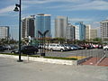
Fort Bonifacio skyline

Philippine National Railways stop in Taguig
Fort Bonifacio

Residential houses in Taguig


