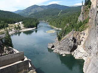
Pend Oreille River
|
Pend Oreille River Pend d'Oreille River, Pend-d'Oreille River |
||
|
The catchment area of the Pend Oreille River with its tributaries |
||
| Data | ||
| Water code | US : 1533197 | |
| location |
Washington , Idaho ( USA ), British Columbia ( Canada ) |
|
| River system | Columbia River | |
| Drain over | Columbia River → Pacific Ocean | |
| source |
Lake Pend Oreille 48 ° 15 ′ 30 ″ N , 116 ° 32 ′ 4 ″ W. |
|
| Source height | 630 m | |
| muzzle | in the Columbia River coordinates: 49 ° 15′0 ″ N , 117 ° 37′10 ″ W 49 ° 15′0 ″ N , 117 ° 37′10 ″ W. |
|
| Mouth height | 49 m | |
| Height difference | 581 m | |
| Bottom slope | 2.8 ‰ | |
| length | 209 km | |
| Catchment area | 66,874 km² | |
| Discharge at gauge border USA-Canada Location: 25.9 km above the mouth |
MQ MHQ |
748 m³ / s 4851 m³ / s |
| Right tributaries | Priest River , Salmo River | |
|
Pend Oreille River below the Boundary Dam |
||
|
Location of the dams on the Pend Oreille River |
||
The Pend Oreille River is a 209 km long tributary of the Columbia River in northern Idaho , northeast Washington in the United States, and known as the Pend d'Oreille River or Pend-d'Oreille River in southeast British Columbia in Canada .
It drains an area of the Rocky Mountains east of the Columbia River on the border between the United States and Canada . The catchment area of the river covers an area of 66,874 km², to which mainly the Clark Fork and its tributaries in western Montana contribute. The river is also referred to in some publications as the lower part of the Clark Fork River.
Run
The Pend Oreille River has its origin in Lake Pend Oreille in Bonner County , Idaho. He leaves the lake at the western end near Sandpoint . The Clark Fork River is the lake's largest tributary at the eastern end. The river flows to the west and increases from north to Priest River and then reaches in Newport , the Pend Oreille County in northeastern Washington. It then swings north along the eastern flank of the Selkirk Mountains . It follows a roughly 80 km parallel to the state border with Idaho through the Colville National Forest , past Tiger and Metaline Falls and finally it crosses the international border into the southeast of the Canadian province of British Columbia. In an approximately 25 km long arc it turns west and flows 8 km south of Montrose , only 3 km north of the border into the Columbia River.
Hydropower plants and dams
There are five hydropower plants with associated dams on the Pend Oreille River. In the direction of discharge these are:
- Dams in the United States
- Albeni Falls Dam ( United States Army Corps of Engineers )
- Box Canyon Dam (Pend Oreille PUD)
- Boundary Dam (Seattle City Light)
- Dams in Canada
- Seven Mile Dam ( BC Hydro )
- Waneta Dam ( Teck Cominco )
There was no fish ladder at any of these dams in the early 2010s .
Hydrology
The United States Geological Survey has been operating a gauge on the Canadian border since November 1908 . The average annual runoff there is 750 m³ / s. The highest value ever observed was measured on June 13, 1948 with 4860 m³ / s, no measurable flow existed due to water level controls on several days in August and September 1988 and on August 7, 1994.
Different names
The Geographic Names Information System lists a number of alternative names for this river. These are:
- Bitter Root River, Bitterroot River
- Clark Fork, Clarke Fork, Clarke's Fork, Clarks Fork, Clark's Fork
- Deer Lodge River
- Hell Gate River
- Missoula River
- Silver Bow River
Web links
Individual evidence
- ↑ USGS - GNIS - Lake Pend Oreille
- ↑ USGS - GNIS - Pend Oreille River
- ^ Pend Oreille River in the United States Geological Survey's Geographic Names Information System
- ↑ Pend Oreille River ( Memento of the original from May 11, 2005 in the Internet Archive ) Info: The archive link was automatically inserted and not yet checked. Please check the original and archive link according to the instructions and then remove this notice. , The Columbia Gazetteer of North America. 2000.
- ↑ Pend d'Oreille River . In: BC Geographical Names (English)
- ^ Pend Oreille Drainage , Idaho State University
- ↑ Water Data Report WA-05-1 , Chapter Pend Oreille, Kettle, and Colville River Basins, and the Columbia River from the International Boundary to the confluence with the Spokane River (PDF, accessed July 10, 2008, English; 2, 1 MB)


