Počúvadlo
| Počúvadlo | ||
|---|---|---|
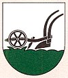
| coat of arms | map | |

|
|
|
| Basic data | ||
| State : | Slovakia | |
| Kraj : | Banskobystrický kraj | |
| Okres : | Banská Štiavnica | |
| Region : | Pohrony | |
| Area : | 15.508 km² | |
| Residents : | 96 (Dec. 31, 2019) | |
| Population density : | 6 inhabitants per km² | |
| Height : | 540 m nm | |
| Postal code : | 969 75 ( Baďan post office ) | |
| Telephone code : | 0 45 | |
| Geographic location : | 48 ° 22 ' N , 18 ° 50' E | |
| License plate : | BS | |
| Kód obce : | 517160 | |
| structure | ||
| Community type : | local community | |
| Administration (as of November 2018) | ||
| Mayor : | Dušan Triebušník | |
| Address: | Obecný úrad Počúvadlo 63 969 75 Baďan |
|
| Website: | www.pocuvadlo.sk | |
| Statistics information on statistics.sk | ||
Počúvadlo (1927-1948 Slovak "Pocuvadlo"; German Pockhaus , Hungarian Bacsófalva - to 1892 Pocsuvadló ) is a small community in the middle of Slovakia , with 96 inhabitants (31 of December 2019), which for Okres Banská Štiavnica , a circle of Banskobystrický kraj belongs.
geography
The municipality is located in the Štiavnické vrchy Mountains by the Počúvadlianský brook , 15 kilometers south of Banska Štiavnica .
history
Počúvadlo was first mentioned in writing as Pocholla in 1333 , when it belonged to Lewenz Castle . From the 17th century it belonged to the Schemnitz Mining Chamber. In 1828 there were 41 houses and 250 inhabitants who were employed in forestry, mining and charcoal burning.
population
Results after the 2001 census (131 inhabitants):
|
By ethnicity:
|
By religion:
|
Attractions
- Baroque Protestant church from 1771
- Reservoir Počúvadlianske jazero north of the municipality, belongs to the group of tajchy (German pond )
- Starting point for Mount Sitno ( 1009 m nm )
