Podhoria (Banská Štiavnica)
| Podhoria | ||
|---|---|---|
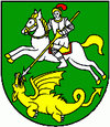
| coat of arms | map | |

|
|
|
| Basic data | ||
| State : | Slovakia | |
| Kraj : | Banskobystrický kraj | |
| Okres : | Banská Štiavnica | |
| Region : | Pohrony | |
| Area : | 21.639 km² | |
| Residents : | 325 (Dec. 31, 2019) | |
| Population density : | 15 inhabitants per km² | |
| Height : | 428 m nm | |
| Postal code : | 969 82 | |
| Telephone code : | 0 45 | |
| Geographic location : | 48 ° 30 ' N , 18 ° 55' E | |
| License plate : | BS | |
| Kód obce : | 517143 | |
| structure | ||
| Community type : | local community | |
| Structure of the municipality: | 2 parts of the community | |
| Administration (as of November 2018) | ||
| Mayor : | Dana Lóžiová | |
| Address: | Obecný úrad Podhorie 84 96982 Podhorie |
|
| Website: | www.podhorie.sk | |
| Statistics information on statistics.sk | ||
Podhorie is a municipality in central Slovakia with 325 inhabitants (as of December 31, 2019).
It is surrounded by the Štiavnica Mountains (Štiavnické vrchy) and was created in 1964 through the merger of towns Teplá (Hungarian Teplafő ) and Žakýl (German Seken , Hungarian Saskőszékely ).
Until 1918 the districts belonged to the Kingdom of Hungary and were in Hont County .
The inhabitants were and are mainly employed in agriculture.
Web links
Commons : Podhorie (Banská Štiavnica) - collection of pictures, videos and audio files

