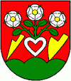
Baďan
| Baďan | ||
|---|---|---|
| coat of arms | map | |

|
|
|
| Basic data | ||
| State : | Slovakia | |
| Kraj : | Banskobystrický kraj | |
| Okres : | Banská Štiavnica | |
| Region : | Pohrony | |
| Area : | 15.11 km² | |
| Residents : | 172 (Dec. 31, 2019) | |
| Population density : | 11 inhabitants per km² | |
| Height : | 427 m nm | |
| Postal code : | 969 75 | |
| Telephone code : | 0 45 | |
| Geographic location : | 48 ° 20 ' N , 18 ° 50' E | |
| License plate : | BS | |
| Kód obce : | 516601 | |
| structure | ||
| Community type : | local community | |
| Structure of the municipality: | 2 parts of the community | |
| Administration (as of November 2018) | ||
| Mayor : | Ľubica Kuková | |
| Address: | Obecný úrad Baďan 11 96975 Baďan |
|
| Statistics information on statistics.sk | ||
Baďan (until 1927 in Slovak also "Baďany"; in Hungarian Bagyan - until 1888 Bagyán ) is a municipality in central Slovakia .
It is surrounded by the Štiavnica Mountains ( Štiavnické vrchy ). The town of Klastava (German Klasittau , Hungarian Kalászi ) , which was incorporated in 1971, belongs to it .
The municipality was already settled in the Neolithic Age, the first written mention as villa Bagun is found in 1245. In the second half of the 16th century, the place was visited by the Turks and temporarily occupied. Until 1918 it belonged to the Kingdom of Hungary and was in Hont County .
The inhabitants were and are mainly employed in agriculture.
The Protestant church in the style of the late Renaissance from 1685 is best known in the village.

