
Rustersieler Groden
|
Rustersieler Groden
City of Wilhelmshaven
Coordinates: 53 ° 33 ′ 57 ″ N , 8 ° 7 ′ 55 ″ E
|
|
|---|---|
| Area : | 5.93 km² |
| Residents : | 53 (2011) |
| Population density : | 9 inhabitants / km² |
| Postal code : | 26388 |
| Area code : | 04421 |
 Location in Wilhelmshaven
|
|

The Rüstersieler Groden is a neighborhood of the Lower Saxon town of Wilhelmshaven with two power plants.
geography
The Rustersieler Groden borders in the north on the dike to the Voslapper Groden and Jade-Weser-Port , in the east on the Innenjade , in the south on the Heppenser Groden and in the west on Voslapp , Rüstersiel and Neuengroden . The Maade flows through the Rüstersieler Groden and flows into the Outer Jade here.
Administratively, the district can be further divided into districts, from north to south:
- Genius bench (with information pavilion on JadeWeserPort and the lighthouse)
- Rustersieler Groden-Nord (with coal-fired power station Engie )
- Rustersieler Groden-Süd (with the former chlorine plant and E.ON coal-fired power plant )
- Maadepolder (with disposal center EZW)
Industry
The district contains the following industrial facilities:
- Wilhelmshaven (Engie) power plant , a hard coal power plant that has been in operation since 2015.
- Ineos Chlorwerk, supplied gaseous chlorine generated by chlor-alkali electrolysis for PVC production in the Voslapp chemical plant until July 2013 .
- Wilhelmshaven power plant (E.ON) , a hard coal power plant in operation since 1976.
history
From 1963, the area of today's district was diked and thus turned into a Groden ; the name comes from the place Rustersiel . In the 1970s the chemical plant and the first power plant were built.
Views

Infobox for the JadeWeserPort
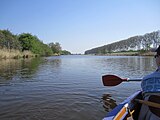
On the Maade

At Maadesiel

Power plant (E.ON)

Top light of the leading light line Voslapp


Web links
Aldenburg | Altengroden | Bant | Ebkeriege | Fedderwarden | Fedderwardergroden | Heppens | Heppenser Groden | Kingdom of Heaven / Coldewei | Inner Harbor | Downtown | JadeWeserPort | Langewerth | Maadebogen | New end | Neuengroden | Rustersiel | Rustersieler Groden | Rüstringer City Park | Schaar | Sengwarden | Siebethsburg | Voslapp | Voslapper Groden