
Rustersiel
|
Rustersiel
City of Wilhelmshaven
Coordinates: 53 ° 33 ′ 53 ″ N , 8 ° 6 ′ 44 ″ E
|
|
|---|---|
| Height : | 3 m |
| Area : | 1.87 km² |
| Residents : | 2075 (2017) |
| Population density : | 1,111 inhabitants / km² |
| Incorporation : | 1937 |
| Postal code : | 26386 |
| Area code : | 04421 |
 Location of Rüstersiel in the city of Wilhelmshaven
|
|

Rustersiel is a district of Wilhelmshaven ; it is characterized by residential developments in the southern and central part, predominantly single-family houses, and has retained a certain village character. There is an industrial park in the northern part.
geography
Rustersiel borders Neuengroden in the south , Altengroden in the west on Freiligrathstrasse , Fedderwardergroden in the north- west and Voslapp in the north on Niedersachsendamm . In the east, the Friesendamm forms the border with the Rustersieler Groden .
The center of Rüstersiel is the port with its boat moorings on the Maade River . The institute for bird research "Vogelwarte Helgoland" is located in the former Fort Rustersiel .
history
The former Sielhafen of Rüstersiel was originally of great importance for the region, but today it only shapes the image of Rüstersiel visually. Around 1920 it was mentioned in the world port register as a "port for small ships". The district emerged from the two Sielhafen towns of Kniphausersiel and Rüstringer- siel. Rustersiel was incorporated into Wilhelmshaven at the end of the 1930s. After the construction of the Maadesiel in 1951, Rüstersiel was cut off from its direct access to the sea, so that the handling of goods came to a standstill. Then the pleasure craft moved into the harbor, which is a popular destination for sailors and landlubbers in summer. Outside the sailing season, the harbor is winter storage for many pleasure craft.
Before the First World War
The history of Rüstersiel began in 1520 with the construction of the 1st Kniphauser Siel, a little south of today's Kreuzelwerk farm. At the same time, the town of Kniphausersiel was built on the northern bank of the Maade . It was not until around 1607 that the farming community of Rüstringersiel came into being south of the Maade river, later called Rustersiel from around 1868. The Doppelsielhafenort Kniphausersiel-Rüstersiel existed until 1937/38. Then both places were incorporated into Wilhelmshaven. Ecclesiastically, the Rustersielers mostly belonged to the Protestant parish Neuende or today to Altengroden, whereas the Kniphausersieler belonged to Fedderwarden (Kniphausen).
The construction of the Rustersiel Fort was started in 1876 as part of a fortress plan for the Imperial War Port Wilhelmshaven. Up until 1911, Rüstersiel lived mainly from the income from the Sielhafen and the soldiers stationed in the Rüstersieler Fort. However, these were withdrawn in 1911.
Between the wars: North Sea resort, settlement, incorporation
From this point on, a new era began for Rüstersiel. So a bold project was born out of the regulars' table idea of some business people: the North Sea resort of Rüstersiel. The realization of this idea was a complete success. So one advertised z. B. in newspapers from southern Germany and the Rhineland for the North Sea resort of Rüstersiel. This upswing was only slowed down by the First World War . After the end of the war, bathing was successfully resumed. The fact that the Rüstersielers were so successful is probably due to their clever concept. Since at that time only the wealthy could afford a vacation in a North Sea resort, the Rüstersielers concentrated on the middle class. The slogan of the time also fitted in with this: "If relaxation is the goal, not luxury, then only choose Rustersiel as the North Sea resort!" The history of the North Sea resort of Rustersiel ended in 1939 when all the beach facilities were destroyed in a storm surge . Due to the Second World War and the emerging plans to dike the Rüstersieler Watts , the destroyed facilities were not rebuilt.
After the beginning of the embankment of the Waage groden (1927) with the construction of the Rüstersieler sea dike, the planning of the "settlement" in Kniphausersiel began in the following years. In 1929 the first topping-out ceremony was held in the settlement. In the initial phase, the newly developed building area looked rather bleak and deserted. This is why the settlement got the name "Kummersdorf". After the first years had passed, one could no longer speak of a "Kummersdorf". The problems that had to be overcome soon led to strong solidarity among the settlers. In 1949, the settlers joined the German Settlers Association (Voslapp district group), which later became the Rustersiel community.
On April 1, 1937, after the amalgamation of Rüstringen and Wilhelmshaven, Rustersiel was incorporated. As a result of a regional reform on June 1, 1938, Kniphausersiel was also incorporated into Wilhelmshaven.
After the Second World War
The port and seaside resort was cut off from the North Sea due to the dike in the Rüstersieler Watts and the construction of the Maadesiel (1948–1951) approx. 3 km away . Although the fishermen called at other ports with their cutters, the port was not orphaned, but presented itself in a new guise. This was ensured by the Rüstersieler Segler Club (RSC), the sailing comradeship Geniusbank (SKG) and the Maadesiel water sports club (WSV).
In the years from 1949 to 1962, Rüstersiel was the seat of the University for Work, Politics and Economics . One of the best-known graduates is the former Federal Minister for Labor and Social Affairs Herbert Ehrenberg . In 1962 the University of Social Sciences was relocated to Göttingen and part of the Georg-August University of Göttingen , another part, the University of Education, moved to Hanover in 1958 .
The new Maade bridge was inaugurated in 1968. In 1971 the old sewer in Rüstersiel was demolished and the adjacent dike was removed. During the dredging work, the remains of the 1st and 2nd Rüstersieler sluice were recovered. In 1993, after three years of construction, the new Maadesiel was inaugurated in the Rustersieler Groden district. The old Maadesiel about 200 meters away was demolished.
The naval support command, which had been housed in the former university village until then , was withdrawn from Rustersiel in 1994, with the exception of the print shop still located there today. The barracks were then torn down and single-family and row houses were built on the site.
In 1995, Rüstersiel celebrated its 475th anniversary, which was actually the 475th anniversary of the construction of the 1st Kniphauser Siel.
Residents
development
Along with Schaar, Rüstersiel is one of the districts that have grown enormously in recent years. From 1997 to 2007 the population of Rüstersiel increased by 52.8%. In 2009, Rüstersiel had a peak in population with 2162 inhabitants. From 2010, however, the number of immigrants decreased, with the population totaling 2075 in 2017.
Share of foreigners and migrants
The proportion of foreigners was 2.3% in 2007 and 2.4% in 2017, with a Wilhelmshaven average of 9.6%. The proportion of migrants is 9.5% with an urban average of 21.8%.
colonization
The area of the district is 186.7 hectares and is roughly the same size as the neighboring district of Voslapp . In contrast, Rüstersiel is sparsely populated due to its almost exclusive development with single-family houses. The arithmetical population density of Rüstersiel is 11.4 inhabitants per hectare.
Age
The district of Rüstersiel has the fourth youngest population of all Wilhelmshaven districts. Only Schaar , Bant and the Rüstringer Stadtpark have - in this regard - a lower average age. The average age of the Rüstersielers is 45 years. This means that the district is exactly in the average of the city as a whole. Mainly 50 to under 55 year olds live in the district. Around 12% of Rüstersielers belong to this age group.
marital status
Rustersiel has a high percentage of married couples (53.5%). Despite this, only 24.3% of the Rüstersielers live with one or more children on their property.
Movement of residents
Up until 2009, Rustersiel belonged to one of the districts that had a surplus of births. This has mostly been the case since 2010. In 2017, however, deaths (21) outweighed births (15).
There was a negative result for the spatial movement of residents. While it was still possible to compensate for the outward migration beyond the city limits, there was a minus of 9 inhabitants for the inner city removals.
Facilities and infrastructure
Rustersiel itself has a primary school, a sports boat harbor and a few grocery stores, but otherwise hardly any shopping, cultural or entertainment options. In the neighboring districts there are z. B. Shopping markets and the Störtebeker Park as well as the Evangelical Apostle Johannes Church .
The largest employer is a plant of Greenland Seafood Wilhelmshaven GmbH (until December 2013: Royal Greenland Seafood GmbH ), in which (as of 2014) over 400 people produce 1.3 million meals every working day. Immediately next to it is a Nordfrost Group's cold store .
Since March 1966 the Heligoland ornithological station has had its headquarters in the former Fort Rustersiel.
Local public transport takes place with buses operated by Stadtwerke-Verkehrsgesellschaft Wilhelmshaven .
Views

Harbor in the dusk location

Community space location

Village square location
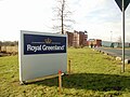
Royal Greenland Seafood location

Bascule bridge over the Maade location

Fallen memorial location

Fort Rustersiel with the bird observatory from the air

GSI SLV welding training center

Greenland Seafood Plant


Individual evidence
- ^ City of Wilhelmshaven: Small-scale population statistics. December 31, 2017, accessed November 25, 2018 .
- ^ City of Wilhelmshaven: settlement of Rüstersiel. December 31, 2007, accessed November 25, 2018 .
- ^ City of Wilhelmshaven: Rustersiel district. December 31, 2017, accessed November 25, 2018 .
- ↑ Greenland Seafood website, December 2014
Web links
Aldenburg | Altengroden | Bant | Ebkeriege | Fedderwarden | Fedderwardergroden | Heppens | Heppenser Groden | Kingdom of Heaven / Coldewei | Inner Harbor | Downtown | JadeWeserPort | Langewerth | Maadebogen | New end | Neuengroden | Rustersiel | Rustersieler Groden | Rüstringer City Park | Schaar | Sengwarden | Siebethsburg | Voslapp | Voslapper Groden