Sandur (Faroe Islands)
| coat of arms | Map (from 2005) |
|---|---|
| no coat of arms yet | |
| Basic data | |
| Surface: | 48 km² |
| Population (2007): | 586 |
| Population density : | 12 inhabitants / km² |
| Markatal : | 97 |
| Topographic map | |
Sandur ( Danish : sand = sandy beach ) is a place in the Faroe Islands in the west of Sandoy on the south coast. The 11th century coin find of Sandur points to an ancient history of the place.
- Population: 599 (as of December 31, 2004)
- Postal code: FO-210
- Municipality : Sands kommuna
- Football club : B71 Sandur
The municipality of Sandur consists of this one place. Sandur is the most populous place on the sand island . Sandur is located on a peninsula between the lakes Gróthúsvatn in the northwest and Sandsvatn in the northeast and the two opposite bays Grótvík and Sandsvágur in the south.
1100 years of history
- see also: Viking Age on the Faroe Islands , coin find from Sandur ; Church history of the Faroe Islands , Church of Sandur

Sandur is an old thing site, where the local várting was held every year . According to the latest results of archeology (summer 2006) the place was already settled by Vikings around 900.
Earlier excavations have unearthed an 11th century stave church on this site . The sacred building from 1839, a typical Faroese wooden church with a grass roof, is located in the same place . In 1988 she was the victim of a devastating fire that melted all the church silver. It turned out to be arson . But it was restored the following year, just in time for the 150th anniversary. See main article: Church of Sandur
In 1863, when the churchyard was being expanded, a silver treasure was found consisting of 98 coins from the 11th century, half of which were of German origin, see: Coin find from Sandur .
In 1989 archaeologists also discovered a pagan burial site from the Viking Age on the Faroe Islands . The skeleton of the early Faroese woman in the 150 cm long grave was well preserved. Three amber beads , a blue glass bead and a knife were found on her.
In the open-air museum of the Danish National Museum near Copenhagen you can see a water mill that was originally built in Sandur in the 18th century.
Sands Bygdasavn is the name of the village museum where objects from the everyday life of the ancestors are shown. It is open in the summer months.
In the meantime (2006) the place has its own art museum and, thanks to a local patron, soon also its own library.
Transport and tourism
The journey from Tórshavn leads via the ferry ports Gamlarætt and Skopun . From there on road 30 along Sandsvatn to Sandur.

The Munkinum campsite is the only one on Sandoy. This is why Sandur is the preferred location for many visitors when they are on the island. There are also the fishing grounds of Sandsvatn and Gróthúsvatn.
All places on the island can be reached from Sandur by bus and are therefore suitable for day trips. Due to the favorable topography of the island, the hiking tours are also suitable for normal walkers and cyclists. Particularly recommended are the detours to the west coast to Søltuvík , to Skarvanes in the south (there are more challenging hiking opportunities) and Húsavík on the east coast.
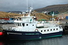
The small passenger ferry M / S Sildberin runs from Sandur to the island of Skúvoy to the south . A special attraction is the tour in the Faroese rowing boat Hvíthamar from Sandur to the bird mountains on the west coast or to Skúvoy. The boat builder Jóan Petur Clementsen rows himself.
Web links
- Faroeislands.dk: Sandur (in English. Info and photos)
- Official website of the Tourist Office in Sandur
Coordinates: 61 ° 51 ′ N , 6 ° 48 ′ W


