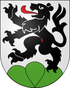
Schwarzenburg district
| Schwarzenburg district | |
|---|---|
| Basic data | |
| Country: |
|
| Canton : |
|
| Main town : | Electors |
| Area : | 157.11 km² |
| Residents: | 9950 (December 31, 2008) |
| Population density : | 63 inhabitants per km² |
| map | |
The Schwarzenburg district was an administrative unit of the Canton of Bern until December 31, 2009 . The administrative district with the capital Schwarzenburg (former municipality Wahlern ) comprised four municipalities with 9,950 inhabitants (as of December 31, 2008) on 157.11 km². The area is known under the name Schwarzenburgerland .
Communities
| Name of the parish | Residents | Area in km² | Inhabitants per km² |
|---|---|---|---|
| Albligen | 468 (December 31, 2009) |
4.30 | 109 |
| Guggisberg | 1556 (December 31, 2013) |
54.91 | 28 |
| Rüschegg | 1615 (December 31, 2013) |
57.30 | 28 |
| Electors | 6248 (December 31, 2009) |
40.60 | 154 |
| Total (4) | 9887 | 157.11 | 63 |
Changes in the community
- 1860: Split from Guggisberg → Rüschegg
- 2010: District change of all 4 municipalities from the Schwarzenburg district → Bern-Mittelland administrative district
Web links
Commons : Schwarzenburgerland - collection of images, videos and audio files
- Anne-Marie Dubler : Schwarzenburg (district). In: Historical Lexicon of Switzerland .
- Anne-Marie Dubler: Schwarzenburgerland. In: Historical Lexicon of Switzerland .


