
Rüschegg
| Rüschegg | |
|---|---|
 |
|
| State : |
|
| Canton : |
|
| Administrative district : | Bern-Mittelland |
| BFS no. : | 0853 |
| Postal code : | 3153, 3154 |
| Coordinates : | 596520 / 180980 |
| Height : | 890 m above sea level M. |
| Height range : | 701–2188 m above sea level M. |
| Area : | 57.30 km² |
| Residents: | 1662 (December 31, 2018) |
| Population density : | 29 inhabitants per km² |
| Website: | www.rueschegg.ch |
 View of the Rüschegg hill with the church |
|
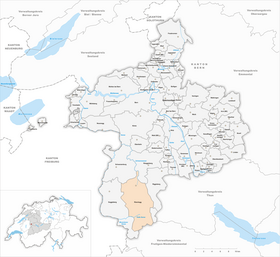
| Location of the municipality | |
  |
|
Rüschegg ( Bern German [ryʃek] ) is a mixed municipality in the Bern-Mittelland administrative district of the Swiss canton of Bern, formed in 2010 .
coat of arms
|
|
Blazon : “ In gold, a black lion's paw growing from the upper left corner, holding a green fir tree with a red trunk, which is placed at an angle to the right. » |
| Justification of the coat of arms: The lion's paw refers to the coat of arms of the district of Schwarzenburg, the fir tree symbolizes the wealth of forests in Rüschegg. The municipal coat of arms was created in 1941 and recognized by the government council in 1945 . |
geography
The northernmost, at the same time the deepest third of the municipality includes numerous farmsteads in scattered settlement as well as the four places Gambach, Hirschhorn, Heubach and Rüschegg-Graben . They are located around the Rüschegg hill, on which the common church stands (937 m above sea level). The continuously inhabited part of the community is drained by numerous streams, including the Gambach, Heubach, Wyssbach and Schwarzwasser . The lowest point is 714 m above sea level. M.
To the south is the range of hills of Egg (Pfyffe 1666 m above sea level), Schüpfenfluh (1720 m above sea level) and Selibühl (1750 m above sea level). This area has no permanently inhabited settlements.
The southern boundary of the municipality is formed by the three Bernese foothills of the Alps, Gantrisch (2176 m above sea level), Bürglen (2165 m above sea level) and Ochsen (2188 m above sea level). One of the source rivers of the Sense , the Cold Sense, has its source here . The only year-round inhabited settlement in this part of the municipality is the Kurhaus Schwefelberg-Bad .
The neighboring communities starting from the west in a clockwise direction are Guggisberg , Schwarzenburg , Rüeggisberg , Riggisberg , Därstetten and Oberwil im Simmental .
geology
The area around the Rüschegg hill consists of sandstone-rich molasses of the tertiary era . The Molasse partly goes over to Nagelfluh . Higher layers also consist of moraine material . Tectonically, the area belongs to the flat, subalpine molasse of the Molasse basin.
The range of hills from Egg, Schüpfenfluh and Selibühl to the south consists of sandstone-rich flysch . It is about Cretaceous sediments . Tectonically this part is the so-called Gurnigel - ceiling counted.
The Gantrisch range consists of limestone interspersed with marls and marl slates. This part of Rüschegg is the oldest in geological terms and belongs to the Jura and the Chalk. Tectonically, the Gantrisch chain belongs to the middle Penninic nappes.
Floors
From a geomorphological point of view, large parts of the municipality are fluvial slopes. These are shaped by the last glaciation of the Würm Ice Age. The Gantrisch chain is karstified . There are major landslides and subsidence.
The soils consist of brown earth , moldy humosem gley and regosol . These soils are of moderate to very poor agricultural suitability. The Gantrisch range is rocky, unproductive soil.
As a result, this area of the western pre-Alps offers little arable land, but a lot of grassland, extensive forests (40% of the municipal area), shrub and herb vegetation as well as alpine lawns. The proportion of coniferous wood in forests is between 60% and 80%, spruce is predominant .
Protected areas
A boulder on the Wyssbach and the Gantrischseeli are under nature protection.
The black water from Heubach to Sackau was included in the federal inventory of floodplain areas of national importance . The total area of this floodplain area is 107 hectares (share of the municipality of Rüschegg approx. 25%). A cantonal forest reserve Teuffengraben / Sackau with a total of 75 hectares does not exactly coincide . The Süftene forest area was left destroyed after hurricane Lothar (1999) and placed under protection.
Fourteen fens in Rüschegg with a total area of around 460 hectares were included in the federal inventory of fens of national importance . In addition, around 30 hectares of raised bog have been inventoried in the federal inventory of raised and transitional bogs of national importance . The entire Gurnigel / Gantrisch moorland reserve covers around 4,500 hectares.
The Gurnigel and Gantrisch areas are listed in the federal inventory of water and migratory bird reserves of international and national importance as a bird sanctuary of international importance.
population
| Population development | |||
|---|---|---|---|
| year | Residents | year | Residents |
| 1860 | 2263 | 1941 | 2062 |
| 1870 | 2354 | 1950 | 1872 |
| 1880 | 2340 | 1960 | 1628 |
| 1888 | 2399 | 1970 | 1346 |
| 1900 | 2318 | 1980 | 1274 |
| 1910 | 2400 | 1990 | 1465 |
| 1920 | 2364 | 2000 | 1628 |
| 1930 | 2104 | 2010 | 1656 |
In 1888, 37% of those entitled to reside in Rüschegg (1664), but only 10% (1022) in 1950. The sharp population decline of almost 50% between 1910 and the mid-1970s caused the Municipality to invest more in building renovations. Federal and cantonal contributions as part of a housing renovation program for mountain areas provided support. Since then, the community's population has grown again by around 30%. Due to the influx of commuters , Heubach in particular has grown significantly.
languages
97% (2000) of the population are German-speaking. The long-time residents use a variant of Bern German in daily use , which is very closely related to the neighboring Guggisberg dialect.
Religions and denominations

84% (2000) of the population are Protestant Reformed . Rüschegg has belonged to the Guggisberg parish since the Reformation . Already in 1744 a branch cemetery was approved in Hirschhorn. In 1809 a parish ministry was established and in 1812/13 the architect Johann Daniel Osterrieth built the church at a prominent location on the Rüschegg hill. With the political separation from Guggisberg in 1860, the church was replaced. The church received an organ in 1869 , a steeple in 1898 to replace the roof turret and was renovated from 1957 to 1960.
Another 6% each (2000) are Roman Catholic or have no denomination.
politics
Rüschegg is a mixed community , that is, the civic community is united with the resident community . The community assembly is the highest organ and is convened twice a year. At the community meeting following the proportional representation, it elects the community president from the 7 members of the community council and the chairman of the meeting from the elected members of the business and auditing committee. Since January 1, 2017, Markus Hirschi has been elected as mayor and Walter Hertig as chairman of the meeting.
| National Council elections in 2003, 2007, 2011 and 2015 | ||||
|---|---|---|---|---|
| Political party | Share of votes in 2003 | Share of votes in 2007 | Share of votes in 2011 | Share of votes in 2015 |
| SVP | 40% | 47% | 44% | 49.1% |
| SP | 20% | 14% | 14% | 13% |
| BDP | - | - | 13% | 11.1% |
| SD / EDU | 14% | 7% | 4% | 3.4% |
| Green | 11% | 11% | 8th % | 6.5% |
| FDP | 9% | 11% | 6% | 5% |
| CVP | -% | -% | -% | 2.7% |
The current municipal council consists of 2 SVP members, one FDP member and 4 independent members (summarized under Uue - independent and committed).
The voting behavior in cantonal and federal bills is currently a few percentage points more liberal than in the neighboring municipality of Guggisberg, but overall, it is typical for a rural municipality in Bern. The turnout in the 2007 National Council elections was 39% and in the 2011 National Council elections 44%.
The seat of the municipal administration is Hirschhorn.
economy
The community is characterized above average by agriculture and livestock farming, even if the structural change since the 1980s cannot be overlooked. Rüschegg has no industry. Some commercial enterprises in the construction industry (wood processing) are located. The basket weavers and peddlers, which were still widespread in the 19th century (in 1900 almost 300 Rüscheggers had appropriate cantonal permits), disappeared completely in the second half of the 20th century.
In Heubach there is a branch of Coop (Switzerland) as well as a doctor's practice and an old people's home.
Since 1953, Rüschegg has received annual grants from the cantonal financial equalization scheme. In 1964 the taxpower per capita was only 28% of the cantonal average; in 1978 it had risen to just under 50%. The share of legal entities in the direct federal tax revenue is only 4% (1997/98). For comparison: in the canton of Bern the value is 23%.
tourism
To the south of Heubach are the Eywald (with public swimming pool and tennis court) and Gustern holiday areas . The Kurhaus Schwefelberg-Bad is located in the Gantrisch area . The Grandhotel Gurnigelbad in the neighboring municipality of Riggisberg was an important employer until the Second World War.
Summer tourism is mostly limited to day-trippers who come from the agglomeration of Bern to hike. The first dry jumping hill in Switzerland existed in Heubach since 1963 (demolished at the beginning of the 1980s) and in Rüschegg-Graben there was a mini golf course. In winter, ski lifts are operated in the Eywald, Selital and at the Kurhaus Schwefelberg-Bad, and cross-country ski trails are marked. The Gantrisch rope park in the hamlet of Längeneybad is open from April to October . It offers seven courses of various levels of difficulty with platforms up to 36 m high.
Rüschegg has been a member of the Schwarzwasser planning region since 1974, which has since merged into the Gantrisch planning region. This consciously promotes gentle tourism in this local recreation area in Bern. There were conflicts with the Swiss Army, which operates a tank firing range in the Selibühl area.
traffic
A post bus line from Schwarzenburg BE station to Riggisberg has been providing access to the four towns around the Rüschegg hill since 1928. The post office has been run as a post agency in the COOP branch in Heubach since spring 2017.
In 1913, Rüschegg even hoped for his own train station as part of the project for a railway line from Thun to Freiburg . The municipality contributed to the planning costs, but the project was not carried out.
history
Rüschegg means “egg with rushes” (from Middle High German rusch (e) “rush, marsh plant” and corner, egge “sharp edge, mountain ridge”). One of the earliest mentions can be found in a cartular from the Rüeggisberg monastery around 1420: apud Ru e sseg . Rüschegg first appeared on a map in 1577/78 with Thomas Schoepf , namely as Rüscheck pagus .
With Guggisberg formed Rüschegg the top commons rule Grasburg . Within Guggisberg, the inhabited area around the Rüschegg hill was known as part of the gorge . This relatively remote area was Allmend country of Commons rule and were inhabited by beggars and vagrants. The beggars could let their cattle graze on the commons (begging order of 1676). 1803 came the common rule Grasburg to Bern and was called Oberamt (from 1831 district) Schwarzenburg.
With the famine years of 1816/17 and 1846/47 as well as unfavorable climatic conditions at the end of the 1830s, the community of Guggisberg became completely impoverished. It was the poorest municipality in the entire canton of Bern. The Bern government regularly sent poor commissioners. In order to reduce the workload of the overwhelmed municipal administration, the municipality of Guggisberg was divided in 1860 and the municipality of Rüschegg was formed from the part of the ravine.
Rüschegg was not spared from disaster: in 1892 the village of Hirschhorn burned down, in 1931 an area of 65 hectares slipped after heavy rainfall, in 1936 the Heubach broke its banks three times in quick succession, and the black water tore a bridge with it.
Culture
schools
When the municipality was divided in 1860, there was one school each in Hirschhorn, Bundsacker (district of Heubach) and at the Rüschegg church. Additional school buildings were built in Rüschegg-Graben and Äugsten in 1881 and in Gambach in 1893.
Today the primary schools Hirschhorn (with gym) and Bundsacker (since 1976 with kindergarten) exist . Since 1997 there has been a central secondary school in Bundsacker for the entire community . The secondary school is attended in Schwarzenburg.
Rüschegg song
The long-time teacher Fritz Stoll composed the Rüschegg song , which can be sung with or without yodelling . Here is the first stanza:
“At the foot of üsne Bärge and above the fyschtre forest, there is
üsersch Rüscheggländli, where I like it most.
From our beautiful chilli you see me in the countryside.
Greetings from the lowlands there is a lot of beautiful and instead of little Huus. "
regional customs
Every September in Riffenmatt (municipality of Guggisberg) the custom of sheep shedding takes place, in which the animals that have summered together on the alpine meadows are returned to their owners. The custom, first mentioned in 1662, is increasingly being replaced by a fair . The day of the sheep's separation is also a local holiday in Rüschegg and there is no school.
Personalities
- Ulrich Dürrenmatt (1849–1908), von Guggisberg, editor, 1868/69 teacher in Hirschhorn
- Robert Kohli (1896–1977), diplomat
- Franz Gertsch (* 1930), painter, honorary citizen of Rüschegg since 2006
- Egon Ammann (* 1941–2017), publisher
- Dodo Hug (* 1950), singer and musician
- Erwin Beyeler (* 1952), former federal prosecutor
- Stefan Riesen (* 1973), triathlete
literature
- Anne-Marie Dubler : Rüschegg. In: Historical Lexicon of Switzerland .
- Festschrift for the centenary of the community of Rüschegg 1860–1960 . 2nd expanded edition. Schwarzenburg: Gerber, 1980. ISBN 3-85699-102-6 .
- Oehrli, Simon: Bundsacker School: Festschrift Basar 1992 . [Rüschegg]: [Municipality], 1992. [Not only deals with the school system].
Web links
Individual evidence
- ↑ Permanent resident population from STAT-TAB of the BfS , municipalities see also regional portraits 2020 on bfs.admin.ch, accessed on May 29, 2020
- ↑ Elections 2015: Results of the Rüschegg community. Canton of Bern, accessed on March 21, 2016
- ^ Rope Park Gantrisch , accessed on May 28, 2012
Allmendingen | Arni | Bäriswil | Belp | Bern | Biglen | Bolligen | Bowil | Bremgarten near Bern | Brenzikofen | Clavaleyres | Deisswil near Münchenbuchsee | Diemerswil | Ferenbalm | Fraubrunnen | Frauenkappelen | Open-leaved | Gerzensee | Grosshöchstetten | Guggisberg | Gurbrü | Membranous | Herbigen | Iffwil | Ittigen | Jaberg | Jegenstorf | Kaufdorf | Sweep | Gravel | Kirchdorf | Kirchlindach | Köniz | Konolfingen | Kriechenwil | Landiswil | Laupen | Linden | Mattstetten | Meikirch | Mirchel | Moosseedorf | Mühleberg | Münchenbuchsee | Münchenwiler | Münsingen | Muri near Bern | Neuenegg | Niederhünigen | Niedermuhlern | Oberbalm | Oberdiessbach | Oberhünigen | Oberthal | Oppligen | Ostermundigen | Riggisberg | Rubigen | Rüeggisberg | Rümligen | Rüschegg | Schwarzenburg | Stettlen | Thurnen | Toff | Urtenen-Schönbühl | Vechigen | Forest | Walk rings | Wichtrach | Wiggiswil | Wileroltigen | Wohlen near Bern | Worb | Zziwil | Zollikofen | Zuzwil
Former communities: Aeschlen bei Oberdiessbach | Albligen | Ausserbirrmoos | Ball moss | Perch wall | Belpberg | Bleiken near Oberdiessbach | Bremgarten City Court | Bümpliz | Büren to the yard | Englisberg | Etzelkofen | Gelterfingen | Golats | Grafenried | Gysenstein | Hoods | Innerbirrmoos | Church gymnastics | Limpach | Lohnstorf | Mädersforst | Measure barns | Mühledorf | Mill urns | Mülchi | Münchringen | Niederwichtrach | Noflen | Oberscheunen | Oberwichtrach | Otterbach near Oberdiessbach | Rüti near Riggisberg | Shells | Barns | Schlosswil | Schönthal | Stalden in the Emmental | Tägertschi | Trimstone | Electors | Zauggenried | Zimmerwald
Canton of Bern | Administrative districts of the canton of Bern | Municipalities of the Canton of Bern