
Brenzikofen
| Brenzikofen | |
|---|---|
 |
|
| State : |
|
| Canton : |
|
| Administrative district : | Bern-Mittelland |
| BFS no. : | 0606 |
| Postal code : | 3671 |
| Coordinates : | 613 376 / 185153 |
| Height : | 583 m above sea level M. |
| Height range : | 571–861 m above sea level M. |
| Area : | 2.19 km² |
| Residents: | 488 (December 31, 2018) |
| Population density : | 223 inhabitants per km² |
| Website: | www.brenzikofen.ch |
 Brenzikofen |
|
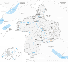
| Location of the municipality | |
  |
|
Brenzikofen is a municipality in the Bern-Mittelland administrative district in the canton of Bern in Switzerland .
geography
Brenzikofen is 583 m above sea level. M. , 7 km north of the city of Thun (linear distance). The village extends at the west foot of the Falkenflue in a wide valley basin, which is separated from the rest of the Aare valley by the bar of the Oppligenberglis , in the pre-Alpine hill country.
The 2.2 km² municipal area covers a section of the Aare valley between Bern and Thun. The western border runs on the Riegel, which extends from the Oppligenbergli to the south. From here, the municipality extends eastward over the almost 1 km wide hollow of Brenzikofen and over the forest-covered steep slope to the Bürglen , a foothill of the Falkenflue, on which at 860 m above sea level. M. the highest point of Brenzikofen is reached. To the south the area extends to the Rotache , which emerges from a notch valley into the Aare plain. In 1997, 8% of the municipal area was in settlements, 36% in forests and woodlands, 55% in agriculture and a little less than 1% was unproductive land.
Brenzikofen includes the Boden ( 592 m above sea level ) settlements on the Rotache on the southern edge of the Brenzikofen and Bälliz valley basin ( 620 m above sea level ) on the lower western slope of the Falkenflue, as well as some individual farms. Neighboring communities of Brenzikofen are Herbligen , Bleiken bei Oberdiessbach , Fahrni , Heimberg and Oppligen .
history
The place was first mentioned in a document in 1236 under the name Brenzichovin . Later the names Brencechoven (1259), Brenzkofen (1302) and Brenzikoven (1317) appeared. The place name goes back to the Old High German personal name Brantio . With the name ending -igkofen, it means something like the courts of the people of Brantio, whereby so-called resettler farms are meant.
In the Middle Ages, Brenzikofen was under the rule of Diessbach, but families from Bern and Thun also owned rich property in the municipality. The sovereignty initially belonged to the Counts of Kyburg , but came to Bern at the end of the 14th century. From 1471 Brenzikofen belonged to the free court of Steffisburg before it came to the Thun office in 1652. The high level of jurisdiction under Bernese rule always lay with the Konolfingen district court. After the collapse of the Ancien Régime (1798), Brenzikofen belonged to the Steffisburg district during the Helvetic Republic and from 1803 to the Konolfingen Oberamt, which received the status of an administrative district with the new cantonal constitution of 1831.
population
With 488 inhabitants (as of December 31, 2018) Brenzikofen is one of the small communities in the canton of Bern. 99.0% of the residents speak German and 0.2% speak English (as of 2000). The population of Brenzikofen was 337 in 1850 and 392 in 1900. In the course of the 20th century, the population always fluctuated between 320 and 360 people. Since 1980 (328 inhabitants) a significant increase in population has been recorded.
politics
The voting shares of the parties in the 2019 National Council elections were: SVP 44.1%, FDP 8.7%, BDP 7.4%, glp 7.4%, GPS 6.3%, SP 4.8%, EVP 3.4 %, EDU 3.2%, JSVP 2.5%, JG 2.2%, CVP 0.5%.
economy
Until the second half of the 20th century, Brenzikofen was predominantly an agricultural village. Even today, dairy farming and animal husbandry have a certain place in the income structure of the population. Further jobs are available in local small businesses and in the service sector. The central army food store has been located in Brenzikofen since 1983 . In the last few decades the village has developed into a residential community. Many employed people are therefore commuters who work mainly in Thun and in the larger towns in the Aare Valley.
traffic
The community is very well developed in terms of traffic. It is located on a connecting road from Heimberg to Oberdiessbach . The closest connection to the A6 motorway (Bern-Thun) is around 4 km from the town center. On July 21, 1899, the railway line from Hasle-Rüegsau to Thun with a station in Brenzikofen was put into operation.
Attractions
In the old town center, characteristic farmhouses in the Bernese country style from the 17th to 19th centuries have been preserved. Brenzikofen does not have its own church, it belongs to the parish of Oberdiessbach. Remains of the earthworks of the former Diessenberg Castle (ancestral seat of the Lords of Diessbach) from the early 13th century are visible on the Bürglen.
Partnerships
Brenzikofen has had a partnership with the municipality of Vyskytná in the Czech Republic since 1994 .
Personalities
- Willy Habegger (1918–2002), farrier, locksmith and manufacturer
See also
Web links
- Official website of the municipality of Brenzikofen
- Anne-Marie Dubler : Brenzikofen. In: Historical Lexicon of Switzerland .
Individual evidence
- ↑ Permanent resident population from STAT-TAB of the BfS , municipalities see also regional portraits 2020 on bfs.admin.ch, accessed on May 29, 2020
- ↑ Elections 2019: Results of the Brenzikofen community. Canton of Bern, accessed on February 4, 2020
Allmendingen | Arni | Bäriswil | Belp | Bern | Biglen | Bolligen | Bowil | Bremgarten near Bern | Brenzikofen | Clavaleyres | Deisswil near Münchenbuchsee | Diemerswil | Ferenbalm | Fraubrunnen | Frauenkappelen | Open-leaved | Gerzensee | Grosshöchstetten | Guggisberg | Gurbrü | Membranous | Herbigen | Iffwil | Ittigen | Jaberg | Jegenstorf | Kaufdorf | Sweep | Gravel | Kirchdorf | Kirchlindach | Köniz | Konolfingen | Kriechenwil | Landiswil | Laupen | Linden | Mattstetten | Meikirch | Mirchel | Moosseedorf | Mühleberg | Münchenbuchsee | Münchenwiler | Münsingen | Muri near Bern | Neuenegg | Niederhünigen | Niedermuhlern | Oberbalm | Oberdiessbach | Oberhünigen | Oberthal | Oppligen | Ostermundigen | Riggisberg | Rubigen | Rüeggisberg | Rümligen | Rüschegg | Schwarzenburg | Stettlen | Thurnen | Toff | Urtenen-Schönbühl | Vechigen | Forest | Walk rings | Wichtrach | Wiggiswil | Wileroltigen | Wohlen near Bern | Worb | Zziwil | Zollikofen | Zuzwil
Former communities: Aeschlen bei Oberdiessbach | Albligen | Ausserbirrmoos | Ball moss | Perch wall | Belpberg | Bleiken near Oberdiessbach | Bremgarten City Court | Bümpliz | Büren to the yard | Englisberg | Etzelkofen | Gelterfingen | Golats | Grafenried | Gysenstein | Hoods | Innerbirrmoos | Church gymnastics | Limpach | Lohnstorf | Mädersforst | Measure barns | Mühledorf | Mill urns | Mülchi | Münchringen | Niederwichtrach | Noflen | Oberscheunen | Oberwichtrach | Otterbach near Oberdiessbach | Rüti near Riggisberg | Shells | Barns | Schlosswil | Schönthal | Stalden in the Emmental | Tägertschi | Trimstone | Electors | Zauggenried | Zimmerwald
Canton of Bern | Administrative districts of the canton of Bern | Municipalities of the Canton of Bern