
Mattstetten
| Mattstetten | |
|---|---|
 |
|
| State : |
|
| Canton : |
|
| Administrative district : | Bern-Mittelland |
| BFS no. : | 0543 |
| Postal code : | 3322 |
| Coordinates : | 605 700 / 208745 |
| Height : | 516 m above sea level M. |
| Height range : | 502–742 m above sea level M. |
| Area : | 3.79 km² |
| Residents: | 561 (December 31, 2018) |
| Population density : | 148 inhabitants per km² |
| Website: | www.mattstetten.ch |
_159.JPG) Mattstetten |
|
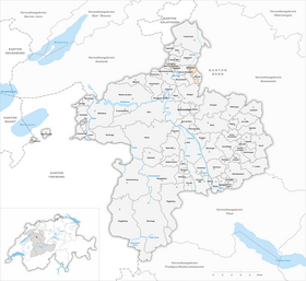
| Location of the municipality | |
  |
|
Mattstetten is a municipality in the Bern-Mittelland administrative district in the canton of Bern in Switzerland .
geography
Mattstetten lies at 516 m above sea level. M. , 10 km north-northeast of the canton capital Bern (linear distance). The village extends in the wide of the Urtenen -carrying hollow between the Rapperswil plateau to the west and the Molassehöhen of Bantigers in the southeast, in the Swiss Plateau .
The area of the 3.8 km² municipal area covers a section of the central Bernese plateau. The larger northern part of the municipality is located in the valley of the Urtenental, which has hardly any relief and is flanked in the east by the main traffic routes of the railroad and motorway between Bern and Olten. In the north, the border runs over the Mattenbühl hill ( 529 m above sea level ). To the south, the municipality extends in a narrow strip over the moss into the wooded area of Röduberg ( 639 m above sea level ), Mattstettenberg ( 662 m above sea level ) to the ridge of the Grauholzes , on which 740 m above sea level . M. the highest point of Mattstetten is reached. In 1997, 16% of the municipal area was in settlements, 34% in forests and woodlands, 39% in agriculture and a little less than 1% was unproductive land.
Mattstetten is home to the new building district in Grossacher west of the Urtenen. Neighboring communities of Mattstetten are Jegenstorf , Münchringen , Hindelbank , Bäriswil , Krauchthal , Bolligen and Urtenen-Schönbühl .
population
With 561 inhabitants (as of December 31, 2018) Mattstetten is one of the smaller communities in the canton of Bern. 97.1% of the residents are German-speaking, 0.7% French-speaking and 0.5% speak Dutch (as of 2000). The population of Mattstetten was 244 in 1850 and 256 in 1900. In the course of the 20th century the population increased steadily; In 1970 there were 400 inhabitants.
politics
The parties' share of the votes in the 2015 National Council elections were: SVP 35.1%, BDP 14.4%, SP 14.2%, FDP 8.6%, GPS 6.1%, EPP 5.7%, glp 5.7 %, EDU 4.1%, CVP 3.2%, pirates 1.7%.
economy
Until the second half of the 20th century, Mattstetten was predominantly an agricultural village. Even today, arable farming , fruit growing , dairy farming and forestry have an important place in the income structure of the population. Further jobs are available in local small businesses and in the service sector. In Mattstetten there are now computer science, body construction, transport and a roofing companies. In the last few decades the village has developed into a residential community. Many workers are therefore commuters who mainly work in the Bern agglomeration .
traffic
Although there are no thoroughfares through the village, the community is well developed in terms of traffic. The main access is from Urtenen-Schönbühl . The closest connection to the A1 (Bern-Zurich) and A6 motorways is around 3 km from the town center. On June 16, 1857, the Herzogenbuchsee-Bern section of the Olten-Bern railway line was opened with a station near Mattstetten. Mattstetten became known throughout Switzerland as the start of the new Mattstetten – Rothrist line as part of Bahn 2000 , which was opened in December 2004. The north portal of the Grauholz tunnel is also located in the municipality.
history
The place was first mentioned in a document in 1201 under the name Mahtstetten . Later the names Mattstetin (1231) and Matstetten (1257) appeared.
Since the Middle Ages , Mattstetten formed its own small rulership, which was under the sovereignty of the Counts of Kyburg . The lords of Mattstetten held lower jurisdiction until 1426, after which there were various changes of ownership. Under Bernese sovereignty (since 1406) the village was assigned to the Zollikofen district court . After the collapse of the Ancien Régime (1798), Mattstetten belonged to the Zollikofen district during the Helvetic Republic and from 1803 to the Fraubrunnen Oberamt, which received the status of an official district with the new cantonal constitution of 1831. The village does not have its own church, it belongs to the parish of Jegenstorf-Urtenen.
Attractions

With its farmhouses in the Bernese country style from the 18th and 19th centuries, Mattstetten has preserved a townscape of regional importance. In the village square there is a limestone fountain with an obelisk from 1780.
Web links
- Official website of the municipality of Mattstetten
- Anne-Marie Dubler : Mattstetten. In: Historical Lexicon of Switzerland .
- Schlössli Mattstetten
Individual evidence
- ↑ Permanent resident population from STAT-TAB of the BfS , municipalities see also regional portraits 2020 on bfs.admin.ch, accessed on May 29, 2020
- ↑ Elections 2015: Results of the Mattstetten community. Canton of Bern, accessed on March 21, 2016.
Allmendingen | Arni | Bäriswil | Belp | Bern | Biglen | Bolligen | Bowil | Bremgarten near Bern | Brenzikofen | Clavaleyres | Deisswil near Münchenbuchsee | Diemerswil | Ferenbalm | Fraubrunnen | Frauenkappelen | Open-leaved | Gerzensee | Grosshöchstetten | Guggisberg | Gurbrü | Membranous | Herbigen | Iffwil | Ittigen | Jaberg | Jegenstorf | Kaufdorf | Sweep | Gravel | Kirchdorf | Kirchlindach | Köniz | Konolfingen | Kriechenwil | Landiswil | Laupen | Linden | Mattstetten | Meikirch | Mirchel | Moosseedorf | Mühleberg | Münchenbuchsee | Münchenwiler | Münsingen | Muri near Bern | Neuenegg | Niederhünigen | Niedermuhlern | Oberbalm | Oberdiessbach | Oberhünigen | Oberthal | Oppligen | Ostermundigen | Riggisberg | Rubigen | Rüeggisberg | Rümligen | Rüschegg | Schwarzenburg | Stettlen | Thurnen | Toff | Urtenen-Schönbühl | Vechigen | Forest | Walk rings | Wichtrach | Wiggiswil | Wileroltigen | Wohlen near Bern | Worb | Zziwil | Zollikofen | Zuzwil
Former communities: Aeschlen bei Oberdiessbach | Albligen | Ausserbirrmoos | Ball moss | Perch wall | Belpberg | Bleiken near Oberdiessbach | Bremgarten City Court | Bümpliz | Büren to the yard | Englisberg | Etzelkofen | Gelterfingen | Golats | Grafenried | Gysenstein | Hoods | Innerbirrmoos | Church gymnastics | Limpach | Lohnstorf | Mädersforst | Measure barns | Mühledorf | Mill urns | Mülchi | Münchringen | Niederwichtrach | Noflen | Oberscheunen | Oberwichtrach | Otterbach near Oberdiessbach | Rüti near Riggisberg | Shells | Barns | Schlosswil | Schönthal | Stalden in the Emmental | Tägertschi | Trimstone | Electors | Zauggenried | Zimmerwald
Canton of Bern | Administrative districts of the canton of Bern | Municipalities of the Canton of Bern