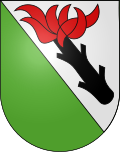
Belpberg BE
| BE is the abbreviation for the canton of Bern in Switzerland and is used to avoid confusion with other entries of the name Belpberg . |
| Belpberg | ||
|---|---|---|
| State : |
|
|
| Canton : |
|
|
| Administrative district : | Bern-Mittelland | |
| Residential municipality : | Belp | |
| Postal code : | 3124 | |
| former BFS no. : | 0862 | |
| Coordinates : | 606 332 / 190819 | |
| Height : | 802 m above sea level M. | |
| Area : | 5.7 km² | |
| Residents: | 423 (December 31, 2011) | |
| Population density : | 74 inhabitants per km² | |
| Website: | www.belp-berg.ch | |
|
The Belpberg seen from the north |
||
| map | ||
|
|
||
Until December 31, 2011, Belpberg was a political municipality on the Belpberg ridge in the Bern-Mittelland administrative district of the canton of Bern in Switzerland . The municipal administration was located in the Linden district .
geography
Belpberg lies at 802 m above sea level. M. , 11 km south-southeast of the canton capital Bern (linear distance). The scattered settlement without actual village center extends on the wide ridge of the Belpberg between the Aare and Gürbetal valleys .
The area of the 5.7 km² large municipal area includes a section of the Belpberg. The main part of the area is taken up by the ridge or the high plateau of the Belpberg (on average at 800 m above sea level ). The eastern municipality boundary runs along the edge of the forest above the steep drop to the Aare valley. On the Chutzen is 893 m above sea level. M. reached the highest point of the municipality. To the west, the municipality extends over the steep forest slope ( Chiefferenwald ) down to the edge of the Gürbe plain (the border is the road from Belp to Gelterfingen). The natural southern boundary runs in the Heiterentälchen (on the west side of the Belpberg) and in the Simmlerentälchen (on the east side of the mountain). In 1997, 5% of the municipal area was accounted for by settlements, 28% for forests and woodlands and 67% for agriculture.
Belpberg consists of the hamlet settlements Linden ( 802 m above sea level ), Fuchsacker ( 771 m above sea level ), Hohburg ( 792 m above sea level ), Oberhüseren ( 800 m above sea level ) Neuhus ( 788 m above sea level). M. ), Grossmatt ( 764 m above sea level ) and Hofstetten ( 800 m above sea level ) on the plateau as well as part of Heitern ( 538 m above sea level ) at the west foot of the mountain and numerous individual farms.
population
With 423 inhabitants (as of December 31, 2011) Belpberg was one of the small communities in the canton of Bern. Of the residents, 99.4% speak German, 0.3% speak Italian and 0.3% speak Portuguese (as of 2000). The population of Belpberg was 501 in 1850 and 439 in 1900. In the course of the 20th century, the population initially fluctuated between 430 and 470 people. Since 1960 (441 inhabitants) a slow population decrease has been recorded.
economy
Until the second half of the 20th century, Belpberg was predominantly an agricultural village. Even today, dairy farming and cattle breeding as well as arable farming have an important place in the income structure of the population. Outside the primary sector, there are only a few jobs in the community, including in a carpenter's shop. Many workers are also commuters who work mainly in the larger towns in the area and in the agglomeration of Bern .
traffic
The community is far away from the major thoroughfares, but can be reached relatively easily from Belp . The closest connection to the A6 motorway (Bern-Thun) is around 7 km from the village. A Postbus course , which operated the route from Belp via Belpberg to Kirchdorf (BE) at certain times of the day , connected the community to the public transport network until 2005. Today she is cut off from it.
history
Celtic and Roman coin finds indicate an early inspection and settlement of the Belpberg. The place was first mentioned in a document in 1342 under the name Belpberge . Later the names Belperg (1380) and Beltperg (1390) appeared. The etymology of the stem Belp is unclear.
In the Middle Ages, the Belpberg area belonged to the Belp-Montenach dominion, which had been under the sovereignty of the city of Bern since 1298. The high jurisdiction lay with the Seftigen district court. After the collapse of the Ancien Régime (1798), Belpberg belonged to the Seftigen district during the Helvetic Republic and from 1803 to the Seftigen District Office, which received the status of an official district with the new cantonal constitution of 1831.
Attractions
Stately farmhouses from the 18th and 19th centuries have been preserved in the hamlets. Particularly noteworthy is the Grossmatt farm group with a farmhouse from 1751. Belpberg does not have its own church; it belongs to the parish of Belp.


