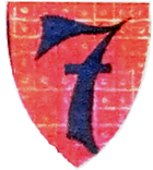
Seven Shepherds (Vienna)
| Seven Shepherds | |
|---|---|
| coat of arms | map |
 |

|
Siebenhirten is a former Lower Austrian municipality that has been a district of Vienna since 1938 . Today Siebenhirten belongs to Liesing , the 23rd district of Vienna , and is one of the 89 Viennese cadastral communities .
geography
Today's cadastral community of Siebenhirten covers an area of 251.22 hectares. The Petersbach flows through the village in a west-east direction . To the south of Siebenhirten is the Schellensee, surrounded by allotment gardens.
The place borders in the south on the Lower Austrian communities Perchtoldsdorf , Brunn am Gebirge and Vösendorf , in the north on the Liesing districts Liesing and Erlaa .
The south of Siebenhirten belongs to the chronostratigraphic level of the Pannonian , the north to the Holocene .
history

The name was derived from sub-shepherds . The first written mention of seven shepherds was around 1140/50. In 1559 the place was united with the rule Rodaun . At that time, most of the town's inhabitants were engaged in growing grain . The viticulture played only a small role. The Siebenhirten cemetery was laid out in the 1780s . In 1783 a separate parish was founded , but it was closed again in 1796. A year later, in 1797, the first school was opened in Siebenhirten. In the 19th century a few factories were established , but most of the population continued to work in agriculture. In 1848 Siebenhirten became an independent Lower Austrian municipality when the basic subservience was lifted.
After the "connection" to the German Reich, Vienna expanded rapidly at the expense of the surrounding communities. With the law of October 1, 1938, Vienna was enlarged from 21 districts to 26 districts to form Greater Vienna on October 15, 1938 . Siebenhirten was united with fourteen other places in Lower Austria to form the 25th district, called Liesing .
During the Second World War , Siebenhirten was initially out of the range of the bomber planes until 1944. That was one of the reasons why an "industrial horst" was to arise in the area of Siebenhirten, Atzgersdorf and Liesing, whose companies (mainly metal processing companies) were to be used as suppliers for the aero engine works of the German Air Force in Ostmark . Not least because of this, these works, and thus also the area of Siebenhirten, were later a target of attack by the Allies . The first attack on the Industriehorst took place on May 29, 1944. Among other things, the Siebenhirtner Martinskirche fell victim to the air raids in 1944.
After the occupation of Vienna by the Allies in 1945, only the urban area given before 1938 was divided into the four-sector city ; all areas that were added in 1938 fell under occupation law into the Soviet occupation zone . Siebenhirten was thus Soviet-occupied Vienna. Vienna and Lower Austria agreed in 1946 to reintegrate 80 of the 97 places attached to Vienna in 1938 into Lower Austria; 17 places, including seven shepherds, were to remain with Vienna. The Soviet occupying power vetoed these constitutional laws and only repealed them in 1954. Then the resolutions of 1946 could come into force. Siebenhirten therefore stayed with Vienna and became part of the new 23rd district.
Between 1978 and 1980, the large residential complex Wiener Flur was built in the northeast of Siebenhirtens according to plans by Klara Hautmann, Rudolf Hautmann and Friedrich Rollwagen . In 1951, the place had 2839 inhabitants at the census. Today around 8,000 people live in Siebenhirten.
Culture and sights

The former Teufelsmühle von Siebenhirten , which was first mentioned in a document in 1477, is located at Petersbach . The mill was still in operation in 1904. After destruction in the Second World War, it was converted into an inn.
Today's Roman Catholic parish church Siebenhirten was built in 1954/1955 according to plans by Herbert Schmid, Otto Rinder and Otto Sobetzky. Bruno Buchwieser's senior construction company was responsible for the execution .
The agricultural land of the Danube terrace in the Brauhausflur is one of four parts of the Liesing landscape protection area . In the 15 hectare section, arable farming, in particular, is protected as a cultural genre. The summer lime tree by the listed chapel on Lemböckgasse is designated as a natural monument .
Economy and Infrastructure
In the north-west of Siebenhirten is the Liesing industrial estate. The Basler Gasse elementary school , which was built between 1949 and 1951 as part of the “Basel helps Vienna-Liesing” relief campaign, is the work of the architect Roland Rainer .
1995 were Siebenhirten and located at the border to Erlaa Perfektastraße the U-U6 opened and Siebenhirten thus connected network subway to the Wiener. The Triester Straße coming from Wienerberg forms the border between the district and Vösendorf.
Sports
Football club
The SC Siebenhirten is the local football club. The club's sports field is located in Anton-Freunschlag-Gasse.
Tennis club
There is a small tennis club that can be reached via Kellerberggasse. The facility is located in the Kellerberg recreation area. The club offers three clay courts and eight teams in the various age groups of the Lower Austrian championship.
Personalities
- Leopold Stípčak (1909–1944), resistance fighter
literature
- Ferdinand Opll : Liesing: History of the 23rd Viennese district and its old places . Jugend und Volk, Vienna 1982, ISBN 3-7141-6217-8 .
Web links
Individual evidence
-
↑ Helene Eis: Investigation of the industrial area Liesing-Atzgersdorf. Dissertation to obtain the degree of Doctor of Commerce at the University of World Trade. Vienna 1961. S. 19.
Norbert Schausberger : Armaments in Austria 1938-45: a study on the interaction of economy, politics and warfare. In: Publications of the Austrian Institute for Contemporary History. Volume 8. Hollinek, Vienna 1970. p. 83. - ^ Norbert Schausberger: Armor. Pp. 150-151.
- ↑ Ferdinand Opll: Liesing: History of the 23rd Viennese district and its old places . Jugend und Volk, Vienna 1982, ISBN 3-7141-6217-8 . P. 201.
- ↑ Since the boundaries of the census districts and census districts differ from those of the cadastral municipality, no exact number of inhabitants is available. The enumeration district Siebenhirten had loud VZ 2001 7861 inhabitants. - Source: Directory 2001 Vienna , ed. v. Statistics Austria, Vienna 2005, p. 101.
- ^ Dehio-Handbuch Wien. X. to XIX. and XXI. to XXIII. District. Edited by Federal Monuments Office. Anton Schroll, Vienna 1996, ISBN 3-7031-0693-X , p. 700.
- ↑ 50 years of the parish church of St. Martin in Siebenhirten. ( Memento of the original from 23 August 2016 in the Internet Archive ) Info: The archive link was automatically inserted and not yet checked. Please check the original and archive link according to the instructions and then remove this notice. P. 7 (PDF; 13.9 MB), accessed on August 9, 2017
- ↑ Liesing landscape protection area - agricultural land of the Danube terrace (part D) . Website of the City of Vienna, accessed on June 20, 2012.
- ↑ Natural Monument No. 635 . Website of the City of Vienna, accessed on June 20, 2012.
Coordinates: 48 ° 8 ' N , 16 ° 19' E
