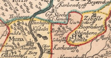
Starlings Czaple (Trzebiel)
| Starlings Czaple | ||
|---|---|---|
 Help on coat of arms |
|
|
| Basic data | ||
| State : | Poland | |
| Voivodeship : | Lebus | |
| Powiat : | Żary | |
| Gmina : | Trzebiel | |
| Geographic location : | 51 ° 35 ' N , 14 ° 46' E | |
| Residents : | 124 (March 31, 2011) | |
| Postal code : | 68-210 | |
| Telephone code : | (+48) 68 | |
| License plate : | FZA | |
| Economy and Transport | ||
| Street : | Droga krajowa 12 | |
| Rail route : | Lubsko – Bad Muskau railway line | |
| Next international airport : | Dresden | |
| Poznań | ||
Stare Czaple (German: Alt Tschöpeln , 1936-1945 Lindenhain ) is a village in the Polish rural community of Trzebiel in the district of Żary ( Lebus Voivodeship ).
geography

Stare Czaple is located on Droga krajowa 12 , which leads from the German-Polish border crossing Bad Muskau - Łęknica via Trzebiel (Triebel) and Żary (Sorau) to the Polish eastern border.
From a historical point of view, the village is a Silesian one, bordered by Lower Lusatia in the north and Upper Lusatia in the west .
history
The village of Zepeln is documented in 1498 as belonging to the Duchy of Sagan . It is the oldest of the three villages Stary Czaple (Alt Tschöpeln) , Nowy Czaple (Neu Tschöpeln) and Czaple (Tschöpeln, initially the Tschöpeln colony) , which is why it originally had no name prefix. At the time when the duchy was divided into three districts, the village belonged to the Priebussischer Kreis.
In 1543, Duke Moritz von Sachsen enfeoffed Melcher von der Heide with shares of (old) Tschöpeln.
According to a document from 1693, the village was obliged to haul wood to Priebus .
Around 1800 the manor was still a Sagan fief. There were five farms , eight gardeners and one cottager job . The Catholic inhabitants of the village were parish in Muskau , the Protestants in Groß Särchen , where the children also attended school.
| year | Residents |
|---|---|
| 1933 | 125 |
| 1939 | 138 |
When the Sagan district was dissolved , its western part, including Alt Tschöpeln, came to the Rothenburg district in 1932 . In the course of the National Socialist Germanization of Sorbian place names , the village was named Lindenhain in 1936 .
After the Second World War the village was on the Polish-administered side of the Oder-Neisse line as a result of Poland's shift to the west . Together with most of the other communities in the eastern part of the Rothenburg district, the community now known as Stare Czaple came to the powiat Żarski , which arose from the Polish part of the Sorauer district . From 1950 until it was dissolved by the Polish administrative reform of 1975, the district belonged to the Grünberg Voivodeship , which was made smaller during the reform. Since the reintroduction of the districts on January 1, 1999, Stare Czaple is back in the Żary district ( Lubusz Voivodeship ).
literature
- Priebus and the villages of the former Sagan western part . In: Robert Pohl (ed.): Heimatbuch des Kreis Rothenburg O.-L. for school and home . tape 2 : Supplement and register . Buchdruckerei Emil Hampel, Weißwasser O.-L. 1934, p. 32 .
Individual evidence
- ^ CIS 2011: Ludność w miejscowościach statystycznych według ekonomicznych grup wieku (Polish), March 31, 2011, accessed on May 28, 2017
- ^ Johann Adam Valentin Weigel: The principalities of Sagan and Breslau (= geographical, natural-historical and technological description of the sovereign Duchy of Silesia . Volume 6 ). Himburgische Buchhandlung, Berlin 1802, p. 26 ( full text [ Wikisource ]).
- ^ Michael Rademacher: German administrative history from the unification of the empire in 1871 to the reunification in 1990. Rothenburg district (Upper Lusatia). (Online material for the dissertation, Osnabrück 2006).

