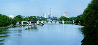
Heilbronn barrage
| Heilbronn barrage | ||
|---|---|---|
| location | ||
|
|
||
| Coordinates | 49 ° 8 '13 " N , 9 ° 11' 57" E | |
| Country: | Germany | |
| Place: | Heilbronn | |
| Waters: | Neckar | |
| Water kilometers : | km 113.59 | |
| Data | ||
| Construction time: | 1952 | |
| lock | ||
| Type: | Chamber lock | |
| Usable length: | 110 m | |
| Usable width: | 12 m | |
| Height upstream : | 154.04 m | |
| Average height of fall : |
3.18 m | |
| Others | ||
| Associated power plant: | 1.7 MW run-of-river power plant | |
The Heilbronn barrage is a river barrage in the Neckar. It consists of a double lock , a hydroelectric power station and a three-field weir with two sinkers and a roller gate.
location
Seen from the Rhine , the Heilbronn barrage is the twelfth of its kind.
Web links
Commons : Heilbronn barrage - collection of images, videos and audio files
- Federal waterways and shipping administration, Office for Neckar Development Heidelberg, Heilbronn lock


