Silent brook
| Silent brook | ||
| Data | ||
| Water code | DE : 2154724 | |
| location | Ravensburg district , Baden-Württemberg , Germany | |
| River system | Rhine | |
| source | Well of origin east of Lochmoos as well as Kocherlöcher at Unterankenreute 47 ° 48 '5 " N , 9 ° 43' 59" E
|
|
| length | 11.5 km | |
| Flowing lakes | Rössler pond | |
| Medium-sized cities | Vineyard | |
| Communities | Schlier | |
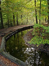
The water network of the Stillen Bach near Weingarten in the Ravensburg district in Baden-Württemberg is one of the oldest canal systems in Germany. It was expertly laid out by Benedictine monks in the Middle Ages to supply the Weingarten Monastery with water and has remained almost unchanged to this day. The area of the water network is around 25 km² and includes ten canals and around 20 ponds. The main construction period of the Stiller Bach and its parts of the river extends over a period of more than half a millennium (11th to 17th centuries).
Today the Silent Bach is a destination where a walk takes you deep into the cultural history of the region.
use
Many areas of the vineyard's life have benefited from the extremely diverse use of the silent brook. He supplied the monks with water and saved the monastery and the otherwise waterless upper town of Weingarten from devastating fires. Its water was used for bleaching cloth, was used to run a wash house and at the same time led the waste water into meadow irrigation channels, the so-called Rongsen , to fertilize the irrigation meadows in the Schussen basin . The Benedictines also knew how to use their rivers for energy purposes: at least until the abolition of the monastery in 1803 they worked within the canal system
- eight grinding mills with 17 water wheels
- five sawmills with seven water wheels
- three oil mills with two water wheels
- a hammer forge with two water wheels
- a bone and plaster stamp with a water wheel
- a wage mill with a water wheel
- a hemp grater with a water wheel
As a result of advancing industrialization, the mills were gradually replaced and the flowing waters were used to generate electricity. Up to twelve turbines were operated by the water power of the Stillen Bach with a total output of 1,800 kW .
Sewer network
The components of the irrigation system are largely completely new creations in the gravel area above the Schussen Basin and its side valleys, which was originally poor in streams. Among the main sources of the system include its origin well to the east of Loch Moss because of their geohydrological particularity as natural monuments 4 source pots "Kocher holes" reported kettle holes at Unterankenreute . In order to tap into several rich source areas, the canals often overcome regional watersheds . In order to avoid maintenance-intensive canal bridges ( aqueducts ), the upper course of the Stille Bach had to be built with a minimal gradient, that is, it had to flow around hills or valleys. Due to this target and the partly very low slope of the terrain, the determination of an optimal flow route was extremely time-consuming and, with the aids available in the Middle Ages, is to be regarded as an engineering masterpiece.
The network has consisted of ten switchable channels since the Renaissance and was expanded to a length of 11.5 km by 1605. Of the previously up to 30 reservoirs in the Stiller Bach, only nine artificial lakes are now dammed. In order to guarantee a year-round water flow, the Lochmoos moorland water reservoir is important in the upper reaches, the 800-year-old Rössler pond as the central switching point of the system and the Mahlweiher in Nessenreben in the lower reaches . Nessenreben refers to a medieval clearing island above Weingarten, which was initially managed by the monastery and after secularization as a state domain . The Mahlweiher Nessenreben stores the water of the Stiller Bach before it shoots down the lower reaches of Weingarten with a steep gradient.
Rössler pond
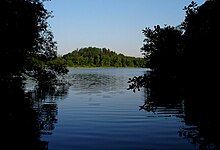
The Rösslerweiher emerged as a natural lake around 10,000 years ago when the Ice Age Rhine glacier retreated, leaving dams made of scree ( moraines ) and depressions, the gravel of which had been sealed with fine clays to make them impermeable to water. The moraine dam broke in a devastating natural disaster. The floods of water fell into the Scherzach valley and carved the Hochtobel into the terrain. Much later, people built a replacement dam at this point. In 1155 the new reservoir was mentioned as lacus Grindel (= dam lake) in a Staufer document.
Thus the 20 hectare pond is one of the oldest reservoirs in Central Europe. It has been used for energy and fishing for over 800 years and fulfills an important function in the flood protection of Weingarten. The silent brook plays a central role in all of this.
The Rösslerweiher, located near Unterankenreute in the municipality of Schlier , is traditionally a popular local recreation area for swimming enthusiasts, ice skaters and hikers. Since 1989 the 5.5 km long signposted Wasserbauhistorische Wanderweg has been a circular route around the Rösslerweiher. As a state fishing water, it is used today by the Ravensburg District Forestry Office. Every year the autumn carp harvest takes place here on the second Wednesday in October, when around four tons of fish are bought.
Water level regulation
With four other canals, the Altweiher Canal forms the upper reaches of the Stiller Bach. It has been supplying the Rössler pond with water from the Wolfegger Ach catchment area since the 16th century . The Altweiher Canal coming from the north and the Kehrenberger Mühlkanal , which runs past the east bank of the Rösslerweiher , meet in a canal crossing immediately before the inflow into the Rösslerweiher. From there the water flows both into the Rösslerweiher and into a deeply cut interim canal, which is separated from the Rösslerweiher by a 300 meter long dam. At the crossing point is the trapping stick , a device that can be pulled and locked so that the interim canal takes up the entire headwater. This happens when there is a risk of flooding or when fishing from the Rösslerweiher.
With the help of a monk , a barrier structure at the outlet of the Rösslerweiher, the water level in the silent brook or in the pond can also be regulated. In addition, there are two more weirs in the Altdorf Forest to keep floods away from the Silent Bach.
Hochtobel
After leaving the Rösslerweiher, the Stille Bach flows in an exposed route along the mountain flank of the Hochtobel. The route is reminiscent of irrigation canals with similar characteristics in South Tyrol (see Waale ) and in the Swiss canton of Valais (see Suonen / Bisses).
Up until the 1980s, violent outbreaks kept occurring in the Hochtobel after the water of the Stiller Bach had dammed up due to a wind break. These former mudslides to the Schwarzbächle , which flows 50 meters below, are still visible as deep gullies in the steep slope.
Since the monks could not bypass the Hochtobel because they needed the water in the Nessen vines for their dairy , their meadows and mills, they nurtured the natural vegetation, the roots of which protected the edges from being washed away. The most dangerous section of the medieval route was later replaced by a shorter connection. Almost 10,000 m³ of soil had to be excavated with simple means for the roughly 100-meter-long and ten-meter deep penetration through the Lindenberg .
Canal systems of the Benedictines in Upper Swabia
In addition to the Silent Bach, there are two other canal systems in the Upper Swabian Benedictine monastery complexes:
- Krummbach in Ochsenhausen
- Motzenbach in Ottobeuren
All three systems have belonged to the 100 or so stations on Mühlenstraße Oberschwaben since 2005 .
proof
- The silent brook and its waters , City of Weingarten 2005
- Historical hydraulic engineering hiking trail, vineyard
Web links
- on the website of the city of Weingarten with a link to the brochure
- Video clips with views of the Still Bach (in 18 parts) on Youtube


