
Târgu Neamț
|
Târgu Neamț Németvásár |
|||||
|
|||||
| Basic data | |||||
|---|---|---|---|---|---|
| State : |
|
||||
| Historical region : | West Moldova | ||||
| Circle : | Neamț | ||||
| Coordinates : | 47 ° 12 ' N , 26 ° 22' E | ||||
| Time zone : | EET ( UTC +2) | ||||
| Height : | 365 m | ||||
| Area : | 47.31 km² | ||||
| Residents : | 18,695 (October 20, 2011) | ||||
| Population density : | 395 inhabitants per km² | ||||
| Postal code : | 615200 | ||||
| Telephone code : | (+40) 02 33 | ||||
| License plate : | NT | ||||
| Structure and administration (as of 2016) | |||||
| Community type : | city | ||||
| Structure : | 3 districts / cadastral communities: Blebea , Humuleşti , Humuleştii Noi | ||||
| Mayor : | Vasilică Harpa ( PSD + UNPR ) | ||||
| Postal address : | St. Ștefan cel Mare, no. 62 loc. Târgu Neamț, jud. Neamț, RO-615200 |
||||
| Website : | |||||


Targu Neamt ( Hungarian Németvásár , German Niamtz ) is a town in the district of Neamt in the West of Moldova in Romania .
location
Târgu Neamț is located on the eastern edge of the Stânişoara Mountains , which is part of the Eastern Carpathians . The Neamț (also Ozana ) flows through the city . The district capital Piatra Neamț is located about 30 km south of Târgu Neamț.
history
The area of today's city was already settled in the Neolithic , the Bronze Age and the Dacian times. Târgu Neamț was first mentioned in a document between 1387 and 1392. Whether the city was founded by German settlers, as the name suggests (Rum. Neamț = "German"), is disputed among Romanian historians.
Târgu Neamț was one of the oldest cities in the Principality of Moldova . The nearby castle Neamț , which existed since the 14th century and which was expanded under Ștefan cel Mare , played an important role for the city .
In the 17th and 18th centuries, with the decline of the Principality of Moldova and under Ottoman rule, there was also a stagnation in the development of the city. In the 19th century, many Jews moved from Transylvania ; Târgu Neamț experienced a renewed boom, which continued until the Second World War . During the communist era, the city did not have any large-scale operations, so the population grew more slowly than in other cities.
population
At the first count in 1772, 145 houses were registered in Târgu Neamț; in 1835 there were 519 families. In 1915 there were 9115 inhabitants; the peak of the population was reached in 1997 with 22,700. The 2002 census recorded 20,496 inhabitants in the city, including 20,152 Romanians , 12 Hungarians , 302 Roma , 12 Jews and 2 Germans .
traffic
Târgu Neamț is the end of a railway line that went into operation in 1986 and runs from the Paşcani railway junction . Local trains run into this city several times a day. There are regular bus connections. a. to Piatra Neamț and to Iași .
Târgu Neamț is on the national roads Drum naional 15B and Drum național 15C . According to current planning (2008) an A4 motorway , which is to connect Iași with the north-west of the country, will pass through Târgu Neamț.
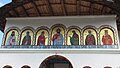
Attractions
- Neam Castle
- historical Museum
- Memorial house for Ion Creangă
- Neamț Monastery , about 15 km west of the city
- Văratec Monastery , about 12 km south of the city
- Agapia Monastery , about 10 km southwest of the city
- Secu Monastery, about 20 km west of the city
- Sihla Monastery, about 30 km west of the city
- Sihăstria Monastery, 22 km west of the city

Neam Castle

Neam Castle

Neam Castle

Wooden church in Agapia

Agapia Monastery

Sihăstria Monastery (old church)

Sihăstria Monastery (New Church)
Sihăstria Monastery (New Church)

Secu Monastery (2008)

Secu Monastery (2012)


Personalities
- Ion Creangă (1839–1889), writer
- Irving Layton (1912-2006), Canadian poet and author
- Moshe Idel (* 1947), Israeli philosopher
- Ioan Vieru (* 1962), writer
Parish partnership
- Saint-Just-Saint-Rambert , Loire department , France (since 1999)
Web links
Individual evidence
- ↑ 2011 census in Romania at citypopulation.de
- ^ Johann Daniel Ferdinand Neigebaur (ed.): The Moldau-Wallachians or Romanes and the Russian protection. Johann Urban Kern, Breslau 1855. online
- ↑ a b Târgu Neamț website accessed on February 4, 2016
- ↑ 2002 census, accessed November 27, 2008
- ↑ Information on Sihla Monastery at viziteazaneamt.ro (Romanian).
- ↑ Information on the Sihăstria monastery at viziteazaneamt.ro (Romanian).