
Tannhörnle
| Tannhörnle | ||
|---|---|---|
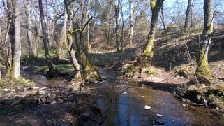
 Typical landscape in the Tannhörnle nature reserve |
||
| height | 766 m above sea level NHN | |
| location | Schwarzwald-Baar district , Baden-Wuerttemberg | |
| Mountain range | Black Forest | |
| Coordinates | 48 ° 2 '30 " N , 8 ° 25' 34" E | |
|
||
| particularities | z. T. nature reserve | |

The Tannhörnle is an elevation in Villingen-Schwenningen . It reaches a height of approx. 766 meters. Tannhörnle is also the name of the nature reserve of protection class 4 established on the north-eastern slope of the elevation. The western part of the northern slope is used for agriculture, the southern slope is partially built on.
Location and landscape
The Tannhörnle is located between the southern edge of Villingen and Pfaffenweiler , west of the Magdalenenberg . Beyond the Warenbach , the northern (left) bank of which forms the northern border of the area, remains of the moat systems of Runstal Castle are visible. The area is enclosed in the east, north and west by the nature reserve Villingen Süd . In the south, the residential development of Pfaffenweiler borders on the protected area.
The nature reserve has an area of 23.2 hectares . The former pasture is now only used for landscape maintenance with sheep and goats. The landscape is characterized by grasslands and oaks .
Some endangered species can be found here:
- Plant species: Orchid , devil's bite , three types of gentian
- Animal species: Red-backed killer , tree pipit , belly insect
The Kuhmoosbach flows into the Warenbach west of the nature reserve , as does the Sandweglebach , which rises in the northwest of the elevation, outside the nature reserve.
Protection status
The eastern part of its northern slope was placed under protection as a nature reserve by the Freiburg Regional Council as a higher nature conservation authority by ordinance of September 17, 1982 (Journal of Laws of October 29, 1982, p. 454) . According to Section 4 (1) of this ordinance, all actions are prohibited in the "nature reserve [...] which can lead to the destruction, damage or alteration of the protected area or its components, to a lasting disruption or to an impairment of scientific research." actions are listed that are "particularly" prohibited. The Tannhörnle is part of the FFH area of Baar, Eschach and the southeastern Black Forest .
history
The name is first recorded as "an danhorn" in 1320 and at that time referred to a forest on the hill. On the poor grassland, the common land grazing animals, v. a. Sheep, kept. In Villingen, several professions benefited from it, such as weavers , dyers , bleachers , cloth millers and tanners . The street names Gerberstrasse, Färberstrasse and Webergasse in the old town bear witness to the importance of these professions for Villingen.

On March 5, 1942, Marian Lewicki, a then 23-year-old Polish prisoner of war and forced laborer, was hanged in the area of today's landscape protection area for a relationship with a young German (so-called " racial disgrace ") by order of the Reich Security Main Office . Next to the oak on which he found death, a stone cross (atonement cross) reminds of his fate. The so-called “Polish oak” is also still there. The young woman survived the Ravensbrück and Auschwitz concentration camps and died in Villingen at the age of 82. The atonement cross was set up in 1988 by the Villingen History and Local History Association, and a memorial plaque explains the connections.
gallery

Another view of the landscape

"Polish oak" with atonement cross
The Warenbach forms the northern border of the nature reserve (view and flow direction from west to east)


literature
- Helmut Gehring: A 2000 year old pasture landscape - the “Tannhörnle” nature reserve near Villingen has retained its character unchanged . In: Almanach 2000. Heimatjahrbuch des Schwarzwald-Baar-Kreis . Episode 24, 2000, ISBN 3-927677-24-8 , pp. 243-251. ( online )
- Walter Fritz: The vegetation on the Villinger "Tannhörnle" - a model of the Hallstatt period vegetation on the western edge of the Baar . IN: Writings of the Association for History and Natural History of the Baar . Volume 32, Donaueschingen 1978, pp. 36-60. ( online )
- See also the bibliography on the website of the State Agency for the Environment Baden-Württemberg
Web links
- Protected area profile. State Institute for the Environment Baden-Württemberg, accessed on May 9, 2021 .
- Tannhörnle in the World Database on Protected Areas (English)
- Ordinance of the Freiburg Regional Council as the higher nature conservation authority on the »Tannhörnle« nature reserve in the Villingen district, Schwarzwald - Baar - Kreis dated September 17, 1982 (Journal of Laws of October 29, 1982, p. 454). State Institute for the Environment Baden-Württemberg, accessed on May 9, 2021 .
- Extension of the nature reserve. OpenStreetMap, accessed May 9, 2021 .
See also
Individual evidence
- ↑ a b Extension of the nature reserve. OpenStreetMap, accessed May 9, 2021 .
- ^ City of Villingen-Schwenningen: Development plan Tannhörnle-Vogelsang-Langes Gewann. February 16, 1972, accessed June 5, 2021 .
- ↑ Tannhörnle in the World Database on Protected Areas (English)
- ↑ Protected area profile . State Institute for the Environment Baden-Württemberg, accessed on May 9, 2021 .
- ↑ a b Sheep and goats graze on the Tannhörnle. In: Black Forest Messenger . Schwarzwälder Bote Mediengesellschaft mbH, October 25, 2016, accessed on June 5, 2021 .
- ↑ a b Such an official information board on site.
- ↑ Wording of the ordinance
- ↑ LUBW data and map service. LUBW State Institute for the Environment Baden-Württemberg, accessed on April 29, 2021 .
- ↑ History and Folk Society Villigen: Tannhörnle . In: Villingen through the ages . 2018, p. 57-58 ( online ).
- ↑ Huger, Werner: We remember . In: Villingen through the ages . 2007, p. 66-67 ( online ).
- ↑ Huger, Werner: Atonement cross in the Tannhörnle . In: History and local history association Villingen . 1988, p. 72-75 ( online ).


Albtrauf Baar | Betzenbühl | Billibuck | Birch mean | Blindensee | Briglirain | Deggenreuschen - Rauschachen | Elzhof | Gifitzenmoos | Grüninger Ried | Günterfelsen and surroundings | Hondinger Zisiberg | Laubeck-Rensberg | Mönchsee-Weiherwiesen | Mühlhauser Halde | Palmenbuck | Plate moss | Rohrhardsberg-Obere Elz | Schlossberg-Hauberg | Schwenninger Moos | Tannhörnle | Underwoods forest | Weiherbachtal | Anger flare | Wutach Gorge | Zollhausried