
Thondorf (Gerbstedt)
|
Thondorf
City of Gerbstedt
Coordinates: 51 ° 35 ′ 59 ″ N , 11 ° 31 ′ 44 ″ E
|
||
|---|---|---|
| Height : | 233 m above sea level NHN | |
| Area : | 4.9 km² | |
| Incorporation : | July 1, 1950 | |
| Incorporated into: | Siersleben | |
| Postal code : | 06347 | |
| Area code : | 03476 | |
Location of Thondorf in Saxony-Anhalt |
||

Thondorf is a district of the Gerbstedter locality Siersleben in Saxony-Anhalt .
history
In a register of the tithe of the Hersfeld monastery , which was created between 881 and 899, Thondorf is mentioned for the first time in a document as the place of Theodendorpf im Friesenfeld, which has to be titled .
Thondorf was incorporated into Siersleben on July 1, 1950 , and in 2010 the place went to the city of Gerbstedt.
Location and infrastructure
Thondorf is located 1 km west of Siersleben on the road to Klostermansfeld, 3 km away, and has a stop for the Mansfeld mine railway . Dirt roads lead to Großörner in the north, Mansfeld in the west and Hübitz in the east. There is a cycle path between Thondorf and Siersleben.
- Supraregional traffic routes
- DB route Magdeburg - Erfurt , next train station is Klostermansfeld
- Federal roads 180 and 242 south and west of the village
- Bundesautobahn 14 near Könnern, 18 km as the crow flies
landscape
Thondorf lies on a wavy plateau, which is dominated by fields. The meanwhile dried up Wickengraben flowed from the village pond (now filled in) in the direction of Siersleben into the Risterbach . In the west lies the Regenbeck grove through which the Alte Wipper brook flows, in the northeast the Welfesholz grove. Thondorf, together with Siersleben , Hübitz and Augsdorf are also referred to as the Griftdörfer , or as villages on the Grift (bach).
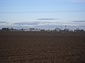
View of Thondorf

Ruins of the Church of St. George in Thondorf


literature
- Erich Neuss : "Walks through the County of Mansfeld"; Volume 3, In the Heart of the County . fly head publishing house, Halle (Saale), 2001
Individual evidence
- ^ Reg. Thur. No. 287
Web links

Locations: Augsdorf | Free | Friedeburg (Saale) | Friedeburgerhütte | Gerbstedt (village) | Heiligenthal | Hübitz | Ihlewitz | Rottelsdorf | Siersleben | Welfesholz | Zabenstedt
Districts: Adendorf | Bösenburg | Elves | Helmsdorf | Lochwitz | Oeste | Pfeiffhausen | Strausshof | Thaldorf | Thondorf | Zabitz