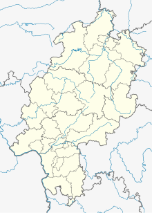
Todenhausen (Wolfhagen)
Coordinates: 51 ° 18 ′ 19 ″ N , 9 ° 11 ′ 37 ″ E
Todenhausen was a village settlement in what is today the district of the north Hessian city of Wolfhagen , district of Kassel . The place was first mentioned in a document in 1074 and was desolate by 1422 at the latest .
Geographical location
The place was located about 2.5 km southeast of Wolfhagen and about 1 km north of the Wolfhagen district of Bründersen on the Wolfhagen district boundary at 302 m altitude in the fields of the Todenhausen corridor immediately east of the district road 107 from Wolfhagen to Bründersen. About 250 m to the west is the Glockenborn nature reserve , a wetland around the pond of the same name, fed by the Glockenborn spring and the mill water . The field names "Am Todenhäuser Sande", located a little south-east, and "Todenhäuser Wiesen" (around the NSG Glockenborn) point to the disappeared settlement.
Place name
The place name appeared in alternating spelling over the centuries, although it is unclear whether the earlier information refers to this or another Todenhausen: Doddonhusun (968–969), Dodenhusen (976–979, 1206), Dodenhusun (1081 ), Dǒdenhusen (1123), Tůtenhůsen (1154/59), Dothenhusen (1231), Tudenhusen (1253, 1310), Thodinhusin (1361), Todeshusen (1424, 1435), Thodenhusen (1442), Todtenhausen (1708/10) and Todtenhausen (1926); Dudinhusen and Düdenhusen are also mentioned.
history
Little is known about the history of the place, and it is not always clear whether some of the documented references are to this or another Todenhausen. So is z. For example, it is no longer possible to determine in which Todenhausen the Corvey monastery owned land in the 10th century. It is also uncertain whether the confirmations of Popes Innocent III. in 1206 and Gregory IX. 1231 from ownership of the monastery Werbe refer to this Todenhausen; however, this is likely because the villages Bründersen and Immenhausen are mentioned as neighboring. It is certain that Abbot Hildebold of Hasungen Monastery acquired a total of five hooves in Todenhausen in 1154/1159 and gave them to his monastery as a soul tool. Tenth earnings in Todenhausen are stated for the St. Petri-Stift in Fritzlar in 1209, 1253 and 1310.
The settlement was probably already desolate in 1422, but no later than 1437, when Reinhard von Dalwigk and his nephew and ward Friedrich IV von Hertingshausen gave Landgrave Ludwig I of Hesse the Weidelsburg and Todenhausen as fiefs ; In 1448, after repeated breaches of the peace , the two were punished by the landgrave and the Archbishop of Mainz , Dietrich, by withdrawing large parts of their fiefdoms, including Weidelsburg and Todenhausen.
The old cemetery on the K 107 north of the Mühlenwasser, popularly known as "Alte Kraft" ( 51 ° 18 ′ 16 ″ N , 9 ° 11 ′ 32 ″ E ), is the churchyard of the former death houses, consecrated around 1100 Church that was donated by the parents of the then Presbyter Albrandt. It was originally a branch church of the church on the Schützeberg and was subordinated to the Hasungen Monastery by the Archdiocese of Mainz in 1124 . Even after Todenhausen was abandoned, it served the residents of Bründersen until the 15th century, which only got its own village church in 1534 and a new cemetery in 1895.
One of the two bells of the church had to be given to the city of Wolfhagen around 1422. The other is said to have fallen during the later collapse of the church in the Glockenborn located to the west below the church; According to a local legend, it was deliberately sunk in the swampy area so that it would not be prey to wandering gangs or the war people. According to another legend, some Wolfhagans wanted to steal the bell for their own church tower, went to Todenhausen in a car at night, fetched the bell from the tower that was in danger of collapsing, loaded it onto the car and drove away with it. On the way to Wolfhagen the bell fell from the wagon, and as it was soon to be day, the thieves first covered it with brushwood. The next night they returned to collect the bell, but found only a hole in the ground in its place. As they poked at the bell with sticks, water suddenly began to gush out of the hole, and since then the Glockenborn has been located there, which provided Wolfhagen with good water for a long time.
The stones of the collapsed church were subsequently built elsewhere, partly in the portal of the churchyard, while the wall of the churchyard was preserved due to its use as a cemetery. One of the grave slabs on the portal of the churchyard wall is for the commander of an English cavalry unit who lost his life in a battle with the French between Bründersen and Graner Berg during the Seven Years' War .
Footnotes
- ^ Todenhausen, Kassel district. Historical local dictionary for Hessen. In: Landesgeschichtliches Informationssystem Hessen (LAGIS).
- ^ Heinrich Reimer (Hrsg.): Historisches Ortslexikon für Kurhessen (publications of the historical commission for Hessen). Elwert, Marburg, 1974, p. 541
- ↑ https://www.xn--brndersen-r9a.de/unser-dorf/naturschutzgebiet-glockenborn-naturpark-habichtswald.html
- ↑ History and stories from Bründersen and the surrounding area. HNA, accessed July 20, 2016 .
- ↑ https: //www.bründersen.de/unser-dorf/todenhausen-alte-kraft.html
literature
- Georg Landau : Historical-topographical description of the desolate localities in the Electorate of Hesse and in the grand-ducal Hessian parts of Hessengaue, Oberlahngaue and Ittergaue (= journal of the Association for Hessian History and Regional Studies. Supplement 7, ZDB -ID 200295-4 ). Theodor Fischer, Kassel 1858, p. 176 .
- Heinrich Reimer (Hrsg.): Historical local lexicon for Kurhessen (publications of the historical commission for Hessen). Elwert, Marburg, 1974, p. 541.
Web links
- Todenhausen, district of Kassel. Historical local dictionary for Hessen. In: Landesgeschichtliches Informationssystem Hessen (LAGIS).
- https: //www.bründersen.de/unser-dorf/todenhausen-alte-kraft.html
