Tom (whether)
|
Tom Томь |
||
|
Tom at Tomsk |
||
| Data | ||
| Water code | RU : 13010300212115200007313 | |
| location | Khakassia , Kemerovo Oblast , Tomsk Oblast ( Russia ) | |
| River system | If | |
| Drain over | Whether → Arctic Ocean | |
| source | in the Abakan Mountains 53 ° 36 ′ 36 ″ N , 89 ° 40 ′ 28 ″ E |
|
| Source height | 903 m | |
| muzzle | below Seversk in the Ob Coordinates: 56 ° 49 ′ 54 ″ N , 84 ° 29 ′ 30 ″ E 56 ° 49 ′ 54 ″ N , 84 ° 29 ′ 30 ″ E |
|
| Mouth height | 67 m | |
| Height difference | 836 m | |
| Bottom slope | 1 ‰ | |
| length | 827 km | |
| Catchment area | 62,000 km² | |
| Discharge at the Wodpost 1 A Eo gauge : 19,800 km² Location: 622 km above the mouth |
MQ 1950/1966 Mq 1950/1966 |
507 m³ / s 25.6 l / (s km²) |
| Discharge at the Nowokuznetsk A Eo gauge : 29,800 km² Location: 580 km above the mouth |
MQ 1894/2000 Mq 1894/2000 |
647 m³ / s 21.7 l / (s km²) |
| Discharge at the Kemerowo A Eo gauge : 47,400 km² Location: 273 km above the mouth |
MQ 1936/2000 Mq 1936/2000 |
834 m³ / s 17.6 l / (s km²) |
| Discharge at the Tomsk A Eo gauge : 57,000 km² Location: 75 km above the estuary |
MQ 1918/2000 Mq 1918/2000 |
1067 m³ / s 18.7 l / (s km²) |
| Left tributaries | Mras-Su , Kondoma , Unga | |
| Right tributaries | Ussa , Verkhnyaya Ters , Srednjaja Ters , Nizhnyaya Ters , Taidon | |
| Big cities | Meshduretschensk , Novokuznetsk , Kemerovo , Tomsk , Seversk | |
| Medium-sized cities | Jurga | |
|
Catchment area of the Tom |
||
|
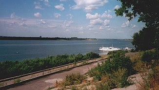
Tom below Kemerovo |
||
|
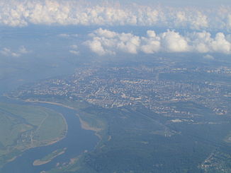
Aerial view of Tom near Tomsk |
||
|
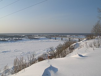
Frozen Tom in Tomsk |
||
The 827 km long Tom ( Russian Томь , fem .; German also mask. ) Is a right tributary of the Ob in southern western Siberia in Russia .
The river arises in the Abakan Mountains between Western Sayan , Altai and Kuznetsk Alatau from the source streams Prawaja Tom ("Right Tom") and Levaya Tom ("Left Tom"), which are only a few kilometers long . It flows partly along the western edge of the Kuznetsk Alatau in a predominantly northwestern direction via Meschduretschensk , Novokuznetsk , Kemerovo and Jurga through the Kuznetsk Basin , past the cities of Tomsk and Seversk to the confluence with the Ob .
The Tom River, which is over a kilometer wide near its mouth and overcomes 835 m difference in altitude from its source to its mouth, has a catchment area of around 62,000 km². The mean water flow at the mouth is 1100 m³ / s. The largest tributaries are Mras-Su and Kondoma from the left.
Web links
Individual evidence
- ↑ a b c Article Tom in the Great Soviet Encyclopedia (BSE) , 3rd edition 1969–1978 (Russian)
- ↑ a b Tom in the State Water Register of the Russian Federation (Russian)
- ↑ Tom at the Wodpost 1 gauge - hydrographic data at R-ArcticNET
- ↑ Tom at the Novokuznetsk gauge - hydrographic data at R-ArcticNET
- ↑ Tom at the Kemerowo gauge - hydrographic data at R-ArcticNET
- ↑ Tom at the Tomsk gauge - hydrographic data at R-ArcticNET


