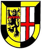
Verbandsgemeinde Gerolstein (1968-2018)
| coat of arms | Germany map | |
|---|---|---|

|
Coordinates: 50 ° 13 ' N , 6 ° 39' E |
|
| Basic data (as of 2019) | ||
| Existing period: | 1968-2019 | |
| State : | Rhineland-Palatinate | |
| County : | Vulkaneifel | |
| Area : | 188.22 km 2 | |
| Residents: | 13,567 (Dec. 31, 2017) | |
| Population density : | 72 inhabitants per km 2 | |
| License plate : | DAU | |
| Association key : | 07 2 33 5002 | |
| Association structure: | 13 municipalities | |
| Association administration address : |
Kyllweg 1 54568 Gerolstein |
|
The Verbandsgemeinde Gerolstein (1968-2018) was an administrative unit in the legal form of a regional authority in the Vulkaneifel district in Rhineland-Palatinate . The municipality included the city of Gerolstein and twelve separate local churches at the administrative headquarters was in the eponymous town of Gerolstein. In 2019, the Verbandsgemeinde merged with neighboring Verbandsgemeinde to form the new Verbandsgemeinde Gerolstein .
Association members communities
| Local parish, city | Area (km²) | Residents |
|---|---|---|
| Berlingen | 3.59 | 231 |
| Birresborn | 20.88 | 1,115 |
| Densborn | 14.42 | 521 |
| Duppach | 10.28 | 288 |
| Gerolstein , city | 64.38 | 7,616 |
| Hohenfels-Essingen | 5.02 | 304 |
| Kalenborn scrubbing | 7.34 | 394 |
| Kopp | 8.40 | 178 |
| Mürlenbach | 21.64 | 545 |
| Neroth | 7.24 | 830 |
| Pelm | 10.06 | 1,001 |
| Rockeskyll | 5.88 | 225 |
| Salm | 9.09 | 319 |
| Association municipality of Gerolstein | 188.22 | 13,567 |
(Residents on December 31, 2017)
history
The Verbandsgemeinde Gerolstein came into being as part of the Rhineland-Palatinate functional and territorial reform carried out in the second half of the 1960s and early 1970s from the Gerolstein Office, which had existed since 1927 . On October 1, 1968, all 132 offices in the administrative districts of Koblenz and Trier , including the Gerolstein office, were converted into association municipalities on the basis of the “State Law to Change Local Constitutional Regulations and Prepare for the Reorganization of Municipalities” of July 16, 1968 .
In 1968 the municipality of Gerolstein included the town of Gerolstein and the local communities of Berlingen, Betteldorf, Bewingen, Büscheich, Gees, Hinterhausen, Hinterweiler, Hohenfels-Essingen, Kalenborn-Scheuen, Lissingen, Michelbach, Müllenborn, Neroth, Pelm, Rockeskyll, Roth and Salm.
In a further step of the territorial reform, the "eighth state law on administrative simplification in the state of Rhineland-Palatinate" of July 28, 1970, the association communities in the Daun district were newly formed with effect from November 7, 1970. The following communities were assigned to the new Gerolstein association:
- from the previous community of Gerolstein, the town of Gerolstein and the local communities of Berlingen, Büscheich, Gees, Hohenfels-Essingen, Kalenborn-Schänen, Michelbach, Müllenborn, Neroth, Pelm, Rockeskyll, Roth and Salm,
- from the dissolved community of Birresborn ( district of Prüm ) the communities of Birresborn, Densborn, Kopp and Mürlenbach,
- from the previous association municipality of Prüm-Land (district of Prüm) the municipalities of Duppach and Oos.
The new Verbandsgemeinde Gerolstein became the legal successor to the dissolved Verbandsgemeinden Gerolstein and Birresborn. The city of Gerolstein remained the administrative seat.
Before the new community was formed, the communities Bewingen, Hinterhausen and Lissingen were incorporated into Gerolstein on June 7, 1969. The communities of Betteldorf and Hinterweiler were assigned to the Daun community.
On January 1, 2019, the municipalities of Gerolstein, Hillesheim and Obere Kyll merged to form the new municipality of Gerolstein .
Population development
The development of the population in the area of the Verbandsgemeinde Gerolstein at the time of the dissolution; the values from 1871 to 1987 are based on censuses:
|
|
Association municipal council
The Gerolstein municipal council consisted of 28 volunteer council members who were elected in a personalized proportional representation in the local elections on May 25, 2014 , and the full-time mayor as chairman.
The distribution of seats in the municipal council:
| choice | SPD | CDU | GREEN | FDP | FWG | BUV | total |
|---|---|---|---|---|---|---|---|
| 2014 | 7th | 11 | 3 | 1 | 4th | 2 | 28 seats |
| 2009 | 7th | 11 | 2 | 1 | 3 | 4th | 28 seats |
| 2004 | 6th | 15th | 2 | 1 | 4th | - | 28 seats |
| 1999 | 10 | 15th | 1 | 0 | 2 | - | 28 seats |
- FWG = Free Voting Community Landkreis Vulkaneifel e. V.
- BUV = BürgerUnion Vulkaneifel e. V.
Individual evidence
- ^ A b c d Friedbert Wißkirchen: Reorganization of the Verbandsgemeinden with extensive reforms. In: Heimatjahrbuch 1995. Vulkaneifel district, accessed on April 9, 2019 .
- ↑ History of the Vulkaneifel district ( memento from February 12, 2013 in the web archive archive.today ) at www.vulkaneifel.de
- ↑ Official municipality directory (= State Statistical Office of Rhineland-Palatinate [Hrsg.]: Statistical volumes . Volume 407 ). Bad Ems February 2016, p. 164 (PDF; 2.8 MB).
- ↑ State Statistical Office Rhineland-Palatinate - regional data ( Memento from March 17, 2016 in the Internet Archive )
- ↑ The Regional Returning Officer Rhineland-Palatinate: Municipal elections 2014, Verbandsgemeinderatswahlen

