
Administrative community Oppurg
| coat of arms | Germany map | |
|---|---|---|

|
Coordinates: 50 ° 42 ' N , 11 ° 39' E |
|
| Basic data | ||
| Existing period: | 1991– | |
| State : | Thuringia | |
| County : | Saale-Orla district | |
| Area : | 97.97 km 2 | |
| Residents: | 5371 (Dec. 31, 2019) | |
| Population density : | 55 inhabitants per km 2 | |
| License plate : | SOK, LBS, PN, SCZ | |
| Association key : | 16 0 75 5005 | |
| Association structure: | 13 municipalities | |
| Association administration address : |
Am Türkenhof 5 07381 Oppurg |
|
| Website : | ||
| Community Chairman : | Bernd Klimesch | |
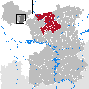
| Location of the administrative community Oppurg in the Saale-Orla district | ||
  |
||

In the Thuringian administrative community of Oppurg from the Saale-Orla district , 13 communities have come together to handle their administrative business. It lies between the cities of Pößneck and Neustadt an der Orla .
The administrative community is based in Oppurg .
The municipalities
The first documentary mention in brackets
- Bodelwitz (1350)
- Dobritz (1350)
- Gertewitz (1350)
- Grobengereuth (January 24, 1500); with the district of Daumitsch (July 18, 1422)
- Langenorla (July 18, 1123); with the districts of Kleindembach (1366) and Langendembach (November 11, 1299) (since 1995)
- Lausnitz (June 8, 1266)
- Nimritz (December 1074)
- Oberoppurg (1378)
- Oppurg (December 1074) with the districts of Kolba (May 1, 1323) and Rehmen (1350)
- Quaschwitz (1350)
- Solkwitz (December 1074)
- Weira (July 31, 1307); with the district of Krobitz (December 1074)
- Wernburg (June 1, 1320)
history
The administrative community was founded on February 4, 1991. Grobengereuth joined the administrative community on March 18, 1994. On June 30, 1994, the communities Lausnitz , Quaschwitz and Weira joined. On July 28, 1995, the municipality of Langenorla joined the administrative community.
Population development
Development of the population (as of December 31st) :
|
|
|
|
|
- Data source: Thuringian State Office for Statistics
Web links
Individual evidence
- ^ Population of the municipalities from the Thuringian State Office for Statistics ( help on this ).
- ^ Wolfgang Kahl : First mention of Thuringian towns and villages . Verlag Rockstuhl, 2010, ISBN 978-3-86777-202-0 , pp. 36, 57, 88, 99, 52, 157, 144, 157, 159, 201, 209, 213, 150, 228, 225, 265, 307, 154 and 310.

existing: Oppurg | Ranis-Ziegenrück | Lake District | Triptis
former: Gefell | Heinersdorf | Krölpa | Ranis Oberland | Wurzbach region | Saalburg | Saale-Rennsteig | Saale-Sormitz-Heights | Tanna