
Langenorla
| coat of arms | Germany map | |
|---|---|---|

|
Coordinates: 50 ° 44 ' N , 11 ° 35' E |
|
| Basic data | ||
| State : | Thuringia | |
| County : | Saale-Orla district | |
| Management Community : | Oppurg | |
| Height : | 185 m above sea level NHN | |
| Area : | 22.58 km 2 | |
| Residents: | 1241 (Dec. 31, 2019) | |
| Population density : | 55 inhabitants per km 2 | |
| Postal code : | 07381 | |
| Area code : | 03647 | |
| License plate : | SOK, LBS, PN, SCZ | |
| Community key : | 16 0 75 054 | |
| LOCODE : | DE LRA | |
| Community structure: | 3 districts | |
| Association administration address: | Am Türkenhof 5 07381 Oppurg |
|
| Website : | ||
| Mayor : | Lars Fröhlich | |
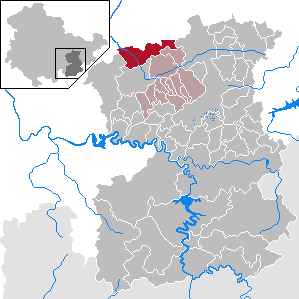
| Location of the municipality of Langenorla in the Saale-Orla district | ||
  |
||

Langenorla is a municipality in the Saale-Orla district in Thuringia . It consists of the districts Langendembach , Kleindembach and Langenorla with a total of about 1,500 inhabitants on an area of 22.71 km². The northern border of the municipality also forms part of the border with the Saale-Holzland district .
geography
The community is located in the Orlatal in the southern foothills of the northern red sandstone foreland of the Thuringian Slate Mountains . The districts of Langenorla and Kleindembach are located in the Orla valley itself, while Langendembach lies a little further to the east in the narrow valley of the Floßbach, which flows into the Orla in Kleindembach . At an average height of 265 m, Langendembach is about 80 m above the remaining districts. The community is surrounded by mountains up to 400 m high.
Neighboring communities
Neighboring communities are (in the Saale-Holzland district) Freienorla , Hummelshain , Trockenborn-Wolfersdorf and (in the Saale-Orla district) Neustadt an der Orla , Lausnitz , Oppurg , the town of Pößneck and Krölpa .
history
Langenorla was first mentioned on June 18, 1123, Kleindembach 1366 and Langendembach on November 11, 1299. From 1572 the municipality belonged to the Duchy of Saxony-Weimar due to the division of Erfurt . 31 years later, in 1603, it fell to the Duchy of Saxony-Altenburg . From 1672 to 1826 it was the territory of Saxe-Gotha-Altenburg . From 1826 until the founding of Thuringia in 1920, Langenorla was again part of Saxony-Altenburg. With the territorial reform in 1922, the municipality was added to the Saalfeld district.


In April 1945 the area was occupied by the US Army , which was replaced by the Red Army in early July . It went along with all social changes in the Soviet occupation zone and the GDR , including expropriations and collectivization of agriculture.
On July 1, 1950, the previously independent communities of Kleindembach and Langendembach were incorporated.
In 1952 the state of Thuringia was dissolved and divided into the districts of Gera , Erfurt and Suhl , and a new regional reform was carried out. From this point on, the community area belonged to the Pößneck district , which in 1994 became part of the Saale-Orla district .
Due to the abundance of forests in the municipality, the processing of wood has a long tradition. Until the middle of the 20th century, wood was felled in the forest east of Langendembach, among other things, and rafted to the sawmill in Langenorla using the raft brook, which was named after it .
In the 1980s, the bed of the raft brook was partly framed with concrete and widened for the purpose of flood protection , as it runs in parts in the middle of the settlement area.
Population development
Development of the population (as of December 31st) :
|
|
|
|
|
- Data source: Thuringian State Office for Statistics
politics
mayor
In September 2014, Lars Fröhlich (SPD / Open Citizens List) was elected mayor.
coat of arms
The coat of arms was approved on October 12, 1993.
Blazon : “Split and split behind; in front in silver a half black eagle with red feet and tongues with a golden wolf's head at the gap, in the back above red and silver split by three points, in the back below in blue an oblique left golden wavy bar. "
The eagle with a wolf's head was the heraldic animal of the town's founders, the lords of Orla, who were robber barons in the Middle Ages. The three points represent both the coat of arms of the noble family von Boes (Raven / Beust), as well as the three districts. The lower field symbolizes the abundance of water as a symbol of bubbling life and the wave bar as the embodiment of the orla.
The coat of arms was designed by the heraldist Michael Zapfe .
Culture and sights
Attractions
- Church of St. Blaise with monuments to the fallen of the First and Second World Wars and churchyard
- Langendembach village church
- Kleindembach village church, in need of restoration (2011)
- War memorial for the fallen of both world wars in Kleindembach
Historical monuments
Since 1960, a memorial stone in the cemetery in the Kleindembach district has been commemorating 152 Slovak victims of forced labor known by name , who died of abuse and catastrophic living conditions while working in the armaments company REIMAHG . A total of 450 workers were probably housed in the disused porcelain factory. In the cemetery of the Langenorla district, grave monuments commemorate three Italian prisoners on a death march from the Buchenwald concentration camp , who were murdered by SS men in April 1945.
Museums
From 1999 to 2018, the Orla Railway Museum was located in the entrance building of the Langenorla Ost train station in the Kleindembach district , where you could go back to the heyday of the Orla Railway , which was particularly important as a freight transport route in the 19th century.
In the district of Langendembach there is a local history museum with restored rooms from farmhouses, which illustrate the life of the simple population in the region until the middle of the 20th century.
Web links
Individual evidence
- ^ Population of the municipalities from the Thuringian State Office for Statistics ( help on this ).
- ^ Wolfgang Kahl : First mention of Thuringian towns and villages. A manual. 5th, improved and considerably enlarged edition. Rockstuhl, Bad Langensalza 2010, ISBN 978-3-86777-202-0 , pp. 157, 144, 157.
- ↑ http://wahlen.thueringen.de/datenbank/wahl1/wahl.asp?wahlart=BM&wJahr=0000&zeigeErg=GEM&auswertung=1&wknr=075&gemnr=75054&terrKrs=&gemteil=000&buchstabe=&Langname=&wahlvorschlag=&sort=&druck=&XLS=&anzahlH=- 8 & Non_existing = & x_vollbildDatteil = & optik = & aktuell = & ShowLand = & ShowWK = & ShowPart = & w_date = 14.09.2014 /
- ↑ Hartmut Ulle: New Thuringian Wappenbuch. Volume 2: Ilmkreis, Jena, Kyffhäuserkreis, Saale-Orla-Kreis, Saalfeld-Rudolstadt (district), Schmalkalden-Meiningen (district), Suhl. 2nd, changed, revised edition. Working Group Genealogy Thuringia, Erfurt 1997, ISBN 3-9804487-2-X , p. 38.
- ↑ Thuringian Association of the Persecuted of the Nazi Regime - Association of Antifascists and Study Group of German Resistance 1933–1945 (Ed.): Local history guide to sites of resistance and persecution 1933–1945. Volume 8: Thuringia. VAS - Publishing House for Academic Writings, Frankfurt am Main 2003, ISBN 3-88864-343-0 , 223.
- ↑ Homepage Orlabahnmuseum ( Memento from October 5, 2017 in the Internet Archive )
- ^ Community Langenorla: Heimatstube Langenorla. Reopening of the Heimatstube on May 12th, 2019. Retrieved May 19, 2020 .
Bad Lobenstein | Bodelwitz | Dittersdorf | Döbritz | Dreitzsch | Eßbach | Gefell | Geroda | Gertewitz | Görkwitz | Göschitz | Gössitz | Grobengereuth | Hirschberg | Keila | Cherry chew | Kospoda | Krölpa | Langenorla | Lausnitz | Lemnitz | Löhma | Miesitz | Mittelpöllnitz | Moßbach | Moxa | Neundorf (near Schleiz) | Neustadt an der Orla | Nimritz | Oberoppurg | Oettersdorf | Oppurg | Paska | Peuschen | Plot | Pörmitz | Pößneck | Quaschwitz | Ranis | Remptendorf | Rosendorf | Rosenthal am Rennsteig | Saalburg-Ebersdorf | Schleiz | Lubricating seat | Schmorda | Schondorf | Seisla | Solkwitz | Tanna | Tegau | Tommelsdorf | Triptis | Volkmannsdorf | Weira | Wernburg | Wilhelmsdorf | Wurzbach | Ziegenrück