
Schmorda
| coat of arms | Germany map | |
|---|---|---|

|
Coordinates: 50 ° 39 ' N , 11 ° 35' E |
|
| Basic data | ||
| State : | Thuringia | |
| County : | Saale-Orla district | |
| Management Community : | Ranis-Ziegenrück | |
| Height : | 510 m above sea level NHN | |
| Area : | 4.84 km 2 | |
| Residents: | 90 (Dec. 31, 2019) | |
| Population density : | 19 inhabitants per km 2 | |
| Postal code : | 07389 | |
| Area code : | 03647 | |
| License plate : | SOK, LBS, PN, SCZ | |
| Community key : | 16 0 75 101 | |
| Association administration address: | Pößnecker Str. 2 07389 Ranis |
|
| Website : | ||
| Mayoress : | Andrea Philipp-Dittrich | |
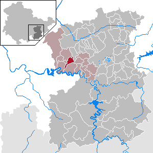
| Location of the community Schmorda in the Saale-Orla district | ||
  |
||


Schmorda is a municipality in the Ranis-Ziegenrück administrative community in the Saale-Orla district in Thuringia .
geography
Schmorda is located on a higher plateau of the Thuringian Slate Mountains northeast of the Hohenwarte reservoir . The demarcation is docked and mostly surrounded by forest. To the north is Ranis .
history
Schmorda was first mentioned in a document in 1525. W. Kahl determined the first documentary mention from the year 1379.
The current church was built in the 19th century.
Until the 19th century, copper and spar were mined at several deposits. Subsequently, the agricultural importance grew, which can still be seen today in the four-sided courtyards of the Angerdorf . Schmorda belonged to the electoral office of Arnshaugk until 1815 and came to the Prussian district of Ziegenrück , to which the place belonged until 1945 , after it was assigned at the Congress of Vienna .
Population development
Development of the population (from 1994: as of December 31) :
|
|
|
|
|
- Data source from 1994: Thuringian State Office for Statistics
Web links
Individual evidence
- ^ Population of the municipalities from the Thuringian State Office for Statistics ( help on this ).
- ^ Wolfgang Kahl : First mention of Thuringian towns and villages. A manual. 5th, improved and considerably enlarged edition. Rockstuhl, Bad Langensalza 2010, ISBN 978-3-86777-202-0 , p. 253.
- ^ A b Michael Rademacher: German administrative history from the unification of the empire in 1871 to the reunification in 1990. Ziegenrück district. (Online material for the dissertation, Osnabrück 2006).
Bad Lobenstein | Bodelwitz | Dittersdorf | Döbritz | Dreitzsch | Eßbach | Gefell | Geroda | Gertewitz | Görkwitz | Göschitz | Gössitz | Grobengereuth | Hirschberg | Keila | Cherry chew | Kospoda | Krölpa | Langenorla | Lausnitz | Lemnitz | Löhma | Miesitz | Mittelpöllnitz | Moßbach | Moxa | Neundorf (near Schleiz) | Neustadt an der Orla | Nimritz | Oberoppurg | Oettersdorf | Oppurg | Paska | Peuschen | Plot | Pörmitz | Pößneck | Quaschwitz | Ranis | Remptendorf | Rosendorf | Rosenthal am Rennsteig | Saalburg-Ebersdorf | Schleiz | Lubricating seat | Schmorda | Schondorf | Seisla | Solkwitz | Tanna | Tegau | Tommelsdorf | Triptis | Volkmannsdorf | Weira | Wernburg | Wilhelmsdorf | Wurzbach | Ziegenrück