
Grobengereuth
| coat of arms | Germany map | |
|---|---|---|

|
Coordinates: 50 ° 40 ′ N , 11 ° 40 ′ E |
|
| Basic data | ||
| State : | Thuringia | |
| County : | Saale-Orla district | |
| Management Community : | Oppurg | |
| Height : | 470 m above sea level NHN | |
| Area : | 5.64 km 2 | |
| Residents: | 196 (Dec. 31, 2019) | |
| Population density : | 35 inhabitants per km 2 | |
| Postal code : | 07389 | |
| Area code : | 036484 | |
| License plate : | SOK, LBS, PN, SCZ | |
| Community key : | 16 0 75 039 | |
| Association administration address: | Am Türkenhof 5 07381 Oppurg |
|
| Website : | ||
| Mayor : | Eberhard Pilz | |
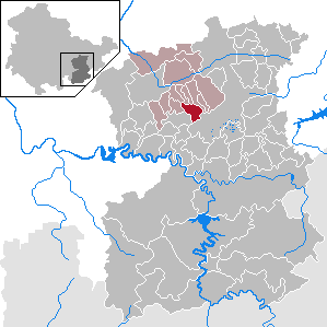
| Location of the community Grobengereuth in the Saale-Orla district | ||
  |
||


Grobengereuth is a municipality in the administrative community of Oppurg in the Saale-Orla district in Thuringia .
location
Grobengereuth and Daumitsch are located on a plateau of the south-east Thuringian slate mountains, which tapers to the north . The demarcations of both places are ring-shaped with forest areas. Via the state road 2359 from Ziegenrück with connection to the federal road 281 in Oppurg , the places have traffic connections.
history
On June 24, 1500, Grobengereuth and on July 18, 1223 the district of Daumitsch were first mentioned in a document. Landlords were u. a. those of Obernitz .
Population development
Development of the population (as of December 31st) :
|
|
|
|
|
- Data source: Thuringian State Office for Statistics
Historical monuments
In the cemetery in the Daumitsch district, a grave memorial commemorates the twelve concentration camp prisoners buried there, who were murdered by SS men during a death march from the Buchenwald concentration camp to the Flossenbürg concentration camp , which passed through the village .
Individual evidence
- ^ Population of the municipalities from the Thuringian State Office for Statistics ( help on this ).
- ^ Wolfgang Kahl : First mention of Thuringian towns and villages. A manual. 5th, improved and considerably enlarged edition. Rockstuhl, Bad Langensalza 2010, ISBN 978-3-86777-202-0 , pp. 99 and 52.
- ↑ Thuringian Association of the Persecuted of the Nazi Regime - Association of Antifascists and Study Group of German Resistance 1933–1945 (Ed.): Local history guide to sites of resistance and persecution 1933–1945. Volume 8: Thuringia. VAS - Verlag für Akademische Schriften, Frankfurt am Main 2003, ISBN 3-88864-343-0 , p. 221 f.
Web links
Bad Lobenstein | Bodelwitz | Dittersdorf | Döbritz | Dreitzsch | Eßbach | Gefell | Geroda | Gertewitz | Görkwitz | Göschitz | Gössitz | Grobengereuth | Hirschberg | Keila | Cherry chew | Kospoda | Krölpa | Langenorla | Lausnitz | Lemnitz | Löhma | Miesitz | Mittelpöllnitz | Moßbach | Moxa | Neundorf (near Schleiz) | Neustadt an der Orla | Nimritz | Oberoppurg | Oettersdorf | Oppurg | Paska | Peuschen | Plot | Pörmitz | Pößneck | Quaschwitz | Ranis | Remptendorf | Rosendorf | Rosenthal am Rennsteig | Saalburg-Ebersdorf | Schleiz | Lubricating seat | Schmorda | Schondorf | Seisla | Solkwitz | Tanna | Tegau | Tommelsdorf | Triptis | Volkmannsdorf | Weira | Wernburg | Wilhelmsdorf | Wurzbach | Ziegenrück