
Eßbach
| coat of arms | Germany map | |
|---|---|---|

|
Coordinates: 50 ° 35 ' N , 11 ° 41' E |
|
| Basic data | ||
| State : | Thuringia | |
| County : | Saale-Orla district | |
| Management Community : | Ranis-Ziegenrück | |
| Height : | 433 m above sea level NHN | |
| Area : | 5.28 km 2 | |
| Residents: | 242 (Dec. 31, 2019) | |
| Population density : | 46 inhabitants per km 2 | |
| Postal code : | 07924 | |
| Area code : | 036483 | |
| License plate : | SOK, LBS, PN, SCZ | |
| Community key : | 16 0 75 023 | |
| Community structure: | 2 districts | |
| Association administration address: | Pößnecker Str. 2 07389 Ranis |
|
| Website : | ||
| Mayor : | Ludwig Reinhold | |
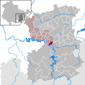
| Location of the municipality of Eßbach in the Saale-Orla district | ||
  |
||


Eßbach is a municipality in the Saale-Orla district in Thuringia and is part of the Ranis-Ziegenrück administrative community .
geography
Geographical location
Eßbach is located in the center of the Saale-Orla district around 9 km west of the small town of Schleiz at around 433 m above sea level. NN . About 3 km southeast of the town center is the Wisenta reservoir with the Wisenta pumped storage plant , through which the Wisenta flows from the southern district of Walsburg and flows into the Saale from the east . Your small reservoir belongs to the Saale Cascade , the largest contiguous reservoir area in Germany . This cascade also includes the Hohenwarte reservoir , 12 km west of Eßbach an der Saale , which is one of the largest reservoirs in Germany and is dammed by the Hohenwarte reservoir. The Obere Saale landscape protection area extends over large parts of the municipality .
Community structure
The community consists of Eßbach and the southern district of Walsburg .
history
The Angerdorf Eßbach was first mentioned in a document in 1378, at that time as Espech . At that time it was one of the accessories of Ziegenrück Castle . A church has been documented in an archive on site since 1544 .
Slight remains of the wall on the mountain spur above the right bank of the Saale near Eßbach indicate the former “Walsburg” fortification. At that time it served to protect and help with the Saale crossing traffic between the Orlasenke with Arnshaugh and Neustadt / Orla and Lobenstein. The castle was probably built by the Lobdeburgers, because in 1323 it came into the possession of the Schwarzburger and in the 15th century it was abandoned. The place belonged to the electoral office of Ziegenrück until 1815 and after its assignment, decided at the Congress of Vienna , came to the Prussian district of Ziegenrück , to which the place belonged until 1945.
Walsburg, which is historically known as a hammer mill near a former robber baron's castle, has been part of the community since 1967.
Population development
Development of the population (from 1994: as of December 31) :
|
|
|
|
|
- Data source from 1994: Thuringian State Office for Statistics
coat of arms
Description : “In silver with a blue flank on the left (in it a golden wave pole) standing over a green shield base on a green ball, a woman in a blue dress with a golden belt, with her right hand swinging a green sail over her head, which she holds with the left Hand grabs. "
Web links
Individual evidence
- ^ Population of the municipalities from the Thuringian State Office for Statistics ( help on this ).
- ↑ Michael Köhler: Thuringian castles and fortified prehistoric and early historical living spaces. Jenzig-Verlag, Jena 2001, ISBN 3-910141-43-9 , p. 265.
- ^ A b Michael Rademacher: German administrative history from the unification of the empire in 1871 to the reunification in 1990. Ziegenrück district. (Online material for the dissertation, Osnabrück 2006).
Bad Lobenstein | Bodelwitz | Dittersdorf | Döbritz | Dreitzsch | Eßbach | Gefell | Geroda | Gertewitz | Görkwitz | Göschitz | Gössitz | Grobengereuth | Hirschberg | Keila | Cherry chew | Kospoda | Krölpa | Langenorla | Lausnitz | Lemnitz | Löhma | Miesitz | Mittelpöllnitz | Moßbach | Moxa | Neundorf (near Schleiz) | Neustadt an der Orla | Nimritz | Oberoppurg | Oettersdorf | Oppurg | Paska | Peuschen | Plot | Pörmitz | Pößneck | Quaschwitz | Ranis | Remptendorf | Rosendorf | Rosenthal am Rennsteig | Saalburg-Ebersdorf | Schleiz | Lubricating seat | Schmorda | Schondorf | Seisla | Solkwitz | Tanna | Tegau | Tommelsdorf | Triptis | Volkmannsdorf | Weira | Wernburg | Wilhelmsdorf | Wurzbach | Ziegenrück