
Bodelwitz
| coat of arms | Germany map | |
|---|---|---|

|
Coordinates: 50 ° 41 ′ N , 11 ° 37 ′ E |
|
| Basic data | ||
| State : | Thuringia | |
| County : | Saale-Orla district | |
| Management Community : | Oppurg | |
| Height : | 280 m above sea level NHN | |
| Area : | 4.61 km 2 | |
| Residents: | 584 (Dec. 31, 2019) | |
| Population density : | 127 inhabitants per km 2 | |
| Postal code : | 07381 | |
| Area code : | 03647 | |
| License plate : | SOK, LBS, PN, SCZ | |
| Community key : | 16 0 75 006 | |
| LOCODE : | DE 4B4 | |
| Association administration address: | Am Türkenhof 5 07381 Oppurg |
|
| Website : | ||
| Mayoress : | Katja Staps ( CDU ) | |
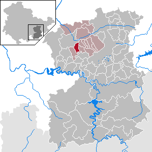
| Location of the municipality of Bodelwitz in the Saale-Orla district | ||
  |
||

Bodelwitz is a municipality in the administrative community of Oppurg in the Saale-Orla district in Thuringia .
geography

Bodelwitz is located to the south not far from Pößneck in a hilly terrain of the south-east Thuringian slate mountains in the transition to the Orlasenke . Wernburg is to the west and Döbritz to the east . The community is located near the federal highway 281 .
With the KomBus line 960 , Bodelwitz has a connection to the city of Pößneck .
history
The village was first mentioned in a document in 1350. Bodelwitz belonged to the electoral office of Arnshaugk until 1815 and, after its assignment, decided at the Congress of Vienna , came to the Prussian district of Ziegenrück , to which the place belonged until 1945.
The village school, built in 1908, stands on the site of a small medieval rampart above the stream, which once gave the citizens protection in case of danger.
Population development
Development of the population (from 1994: as of December 31) :
|
|
|
|
|
- Data source from 1994: Thuringian State Office for Statistics
politics
Municipal council
The 8 seats in the municipal council have been distributed among the individual parties as follows since the 2014 election:
| Political party | Result | Seats |
| CDU | 100% | 8th |
coat of arms
The coat of arms was approved on August 9, 1991.
Blazon : "In silver, a gold-armored black eagle."
The coat of arms was created in the 1930s. Today nothing is known about the origin. It was still attached to the facade of the Ziegenrück town hall until the 1960s. The eagle corresponds to the Prussian one with the same tinging . This suggests that the former Ziegenrück district was a Prussian exclave from 1815 to 1945 .
Culture and sights
Historical monuments
In the cemetery, a memorial stone on the graves commemorates three perished concentration camp prisoners on a death march that led through the district in April 1945 from the Berga / Elster concentration camp external command . They were found in the sand pit on the road to Oppurg . During the Second World War there were also prisoners of war from France who had to do forced labor there as well as in Wernburg and Gertewitz .
church
Individual evidence
- ^ Population of the municipalities from the Thuringian State Office for Statistics ( help on this ).
- ^ Wolfgang Kahl : First mention of Thuringian towns and villages. A manual. 5th, improved and considerably enlarged edition. Rockstuhl, Bad-Langensalza 2010, ISBN 978-3-86777-202-0 , p. 36.
- ↑ Michael Köhler: Thuringian castles and fortified prehistoric and early historical living spaces. Jenzig-Verlag Köhler, Jena 2001, ISBN 3-910141-43-9 , p. 69.
- ^ A b Michael Rademacher: German administrative history from the unification of the empire in 1871 to the reunification in 1990. ziegenrueck.html. (Online material for the dissertation, Osnabrück 2006).
- ↑ http://www.wahlen.thueringen.de/datenbank/wahl1/wahl.asp?wahlart=GW&wjahr=2014&habenErg=GEM&auswert=1&wknr=075&gemnr=75006&terrKrs=&gemteil=000&buchstabe=&Langname=x&wahlvorschlag=&sort=&druck=& .XL=&sort=&druck=& .XL = -3 & Non_existing = & x_vollbildDatteil = & optik = & aktuell = & ShowLand = & ShowWK = & ShowPart =
- ↑ Hartmut Ulle: New Thuringian Wappenbuch. Volume 2: Ilmkreis, Jena, Kyffhäuserkreis, Saale-Orla-Kreis, Saalfeld-Rudolstadt (district), Schmalkalden-Meiningen (district), Suhl. 2nd, changed, revised edition. Arbeitsgemeinschaft Genealogy Thüringen eV, Erfurt 1997, ISBN 3-9804487-2-X , p. 34.
- ↑ Thuringian Association of the Persecuted of the Nazi Regime - Association of Antifascists and Study Group of German Resistance 1933–1945 (Ed.): Local history guide to sites of resistance and persecution 1933–1945. Volume 8: Thuringia. VAS - Verlag für Akademische Schriften, Frankfurt am Main 2003, ISBN 3-88864-343-0 , p. 220.
Web links
Bad Lobenstein | Bodelwitz | Dittersdorf | Döbritz | Dreitzsch | Eßbach | Gefell | Geroda | Gertewitz | Görkwitz | Göschitz | Gössitz | Grobengereuth | Hirschberg | Keila | Cherry chew | Kospoda | Krölpa | Langenorla | Lausnitz | Lemnitz | Löhma | Miesitz | Mittelpöllnitz | Moßbach | Moxa | Neundorf (near Schleiz) | Neustadt an der Orla | Nimritz | Oberoppurg | Oettersdorf | Oppurg | Paska | Peuschen | Plot | Pörmitz | Pößneck | Quaschwitz | Ranis | Remptendorf | Rosendorf | Rosenthal am Rennsteig | Saalburg-Ebersdorf | Schleiz | Lubricating seat | Schmorda | Schondorf | Seisla | Solkwitz | Tanna | Tegau | Tommelsdorf | Triptis | Volkmannsdorf | Weira | Wernburg | Wilhelmsdorf | Wurzbach | Ziegenrück