
Miesitz
| coat of arms | Germany map | |
|---|---|---|

|
Coordinates: 50 ° 44 ' N , 11 ° 50' E |
|
| Basic data | ||
| State : | Thuringia | |
| County : | Saale-Orla district | |
| Management Community : | Triptis | |
| Height : | 330 m above sea level NHN | |
| Area : | 4.45 km 2 | |
| Residents: | 279 (Dec. 31, 2019) | |
| Population density : | 63 inhabitants per km 2 | |
| Postal code : | 07819 | |
| Area code : | 036482 | |
| License plate : | SOK, LBS, PN, SCZ | |
| Community key : | 16 0 75 065 | |
| Association administration address: | Markt 1 07819 Triptis |
|
| Website : | ||
| Mayoress : | Bettina Gäbler | |
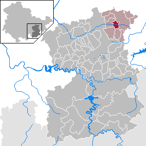
| Location of the community of Miesitz in the Saale-Orla district | ||
  |
||

Miesitz is a municipality in the Triptis administrative community in the Saale-Orla district in Thuringia .
geography

Miesitz and the district are in the Orlatal west of the federal highway 9 and the city of Triptis . The 281 federal road and the Gera - Saalfeld railway line run through the Orlatal .
The community Miesitz consists of the districts Miesitz and Kopitzsch .
history
Miesitz goes back to a Sorbian settlement and was first mentioned in 1074 as Misaci and was the ancestral seat of the noble von Metsch family in the 13th century . The district of Kopitzsch, first mentioned in 1394 as Copacz , had been the seat of the parish office of the then parish Kopitzsch-Miesitz-Traun-Lemnitz since 1529.
On July 1, 1950, the previously independent municipality Kopitzsch was incorporated.
Population development
Development of the population (December 31st each) :
|
|
|
|
|
- Data source: Thuringian State Office for Statistics

coat of arms
|
|
Blazon : "By a silver slanting left-hand wave bar divided by red and green, above a slanting left-hand silver oak leaf, below a slanting left-hand silver bell."
The coat of arms was approved on October 17, 1994 by the Thuringian State Administration Office. |
|
Justification for the coat of arms: The oak leaf symbolizes the giant oak of Miesitz with a height of 32 meters and a crown diameter of around 25 meters, which made it the largest tree in the former Pößneck district.
The bell symbolizes the church, which was fundamentally restored in 1739/40 by order of the then manor owner von Miesitz, the Count von Stein. The sloping wave bar represents the Orla river. |
Business
In the community there is a car workshop, a car paint shop, a horse ranch as well as a hotel and a go-kart track.
Individual evidence
- ^ Population of the municipalities from the Thuringian State Office for Statistics ( help on this ).
- ↑ Hartmut Ulle: New Thuringian Wappenbuch. Volume 2: Ilmkreis, Jena, Kyffhäuserkreis, Saale-Orla-Kreis, Saalfeld-Rudolstadt (district), Schmalkalden-Meiningen (district), Suhl. 2nd, changed, revised edition. Working group Genealogy Thuringia, Erfurt 1997, ISBN 3-9804487-2-X , p. 39.
Web links
Bad Lobenstein | Bodelwitz | Dittersdorf | Döbritz | Dreitzsch | Eßbach | Gefell | Geroda | Gertewitz | Görkwitz | Göschitz | Gössitz | Grobengereuth | Hirschberg | Keila | Cherry chew | Kospoda | Krölpa | Langenorla | Lausnitz | Lemnitz | Löhma | Miesitz | Mittelpöllnitz | Moßbach | Moxa | Neundorf (near Schleiz) | Neustadt an der Orla | Nimritz | Oberoppurg | Oettersdorf | Oppurg | Paska | Peuschen | Plot | Pörmitz | Pößneck | Quaschwitz | Ranis | Remptendorf | Rosendorf | Rosenthal am Rennsteig | Saalburg-Ebersdorf | Schleiz | Lubricating seat | Schmorda | Schondorf | Seisla | Solkwitz | Tanna | Tegau | Tommelsdorf | Triptis | Volkmannsdorf | Weira | Wernburg | Wilhelmsdorf | Wurzbach | Ziegenrück