
Cherry chew
| coat of arms | Germany map | |
|---|---|---|
 Help on coat of arms |
Coordinates: 50 ° 36 ' N , 11 ° 53' E |
|
| Basic data | ||
| State : | Thuringia | |
| County : | Saale-Orla district | |
| Management Community : | Lake district | |
| Height : | 478 m above sea level NHN | |
| Area : | 6 km 2 | |
| Residents: | 208 (Dec. 31, 2019) | |
| Population density : | 35 inhabitants per km 2 | |
| Postal code : | 07919 | |
| Area code : | 03663 | |
| License plate : | SOK, LBS, PN, SCZ | |
| Community key : | 16 0 75 048 | |
| Association administration address: | Schleizer Str. 17 07907 Oettersdorf |
|
| Website : | ||
| Mayor : | André guy | |
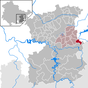
| Location of the municipality of Kirschkau in the Saale-Orla district | ||
  |
||

Kirschkau is a municipality in the Saale-Orla district in Thuringia . It is located in the Thuringian Slate Mountains and belongs to the Lake District administrative community .
neighborhood
Adjacent communities are Göschitz , Löhma and the town of Schleiz in the Saale-Orla district and the town of Zeulenroda-Triebes in the district of Greiz .
geography

The federal highway 94 runs through the municipality . It connects Schleiz and Zeulenroda and the neighboring towns.
geology
Geologically, the landscape in the southeast Thuringian slate mountains lies on a plateau. Its soils have a high proportion of fine soil and a high humus content.
history
Kirschkau was first mentioned in a document on November 25, 1335. In 1407 the church Petrus und Paulus was mentioned for Kirschkau. This church was demolished in 1751 and today's Jesus Church was built on the same site. It has been described as one of the best church buildings in Thuringia in the 18th century.
Population development
Development of the population (December 31st each) :
|
|
|
|
|
- Data source: Thuringian State Office for Statistics
Individual evidence
- ^ Population of the municipalities from the Thuringian State Office for Statistics ( help on this ).
- ↑ Manfred Graf: Organization of the cooperative plant production with a high proportion of grassland in the southeast Thuringian slate mountains. Shown at the KOG "Lobenstein". 1970, (Jena, University, dissertation, 1970; typed).
- ^ Wolfgang Kahl : First mention of Thuringian towns and villages. A manual. 5th, improved and considerably enlarged edition. Rockstuhl, Bad Langensalza 2010, ISBN 978-3-86777-202-0 , p. 142.
- ↑ Lieselotte Swietek, Wolfgang Swietek: village churches in Thuringia (= Small Thuringia library. 27). Verlagshaus Thüringen, Erfurt 1993, ISBN 3-86087-014-9 , pp. 54-55.
Web links
Bad Lobenstein | Bodelwitz | Dittersdorf | Döbritz | Dreitzsch | Eßbach | Gefell | Geroda | Gertewitz | Görkwitz | Göschitz | Gössitz | Grobengereuth | Hirschberg | Keila | Cherry chew | Kospoda | Krölpa | Langenorla | Lausnitz | Lemnitz | Löhma | Miesitz | Mittelpöllnitz | Moßbach | Moxa | Neundorf (near Schleiz) | Neustadt an der Orla | Nimritz | Oberoppurg | Oettersdorf | Oppurg | Paska | Peuschen | Plot | Pörmitz | Pößneck | Quaschwitz | Ranis | Remptendorf | Rosendorf | Rosenthal am Rennsteig | Saalburg-Ebersdorf | Schleiz | Lubricating seat | Schmorda | Schondorf | Seisla | Solkwitz | Tanna | Tegau | Tommelsdorf | Triptis | Volkmannsdorf | Weira | Wernburg | Wilhelmsdorf | Wurzbach | Ziegenrück