Gertewitz
| coat of arms | Germany map | |
|---|---|---|

|
Coordinates: 50 ° 41 ′ N , 11 ° 39 ′ E |
|
| Basic data | ||
| State : | Thuringia | |
| County : | Saale-Orla district | |
| Management Community : | Oppurg | |
| Height : | 358 m above sea level NHN | |
| Area : | 4.21 km 2 | |
| Residents: | 132 (Dec. 31, 2019) | |
| Population density : | 31 inhabitants per km 2 | |
| Postal code : | 07389 | |
| Area code : | 03647 | |
| License plate : | SOK, LBS, PN, SCZ | |
| Community key : | 16 0 75 031 | |
| Association administration address: | Am Türkenhof 5 07381 Oppurg |
|
| Website : | ||
| Mayor : | Günter Brüsch | |
| Location of the community of Gertewitz in the Saale-Orla district | ||
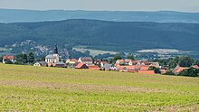
Gertewitz (also: Gaartz) is a municipality in the administrative community of Oppurg in the Saale-Orla district in Thuringia in Germany .
geography
Gertewitz is located south of Pößneck and Bodelwitz in a hilly terrain of the south-east Thuringian slate mountains in the transition to the Orlasenke . Wernburg lies to the west and Döbritz to the northeast, near Döbritz Switzerland . The traffic connection to the federal highway 281 is given.
history
1350 was the first documentary mention of Gertewitz.
Gertewitz was part of the majority rule Oppurg in the Electoral Office of Arnshaugk . He came to the to the Congress of Vienna decided assignment to the Prussian district Ziegenrück in the province of Saxony , which included the place to 1945th At the time of the GDR, the place belonged to the Gera district . Gertewitz has been a member of the Oppurg administrative association since 1992.
Population development
Development of the population (from 1994: as of December 31) :
|
|
|
|
|
- Data source from 1994: Thuringian State Office for Statistics
Attractions
- Gertewitz village church
- Village fountain and newly designed village pond
Individual evidence
- ^ Population of the municipalities from the Thuringian State Office for Statistics ( help on this ).
- ^ Wolfgang Kahl : First mention of Thuringian towns and villages. A manual. 5th, improved and considerably enlarged edition. Rockstuhl, Bad-Langensalza 2010, ISBN 978-3-86777-202-0 , p. 88.
- ^ A b Michael Rademacher: German administrative history from the unification of the empire in 1871 to the reunification in 1990. Ziegenrück district. (Online material for the dissertation, Osnabrück 2006).


