
Ziegenrück
| coat of arms | Germany map | |
|---|---|---|

|
Coordinates: 50 ° 37 ' N , 11 ° 39' E |
|
| Basic data | ||
| State : | Thuringia | |
| County : | Saale-Orla district | |
| Management Community : | Ranis-Ziegenrück | |
| Height : | 318 m above sea level NHN | |
| Area : | 8.25 km 2 | |
| Residents: | 657 (Dec. 31, 2019) | |
| Population density : | 80 inhabitants per km 2 | |
| Postal code : | 07924 | |
| Area code : | 036483 | |
| License plate : | SOK, LBS, PN, SCZ | |
| Community key : | 16 0 75 127 | |
City administration address : |
Markt 6 07924 Ziegenrück |
|
| Website : | ||
| Mayor : | Horst Maschke | |
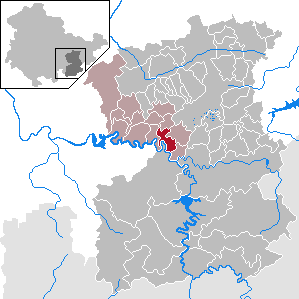
| Location of the town of Ziegenrück in the Saale-Orla district | ||
  |
||

Ziegenrück is a country town in the Saale-Orla district in the south-east of Thuringia and the fifth smallest city in Germany . The city lies in the deeply cut valley of the meandering Saale between the Bleilochtalsperre upstream and the Hohenwarte reservoir downstream. The Kemenate Ziegenrück is located above the city . Since the cramped geographical location prevented further development, Ziegenrück is one of the smallest towns in Thuringia today.
geography
Ziegenrück is located on the northern edge of the Thuringian Slate Mountains on the Saale , which runs through the city in several loops. The slopes at the edge of their valley rise steeply and are forested. Above it are plateaus used as agricultural land.
The old town extends in the valley of the Drebabach, which flows into the Saale from the right. To the south of it is the train station, around it the Neustadt lies on a relatively flat surface in the Saale valley. Ziegenrück also extends into Plothental to the right of the Saale. On the left side of the river there is the school, the sports field; south of the city is an industrial settlement.
Neighboring communities are Eßbach , Keila , Moxa , Paska , Remptendorf and Schöndorf .
Closest larger cities are Schleiz in the east (16 km), Pößneck in the north (13 km), Saalfeld in the west (28 km) and Bad Lobenstein in the south (21 km).
history
Ziegenrück was founded around the year 1000. The first settlement is said to have been mostly above the old sheep farm and was destroyed by a flood. The place name Ziegenrück can be traced back to the Sorbian name Czegenruck , which means something like river bend or river loop . The first written mention of the place comes from the year 1258. Also in this year the upper mill in Ziegenrück was first mentioned in a document and a little later further mills were mentioned. He has had town charter since 1328.

The Ziegenrück Castle (now: Kemenate Ziegenrück ) was a bastion of the Saalfeld estate complex and was first mentioned in 1222. It was strategically located on a rock spur high above the Saale between the Dreba and Sormitz valleys and probably served to monitor and secure the river crossing of the Saale for the former road from north to south. The rock spur has steep slopes on three sides and had trenches that divided the system into sections. The castle was owned by the Counts of Orlamünde. From the 14th century it belonged to the Thuringian Landgrave. Vogt Heinrich II von Plauen was temporarily the owner. 1448–1481 the fortress was pledged to the Lords of Obernitz. In 1485 the Ernestines of the Wettin line were owners. After several fires, the castle was demolished in the 18th and 19th centuries. The bower then served as a youth hostel and is now intended as a hotel.
Ziegenrück came in 1567 with the "assekurierten offices" in the pledge property and from 1660 in the full possession of the Albertine Electorate so belonged to 1815 to the New Town district of the Kingdom of Saxony ( Office Ziegenrück ) and then became a district town in the administrative district of Erfurt of the Prussian province of Saxony ( district Ziegenrück ). The reason for this extraordinary type of administration was probably the marriage on August 24th, 1300 of Margrave Friedrich der Freidige and Elisabeth, the 14-year-old daughter of his stepmother from the connection with Otto von Lobdeburg-Arnshaugk. Therefore, the young woman brought Neustadt an der Orla, Auma, Ziegenrück and a quarter of the city of Jena into the marriage. Not only Friedrich was favored by the emperor, but also the landgrave guardian Heinrich von Plauen of Elisabeth, to whom territories were also transferred. Friedrich also left the castles Triptis, Auma and Ziegenrück to the Russians as a pledge for the sum of 3,000 shock Meißner groschen , which he owed and the emperor agreed.
In 1894 the Oberlandbahn from Triptis reached Ziegenrück, a year later it was continued to Lobenstein .
During the Second World War , numerous prisoners of war and workers from the Soviet Union had to do forced labor . 16 victims of forced labor are buried in the cemetery of honor in the park on the banks of the Saale . A stele was erected there in 1985 to commemorate the death march in which five concentration camp prisoners lost their lives on the road from Paska to Ziegenrück in April 1945 .
On October 1, 1945, the district of Ziegenrück was dissolved. The city of Ziegenrück was assigned to the Saalfeld district. In 1952 the place became part of the Schleiz district in the Gera district . In 1994 the Schleiz district became part of the Saale-Orla district.
Population development
Development of the population (from 1994: as of December 31) :

|
1833 to 1995
|
1996 to 2001
|
2002 to 2007
|
2008 to 2013
|
2014 to 2019
|
- Data source from 1994: Thuringian State Office for Statistics
politics
Ziegenrück is a member of the Ranis-Ziegenrück administrative community based in Ranis .
City council
The municipal council election on May 25, 2014 , with a turnout of 48.4%, led to the following result (the results of the 2009 election in brackets):
| list | be right | Share of votes | Seats |
|---|---|---|---|
| Ziegenrücker Carnival Society Blau-Weiß 1984 eV | 433 (372) | 53.3% (35.0) | 5 (3) |
| Tourist Association Ziegenrück eV | 380 (178) | 46.7% (16.8) | 3 (1) |
The VdK, which had four seats in 2009, is no longer represented on the city council.
coat of arms
Blazon : "In silver a black goat turned left, with a three-tower red building with a raised central tower floating over its back."
Attractions


In the core of the old town is the town church of St. Bartholomew and St. Nicholas . It was first mentioned in 1264 and in its current form dates from the 14th / 15th centuries. Century. After a fire in 1656, the exterior was changed somewhat. On the market square there are some half-timbered houses from the 16th and 17th centuries. Century, including the rectory from 1650.
The Kemenate Ziegenrück, which dates from the first quarter of the 15th century, is located above the town on the Schlossberg. It is the last remaining part of the castle, which was destroyed in 1550, and is comparable to the facilities in Orlamünde and Reinstädt .
The Eisenach – Budapest mountain hiking trail , the Saale-Orla hiking trail and the Saale cycle path run through Ziegenrück . Coming from Rügen, the Baltic Sea-Saale dams long-distance hiking trail ends here .


Also worth seeing is the hydropower museum, which documents the use of hydropower in the first half of the 20th century. The former remote mill , mentioned in a document in 1558, was converted into a run-of-river power station in 1900 and supplied the local cardboard box factory with electricity. The plant, closed in 1965 and preserved as a technical monument, illustrates the beginnings of electrification. The hydropower museum also regularly offers special exhibitions on various topics related to water and hydropower generation in one way or another.
Culture
The Poetenstube in the center of Ziegenrück offers regular poetry readings and art exhibitions. The Poetenstube also has a small library to offer.
In the meeting point photo gallery on the place of the youth in the center of Ziegenrück there is a permanent exhibition of photo art with pictures of Ziegenrück and the surrounding area. There are also monthly special exhibitions with other topics. With over 50 works of art and free admission, the gallery has become a much-visited attraction for tourists and weekend visitors to the city.
The former Catholic Church on Paskaer Straße has also been transformed into a cultural center since it was taken over by private owners, where concerts and exhibitions take place regularly.
Economy and Infrastructure
The Ziegenrück economy is shaped by the Saale. In the past it was mainly used for rafting, today hydropower is important for generating electricity. Ziegenrück is a state-approved resort .
In 1895, Ziegenrück received a rail connection on the Triptis – Marxgrün line , which connected the city with Gera in the north and Hof in the south. In 1945 this route was interrupted by the inner-German border and only operated as far as Blankenstein . In 1998 it was shut down. A railway viaduct over the Saale in the south and a similar overpass in the north of the city center refer to the course of the railway line.
Ziegenrück is connected to Pößneck in the north, Auma in the northeast, Schleiz in the east and Bad Lobenstein in the south via state roads.
Personalities
- Hans von Seebach (1380–1422), bailiff of Ziegenrück
- Balthasar Musculus (* around 1540; † between 1595 and 1597), composer and schoolmaster in Ziegenrück
- Caspar Dornau (1577–1632), doctor and philologist, born in Ziegenrück
- Karl Weyrich (1884–1973), 1915–1924 mayor of Ziegenrück
- Willy Weidermann (1898–1985), SS brigade leader , born in Ziegenrück
- Rudolf Staritz (* 1921), communications engineer, born in Ziegenrück
literature
- Karl Rühl: Ziegenrück in the upper Saale valley. Festschrift for the 31st general meeting of the Thuringian Forest Association in Ziegenrück. Jentzsch, Ziegenrück 1910.
- Dr Horst Lang: Ziegenrück is changing. 2015
Individual evidence
- ^ Population of the municipalities from the Thuringian State Office for Statistics ( help on this ).
- ↑ Werner Diezel: Mills between the upper Saale and Thuringian basin. Water wheels and turbines in mills, hammer mills and smelters in the Saale catchment area as well as windmills on the surrounding plateaus. Rockstuhl, Bad Langensalza 2012, ISBN 978-3-86777-453-6 , p. 18.
- ↑ Thomas Bienert: Medieval castles in Thuringia. 430 castles, castle ruins and fortifications. Wartberg-Verlag, Gudensberg-Gleichen 2000, ISBN 3-86134-631-1 , p. 225.
- ↑ Michael Köhler: Thuringian castles and fortified prehistoric and early historical living spaces. Jenzig Verlag Köhler, Jena 2001, ISBN 3-910141-43-9 , p. 279.
- ↑ Ziegenrück Castle.
- ↑ Wilfried Warsitzka: The Thuringian Landgrave. Bussert & Stadeler, Jena 2004, ISBN 3-932906-22-5 , pp. 260, 293, 294.
- ↑ Thuringian Association of the Persecuted of the Nazi Regime - Association of Antifascists and Study Group of German Resistance 1933–1945 (Ed.): Local history guide to sites of resistance and persecution 1933–1945. Volume 8: Thuringia. VAS - Verlag für Akademische Schriften, Frankfurt am Main 2003, ISBN 3-88864-343-0 , p. 230.
- ^ A b c Michael Rademacher: German administrative history from the unification of the empire in 1871 to the reunification in 1990. District of Ziegenrück. (Online material for the dissertation, Osnabrück 2006).
- ↑ Hartmut Ulle: New Thuringian Wappenbuch. Volume 2: Ilmkreis, Jena, Kyffhäuserkreis, Saale-Orla-Kreis, Saalfeld-Rudolstadt (district), Schmalkalden-Meiningen (district), Suhl. 2nd, changed, revised edition. Working group Genealogy Thuringia, Erfurt 1997, ISBN 3-9804487-2-X , p. 48.
- ↑ Günther Hoppe, Jürgen John: Sites and monuments of history in the districts of Erfurt, Gera, Suhl (= historical guide. ). Urania-Verlag, Leipzig et al. 1978, p. 158.
- ↑ Robert Eitner: Musculus, Balthasar . In: Allgemeine Deutsche Biographie (ADB). Volume 23, Duncker & Humblot, Leipzig 1886, p. 94.
- ^ Hermann Palm: Dornau, Caspar . In: Allgemeine Deutsche Biographie (ADB). Volume 5, Duncker & Humblot, Leipzig 1877, p. 351 f.
Web links
Bad Lobenstein | Bodelwitz | Dittersdorf | Döbritz | Dreitzsch | Eßbach | Gefell | Geroda | Gertewitz | Görkwitz | Göschitz | Gössitz | Grobengereuth | Hirschberg | Keila | Cherry chew | Kospoda | Krölpa | Langenorla | Lausnitz | Lemnitz | Löhma | Miesitz | Mittelpöllnitz | Moßbach | Moxa | Neundorf (near Schleiz) | Neustadt an der Orla | Nimritz | Oberoppurg | Oettersdorf | Oppurg | Paska | Peuschen | Plot | Pörmitz | Pößneck | Quaschwitz | Ranis | Remptendorf | Rosendorf | Rosenthal am Rennsteig | Saalburg-Ebersdorf | Schleiz | Lubricating seat | Schmorda | Schondorf | Seisla | Solkwitz | Tanna | Tegau | Tommelsdorf | Triptis | Volkmannsdorf | Weira | Wernburg | Wilhelmsdorf | Wurzbach | Ziegenrück