
Victoriaville
| Victoriaville | |||
|---|---|---|---|
 Former train station |
|||
| Location in Quebec | |||
|
|||
| State : |
|
||
| Province : | Quebec | ||
| Administrative region : | Center-du-Quebec | ||
| MRC or equivalent : | Arthabaska | ||
| Coordinates : | 46 ° 4 ′ N , 71 ° 57 ′ W | ||
| Height : | 120 m | ||
| Area : | 84.2 km² | ||
| Residents : | 43,462 (as of 2011) | ||
| Population density : | 516.2 inhabitants / km² | ||
| Time zone : | Eastern Time ( UTC − 5 ) | ||
| Municipality number: | 39062 | ||
| Postal code : | G6P-G6T | ||
| Area code : | +1 819 | ||
| Mayor : | Alain Rayes | ||
| Website : | www.ville.victoriaville.qc.ca | ||
 Location in the MRC Arthabaska |
|||

Victoriaville is a city in the south of the Canadian province of Québec . It is located in the administrative region Center-du-Québec , around 100 km southwest of the provincial capital Québec . Victoriaville is the administrative seat of the regional county municipality (municipalité régionale du comté) Arthabaska , has an area of 84.20 km² and has 43,462 inhabitants (2011).
geography
The city is located in the center of the Bois-Francs region, in the transition area between the Saint Lawrence lowlands and the Appalachians . The city center is located between two rivers, the Rivière Nicolet in the south and the Rivière Bulstrode in the north. The latter has been dammed since 1977 to the Réservoir Beaudet, which primarily serves to supply drinking water. While the city is surrounded on three sides by relatively flat terrain, the terrain in the east turns into a hilly landscape. The highest point is the Mont Arthabaska (323 m). Neighboring municipalities are Princeville in the north, Saint-Norbert-d'Arthabaska in the east, Saint-Christophe-d'Arthabaska in the southeast, Warwick in the south, Saint-Albert in the southwest, Saint-Valère in the west and Saint-Rosaire in the northwest.
history
The Abenaki living in the region called the area Arthabaska, which means "place of rushes and reeds". In 1802, the fur trader John Gregory claimed the territory of the newly founded canton Arthabaska for himself and wanted to speculatively sell plots to interested parties. Due to the poor accessibility, however, the settlement did not begin until 1825, from the valley of the St. Lawrence River . The first provincial road was built in 1844, and in 1851 the parish of Saint-Christophe-d'Arthabaska (Arthabaska for short) was founded. The Grand Trunk Railway opened a railway line from Lévis to Richmond in 1854 .
The station was a few kilometers from Arthabaska, which led to the creation of a new settlement. This became self-employed in 1861 and was named Victoriaville, named after the British Queen Victoria . The region developed into a leading center for the timber industry . In 1890 Victoriaville received city status, but a part split off and formed the municipality of Sainte-Victoire-d'Arthabaska. The municipality of Arthabaska also received city rights in 1903. Important events were the opening of the Hôtel-Dieu hospital in 1931 and the Collège du Sacré-Cœur in 1942 (run as CEGEP since 1969 ). The railway line was shut down in 1960. In 1993, Victoriaville, Sainte-Victoire-d'Arthabaska and Arthabaska merged to form today's city.
Attractions
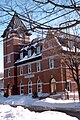
Victoriaville has a National Historic Site : the Musée Laurier was once the home of Canadian Prime Minister Wilfrid Laurier for 20 years and now houses a history museum dedicated to his life and work. Also worth seeing are the former post office (Hôtel des Postes) and the parish church of Saint-Christophe.
population
According to the 2011 census, Victoriaville had 43,462 inhabitants, which corresponds to a population density of 516.2 inh / km². 97.2% of the population stated French as their main language, the share of English was 0.7%. 0.3% said they were bilingual (French and English), other languages and multiple answers accounted for 1.8%. Only French spoke 77.4%. In 2001, 94.5% of the population were Roman Catholic , 2.1% Protestant and 2.7% non-denominational.
Transport and economy
Several national main roads meet in Victoriaville. The Route 116 connects Montreal with Lévis , the Route 122 leads to Drummondville , the Route 161 to Lac Mégantic . The approximately 15 km long Autoroute 955 , which begins just outside the city limits, is a motorway feeder to Autoroute 20 . The regional airport north of the city, which has a 1200 meter long asphalt runway, is used for general aviation and business aviation .
Long known as the furniture capital of Canada, Victoriaville today has a diversified economic structure. The food industry and environmental technology are of particular importance .
Personalities
- René Corbet (* 1973), ice hockey player
- Phillip Danault (* 1993), ice hockey player
- Marie Daveluy (* 1936), singer and music teacher
- Raymond Daveluy (1929–2016), organist, composer and music teacher
- Réal Lemieux (1945–1975), ice hockey player
- Carl Mallette (* 1981), ice hockey player
- Isabelle Mercier (* 1975), poker player
- Gérard Pelletier (1919–1997), politician and diplomat
- Gilbert Perreault (born 1950), ice hockey player
photos
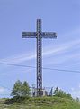
Summit cross on Mont Arthabaska

Saint-Christophe Church
Hôtel des Postes

Laurier Museum


Web links
- Victoriaville Official Website (French)
Individual evidence
- ↑ a b Victoriaville. Commission de toponymie du Québec, accessed January 11, 2014 (French).
- ^ Arthabaska Victoriaville-Les débuts (page 1). Société d'histoire et de généalogie de Victoriaville, 2006, accessed on January 11, 2014 (French).
- ^ Arthabaska Victoriaville-Les débuts (page 2). Société d'histoire et de généalogie de Victoriaville, 2006, accessed on January 11, 2014 (French).
- ↑ Population profile of the municipality of Victoriaville. In: 2011 Census. Statistics Canada , 2011, accessed January 11, 2014 (French).
- ↑ Population profile of the municipality of Victoriaville. In: 2001 Census. Statistics Canada , 2001, accessed January 11, 2014 (French).
- ^ Victoriaville Airport. SkyVector, accessed January 11, 2014 .
- ↑ Portrait économique. City of Victoriaville, accessed January 11, 2014 (French).