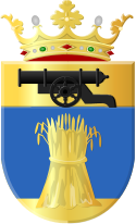
Vlagtwedde
 flag |
 coat of arms |
| province |
|
| local community | Westerwolde |
|
Area - land - water |
170.56 km 2 167.4 km 2 3.16 km 2 |
| Residents | 15,849 (Dec. 31, 2017) |
| Coordinates | 53 ° 2 ' N , 7 ° 7' E |
| Important traffic route |
|
| prefix | 0599 |
| Postcodes | 9541-9549, 9551-9559, 9561-9564 |
Vlagtwedde ( ) is a place and a former municipality in the Netherlands , province of Groningen .
The most important places (from north to south)
- Vlagtwedde
- Bourtange
- Jipsinghuizen
- Sellingen , where the municipal administration is located
- Ter Apelkanaal
- Ter Apel
history
The community is located in the old Saxon district of Westerwolde . This area belonged to the diocese of Münster from 1252 to 1559 , to the county of Aremberg from 1560 to 1617 and from 1619 to the city, and later to the province of Groningen. In practice, however, the city of Groningen had power over Westerwolde from around 1450.
Bourtange, located on a "Tange", a sand ridge, was of great strategic importance as early as the Middle Ages . It was the only passage on the way through the Bourtanger Moor between Groningen and Lingen and on to Westphalia .
When the city of Groningen fell into the hands of the Spaniards through treason during the Eighty Years War , Wilhelm von Oranien had Bourtange expanded into a strong, for the time modern fortress. This was renewed again in 1619. The bishop "Bommen-Berend (Bomben-Bernd)" of Münster, Christoph Bernhard von Galen, was unable to conquer Bourtange in the war of 1672.
The fortress was closed in 1851. As part of the economic development of the area, which threatened to become very poor after the Second World War due to high unemployment, Bourtange was classified as a tourist destination and historical monument from 1972 and has been carefully reconstructed.
Location and economy
The municipality, which is very remote from the Dutch point of view, forms the southeastern tip of the province of Groningen and is bordered by the province of Drenthe and the German Emsland near Rütenbrock (state of Lower Saxony ).
The next motorway is the German A 31 (exits 17 and 19) border crossing Rütenbrock via the federal highway B408 . Ter Apel can only be reached by bus from Emmen or Groningen (journey time 1 to 1.5 hours).
This area has been characterized by agriculture since ancient times. But the presence of some natural and cultural monuments has greatly promoted tourism. The community also tries to attract small, mainly German, industrial and wholesale companies, mainly because of its location near an important German trunk road.
In Ter Apel there is a large complex of buildings in which asylum seekers who are to be evicted from the country remain in custody . It is the largest deportation center in the Netherlands.
Attractions
- The landscape, characterized by small wooded areas, fields and the Ruiten A stream, is popular with nature lovers. You can go on beautiful hikes and bike rides here, also to the neighboring Emsland.
- Parc Emslandermeer, holiday park with marina, subtropical swimming paradise and numerous sports facilities.
- The museum monastery in Ter Apel
- The new nature experience center "Wonderwereld" (= wonder world), intended primarily for children aged 6 to 12 , a few hundred meters south of the monastery near Ter Apel.
- The old Bourtange fortress , completely restored between 1973 and 1992 , with four small museums, two restaurants and some antique and souvenir shops. You can canoe on the canal that surrounds the fortress. Every year actors re-enact old battles from the 16th or 17th centuries. Several tourist markets are also held every summer.
- Sellingen has a medieval village church from the 13th century .
politics
Distribution of seats in the municipal council
| Political party | Seats | |||
|---|---|---|---|---|
| 2002 | 2006 | 2010 | 2014 | |
| Partij Gemeentebelangen | 3 | 4th | 5 | 5 |
| CDA | 5 | 3 | 3 | 4th |
| PvdA | 4th | 6th | 4th | 3 |
| VVD | 3 | 2 | 2 | 1 |
| GroenLinks | 1 | 1 | 2 | 1 |
| PvdD | - | - | - | 1 |
| ChristenUnie | 1 | 1 | 1 | 1 |
| D66 | 0 | - | - | 1 |
| total | 17th | 17th | 17th | 17th |
Personalities
- Anja Hazekamp (* 1968), politician and biologist
- Claudia Bokel (born August 30, 1973 in Ter Apel), German sword fencer
Community partnerships
Parish partnerships exist with the Lower Saxon community of Haren (Ems) and with the French community of Andrésy .
Web links
Individual evidence
- ↑ Bevolkingsontwikkeling; regio per maand Centraal Bureau voor de Statistiek , accessed on June 29, 2018 (Dutch)
- ↑ Allocation of seats in the municipal council: 2002 2006 2010 2014 , accessed on June 29, 2018 (Dutch)
