Wallachian Plain
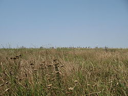
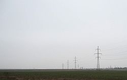
The Wallachian Plain or Romanian Plain ( Rum. Câmpia Română or Câmpia Dunării ) refers to the Romanian part of an extensive lowland in southeastern Europe , on the lower course of the Danube . It is part of the Eurasian steppe belt . The plain continues to a much lesser extent south of the Danube where it is called the " Danube Plain ".
Location and subdivision
Most of this lowland is in Romania (over 80%), in the historical region of Wallachia , from which it got its name. In Romania the level is divided into several sections:
- A. Little Wallachian Plain or Oltenian Plain (Câmpia Olteniei) , named after Little Wallachia , is the westernmost section and includes the following fields:
- Blahniței
- Băileştilor
- Romanați
- B. The Olt-Argeș section lies between the Olt and Argeș rivers
- Pitestilor
- Boianu
- Găvanu-Burdea
- Burnaz
- C. The Bucharest lowlands
- Târgoviştei
- Ploieştilor
- Mizil
- Titu-Gheorghiță
- Vlăsiei
- Câlnăului
- D. The Bărăgan Lowland lies south of the Călmățui River
- Bărăgan of the Călmățui River
- Bărăgan of the
- Mostiştei
- Hagieni
- Brăilei (is often incorrectly added to the Bărăgan section)
- Buzăului
- Râmnicului
- Siretului
- Tecuciului
- Covurlui
- The floodplains of the Danube
- The swampy islands:
- Balta Brăilei or Insula Mare a Brăilei
- Balta Ialomiței
North of the Wallachian Plain are the Wallachian Hills and the Subcarpathian Mountains (in Romania), to the south of them the Moesian Hills (in Bulgaria).
geology
The Wallachian Plain lies on the Moesian Plate and is part of the Moesian Sedimentary Basin . The base is Hercynian , but has a Mesozoic - Cenozoic sediment cover . Another sediment cover took place in the Pleistocene . The layers from the Jurassic and Cretaceous periods are rich in petroleum (especially in Romania); thus the Wallachian Plain is one of the most oil-rich regions in Europe. Loess sediments can be found almost everywhere, and sand dunes in some places .
ground
The soil consists mostly of the nutrient-rich black earth , as well as of alluvial soils along the rivers. Together with the Ukraine, the Wallachian lowlands are the “breadbasket of Europe”.
climate
The climate is temperate continental . The west has Mediterranean influences, while the east is more continental. Especially in the east, the summers are hot and the winters are frosty. Notorious in winter is the Crivăț , a cold continental wind from the northeast (the origin is in the southern Urals Mountains ) and brings permafrost and snowstorms with it.
The mean annual temperatures are 8–11 ° C, summer temperatures are 18–23 ° C, while winter temperatures are −3 to −5 ° C in the east and −1 to −3 ° C in the west. The Wallachian lowlands are relatively dry. In most regions there is a lack of water. The mean rainfall amounts to less than 500 mm in the east and 500–700 mm in the west.
Hydrography
The Danube is the most important flowing body of water and the second largest river in Europe. In addition, numerous rivers cross the plain from north to south (in Romania) or from south to north (in Serbia and Bulgaria). They play an important role in meeting water needs. To the north of the Danube, the following waters should be mentioned: the Jiu , Olt , Călmățui (two rivers bear this name!) , Vedea , Neajlov , Argeș , Dâmbovița , Mostiștea , Ialomița , Buzău , Siret and Prut . From the south the Timok , Lom and Rusenski Lom , Iskar and Jantra flow into the Danube. There are numerous lakes in the floodplains (especially the Danube). During the communist era, some of them were drained (either completely, e.g. Greaca , Bistreț , Suhaia, or partially, e.g. Lake Brateș ).
In the particularly dry interfluvia of the Bărăgan steppe, small steppe lakes can often be found. Their water is mostly salty and is used for curative purposes. As a result, several health resorts have sprung up here over the past two centuries ; the best known are Balta Albă , Amara and Sărata-Monteoru .
Individual evidence
- ↑ Paleogeological Maps - Moesian Platform ( Memento from January 3, 2006 in the Internet Archive ) Paleogeography of the Moesian Platform, Université de Lausanne (English)
Coordinates: 45 ° 0 ′ N , 25 ° 30 ′ E


