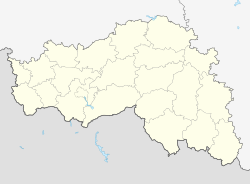
Wolokonowka (Belgorod)
| Urban-type settlement
Wolokonovka
Волоконовка
|
||||||||||||||||||||||||||||||||||
|
||||||||||||||||||||||||||||||||||
|
||||||||||||||||||||||||||||||||||
| List of large settlements in Russia | ||||||||||||||||||||||||||||||||||
Wolokonowka ( Russian Волоко́новка ) is an urban-type settlement in Belgorod Oblast ( Russia ) with 11,552 inhabitants (as of October 14, 2010).
geography
The settlement is located about 90 km east of the Belgorod Oblast Administrative Center on the left bank of the Oskol , a left tributary of the Seversky Donets .
Wolokonowka is the administrative center of the Wolokonowka Raion of the same name and is the only place in which it forms a municipality (gorodskoje posselenije) of the same name.
history
The place came into being after Prince G. Volkonsky recruited volunteers in Akhtyrka , Voroschba and Gluchow (in today's Ukraine ) and settled them in the area. The place name also goes back to the Volkonsky family name. Wolokonowka was still one of the local trading centers in the 18th century and had the status of a Sloboda . The place belonged to the Ujesd Birjutsch of the Voronezh governorate .
During the Soviet period, in 1928, Wolokonovka became the administrative center of the newly created raion of the same name, which was part of Voronezh Oblast until the Belgorod Oblast was spun off in 1954 . During the Second World War , the place was occupied by the German Wehrmacht on July 3, 1942 and recaptured by the Red Army on February 3, 1943 . In 1961, Wolokonovka received urban-type settlement status.
Population development
| year | Residents |
|---|---|
| 1939 | 7,045 |
| 1959 | 8.001 |
| 1970 | 9,989 |
| 1979 | 10,931 |
| 1989 | 12,535 |
| 2002 | 12,256 |
| 2010 | 11,552 |
Note: census data
Attractions
In Volokonovka, the eclectic Church of the Assumption of the Virgin Mary ( церковь Успения Пресвятой Богородицы , tserkov Uspenija Preswjatoi Bogorodizy ) from 1885 has been preserved.
Economy and Infrastructure
There are food and construction industries in Wolokonovka. The place is on the railway line opened on this section on October 1, 1897 , which connects Moscow via Jelez and Waluiki with the Ukrainian Donets Basin (route kilometer 712), which is now operated by the Southeast Railway . The regional road R187 runs through Wolokonowks and connects Nowy Oskol, about 40 km to the north, with Rowenki in the southeast of the oblast.
Individual evidence
- ↑ a b Itogi Vserossijskoj perepisi naselenija 2010 goda. Tom 1. Čislennostʹ i razmeščenie naselenija (Results of the All-Russian Census 2010. Volume 1. Number and distribution of the population). Tables 5 , pp. 12-209; 11 , pp. 312–979 (download from the website of the Federal Service for State Statistics of the Russian Federation)
- ^ Church of the Assumption of Our Lady Wolokonowka at sobory.ru (Russian)
Web links
- Rajon Administration website (Russian)


