
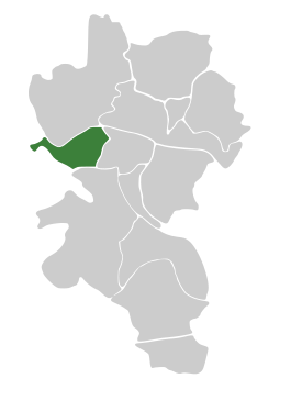
Zellerau
|
district of Würzburg |
|
|---|---|
  |
|
| Coordinates | 49 ° 47 '39 " N , 9 ° 54' 36" E |
| height | 180 m above sea level NHN |
| surface | 3.26 km² |
| Residents | 11,832 (Dec. 31, 2017) |
| Population density | 3629 inhabitants / km² |
| Post Code | 97082 |
| prefix | 0931 |
| Transport links | |
| Federal road |
|
| tram | 2, 4 |
| bus | 7, 9, 22, 18, 47-54 |
| Source: Würzburg.de | |

The Zellerau is a district and at the same time a district of the independent city of Würzburg in the Bavarian administrative district of Lower Franconia .
history
The oldest traces of a settlement in Würzburg were found in the area of Zellerau. Remains of a fortress on the Marienberg from around 1000 BC BC and a stone ax, probably more than 4000 years old, as well as finds from the Bronze Age testify to human settlement. When water pipes were laid under Frankfurter Strasse in 1899, the oldest Germanic graves in Würzburg from the first decades after Christ were discovered.
In 1133 the Benedictine monastery of St. Jakob was founded on the Schottenanger (today Mainviertel). In 1250 the Cistercian monastery Himmelspforten was built . The Schönborn fortifications of the fortress were built after the Thirty Years' War and separated the settlements within the fortification (today: Mainviertel) from those further outside (today: Zellerau).
Between 1714 and 1719 three agricultural estates were built in the north of the Zellerau ( Gut Moschee , Gut Moscow and Gut Talavera , which was converted into a tourist restaurant at the beginning of the 19th century). Until 1927, the land for these goods was bought by the city of Würzburg. The current domicile of the Würzburger Werkstätten in Moscheeweg, which replaced the historic manor house in 1935, is based on the Mosque manor house. The Moscow manor house is now a simple residential building. It has the address Eiseneckstrasse 7. Talavera Manor is now the guest house in the Talavera beer garden, which was completed in 2013 after many years of renovation.
Housing construction on a large scale began at the end of the 19th century, after the opening of the left- Main Main fortification at Zeller Tor in 1870 , initially on Frankfurter Strasse.
In 1873, the Koenig & Bauer company put the production halls for printing machines, which were then used until 1901, into operation on the current Aldi and Dehner site at Frankfurter Strasse 141, as well as the current commercial areas behind it, after the founding site of Oberzell Monastery was gradually removed from the lack of space from 1851 had left.
In 1876 the Royal Brewery (from 1882 Brauhaus AG , from 1934 the Aktiengesellschaft Würzburger Hofbräu ) was relocated from the Mainviertel to today's Höchberger Straße and became the second largest industrial company in Zellerau, exporting Europe-wide and from 1887 also to the USA . In 1886 the brewery of the company later called Würzburger Bürgerbräu was added as a further large employer in the lower Frankfurter Strasse. The Geys malt factory opened in 1901 at Frankfurter Strasse 81 as a supplier to the breweries. From 1878, Johann Rüttinger ran a steam washing facility on Weißenburgstrasse, in 1887 Anton Boegler ran a printing press on Frankfurter Strasse and in 1896 the Fritz Seitz furniture factory was established at Frankfurter Strasse 12.
In 1890 the then 7th company of the Würzburg volunteer fire brigade was founded in Zellerau, which can still be found today as fire engine 4 at Daimlerstrasse 10. Accommodation and equipment were initially very simple, but today there are four ultra-modern fire engines available in the newly converted fire station ; the rest of the technology also meets the highest standards.
From September 1900, connecting the Zellerau with the old town and the main train station, the electric tram from the Juliusspital junction was routed over the newly built Luitpold Bridge to the Bürgerbräu and on November 6, 1900 to the Oberzell monastery. On May 25, 1927, it was reopened as the second Würzburg tram line.
Around 1900 the Zellerau had about 4,300 (civil) inhabitants in 1,000 households. After school barracks were built in 1900 and 1904, the construction of the Zellerauer Schule elementary school, which opened in 1910, began in 1909 .
In 1904 the Bavarian military began building an artillery barracks, which is now the home of the Bavarian riot police . By 1910 , further barracks were built there on Weißenburgstrasse, named after the Battle of Weißenburg (1870) . In 1935 and 1936, two more barracks were opened and the barracks area was expanded at the expense of gardeners to the Himmelspforten monastery. This led to an air raid on the Zellerau on March 31, 1945. The demilitarization of this area, which took place 50 years later, made it possible to further expand the Zellerau in terms of the variety of functions. Today the Friedrich-Koenig-Gymnasium and a municipal youth center are located on the former barracks grounds.

The intensive development of the Zellerau through the use of areas formerly used for agriculture began after the First World War in the area of Fröhlichstrasse, Jägerstrasse and Hartmannstrasse.
There are two Catholic churches in Zellerau, today they are parish communities. The Heiligkreuz parish, the first independent parish in Zellerau, was established in 1935 after the church of the same name was built in 1934.
It was separated from the mother parish of St. Burkard in two steps. First of all, on May 1, 1921, the pastoral care center of St. Jakob was set up in the Schottenangerkirche, the former Schottenkirche rented by the state, for the believers in Zellerau; 14 years later, after numerous efforts, the new Church of the Holy Cross was built with the final establishment of the independent parish.
After the city district had grown considerably due to the influx of refugees as a result of the Second World War, the St. Elisabeth Curate was set up for the outer Zellerau in 1954 and separated from the Heiligkreuz parish. In 1955 the new church of St. Elisabeth was consecrated and the previous curatio was raised to its own parish.
The Deutschhauskirche, not far from the Schottenangerkirche, has served as the Protestant parish church since 1923. The Church of the Redeemer was opened in 1961 to supply the flow of refugees (a historical monument since 1996), a design by Olaf Andreas Gulbransson. As a parish in 1965 independent and in between extended by Zell, Margetshöchheim and Erlabrunn, the latter places were pfarrlich become independent on 1 January 2011, while that of the Sedanstraße to rgerbr reaching Gemeindeteil Erlöserkirche reunited with German house church for the Evangelical Lutheran Church congregation German House Savior.
Branded as a social hot spot after the Second World War, the Zellerau is developing into a preferred district of Würzburg thanks to its good housing and transport infrastructure.
In 1968 the Johannes Foersch School was opened as the second school for people with learning disabilities in Zellerau.
The access road "Zeller Bock", which has been closed since March 2010, was reopened to traffic on April 21, 2016.
education
- Zellerau Middle School, opened as the Zellerau School in 1909
- Elementary School Zellerau [Adalbert Stifter Elementary School = Friedrichstraße Elementary School and Frankfurter Straße branch]
- Deutschhaus high school
- Friedrich-Koenig-Gymnasium
- Christopher School
- Jakob-Stoll-Realschule
- State Fire Brigade School Würzburg
- Elisabeth Weber School
- Friedensreich Hundertwasser School (Schorkstraße), former special educational support center in Würzburg
Culture
In 1999, the Zellerauer Kulturtage was set up by the teacher and long-time rector of the Zellerau secondary school, Oskar Vogel (* 1941) . They were organized in 2017 by Oskar Vogel, Gunther Schunk, Johannes Engels, Andy Sauerwein and Steffen Deeg.
Other facilities
There is an office of the Bavarian State Office for Health and Food Safety (LGL) in Luitpoldstrasse .
literature
- Horst-Günter Wagner : The urban development of Würzburg 1814-2000. In: Ulrich Wagner (Hrsg.): History of the city of Würzburg. 4 volumes, Volume I-III / 2, Theiss, Stuttgart 2001-2007; III / 1–2: From the transition to Bavaria to the 21st century. 2007, ISBN 978-3-8062-1478-9 , pp. 396–426 and 1298–1302, here: pp. 412–414 ( Zellerau - an independent district ).
Web links
Individual evidence
- ^ Horst-Günter Wagner: The urban development of Würzburg 1814-2000. 2007, p. 412.
- ^ Horst-Günter Wagner: The urban development of Würzburg 1814-2000. 2007, p. 413 f.
- ^ Horst-Günter Wagner: The urban development of Würzburg 1814-2000. 2007, p. 412.
- ^ Horst-Günter Wagner: The urban development of Würzburg 1814-2000. 2007, p. 412 f.
- ^ Horst-Günter Wagner: The urban development of Würzburg 1814-2000. 2007, p. 413.
- ^ Sybille Grübel: Timeline of the history of the city from 1814-2006. In: Ulrich Wagner (Hrsg.): History of the city of Würzburg. 4 volumes, Volume I-III / 2, Theiss, Stuttgart 2001-2007; III / 1–2: From the transition to Bavaria to the 21st century. Volume 2, 2007, ISBN 978-3-8062-1478-9 , pp. 1225-1247; here: p. 1238.
- ^ Horst-Günter Wagner: The urban development of Würzburg 1814-2000. In: Ulrich Wagner (Hrsg.): History of the city of Würzburg. 4 volumes, Volume I-III / 2, Theiss, Stuttgart 2001-2007; III / 1–2: From the transition to Bavaria to the 21st century. 2007, ISBN 978-3-8062-1478-9 , pp. 396-426 and 1298-1302, here: p. 405.
- ^ Horst-Günter Wagner: The urban development of Würzburg 1814-2000. 2007, p. 413.
- ^ Harm-Hinrich Brandt : Würzburg municipal policy 1869-1918. In: Ulrich Wagner (Hrsg.): History of the city of Würzburg. 4 volumes; Volume III / 1–2: From the transition to Bavaria to the 21st century. Theiss, Stuttgart 2007, ISBN 978-3-8062-1478-9 ), pp. 64–166 and 1254–1267, here: p. 138.
- ↑ Erik Schlicht: Zellerau street names of military origin. In: Friedrich-Koenig-Gymnasium Würzburg. Annual report 1978/79. Würzburg 1979, pp. 125–127 (from the material appendix to the technical work The decisive years of German history 1866 and 1870/71 as reflected in the history of the Ninth Infantry Regiment in Würzburg ), here: p. 127.
- ^ Horst-Günter Wagner: Urban development of Würzburg 1814-2000. 2007, p. 412 f.
- ↑ Klaus Witt City: church and state in the 20th century. In: Ulrich Wagner (Hrsg.): History of the city of Würzburg. 4 volumes, Volume I-III / 2, Theiss, Stuttgart 2001-2007; III / 1–2: From the transition to Bavaria to the 21st century. 2007, ISBN 978-3-8062-1478-9 , pp. 453–478 and 1304 f., Here: pp. 458–463: The era of the people's and resistance bishop Matthias Ehrenfried (1924–1948). P. 458.
- ^ Sybille Grübel: Timeline of the history of the city from 1814-2006. 2007, p. 1244.
- ↑ Press release of the city of Würzburg - Opening of the Zeller Bock: From April 21st, the cars can start rolling
- ^ Horst-Günter Wagner: The urban development of Würzburg 1814-2000. In: Ulrich Wagner (Hrsg.): History of the city of Würzburg. 2007, p. 1300, note 64.
- ↑ www.josef-Grundschule: to the Friedensreich Hundertwasser School as a cooperation partner .
- ^ City of Würzburg: Oskar Vogel .
- ↑ 19th Zellerau Culture Days: About the ZKT .
- ^ Page of the LGL .

Old town | Dürrbachtal | Frauenland | Grombühl | Heidingsfeld | Heuchelhof | Lengfeld | Lindleinsmühle | Rottenbauer | Sanderau | Steinbachtal | Versbach | Zellerau