Ságújfalu: Difference between revisions
Content deleted Content added
Seacactus 13 (talk | contribs) ←Created page with '{{Infobox settlement | name = Ságújfalu | othere_name = | native_name_lang = | settlement_type = Village (köz...' |
m sp |
||
| Line 53: | Line 53: | ||
| seat = |
| seat = |
||
| government_footnotes = |
| government_footnotes = |
||
| leader_party = |
| leader_party = Independent |
||
| leader_title = Mayor |
| leader_title = Mayor |
||
| leader_name = Szentes Attila |
| leader_name = Szentes Attila |
||
Revision as of 08:46, 30 December 2017
Ságújfalu | |
|---|---|
Village (község) | |
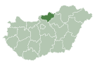
 Location of Nograd County in Hungary | |
| Coordinates: 48°06′14″N 19°40′45″E / 48.10389°N 19.67917°E | |
| Country | |
| Region | Northern Hungary |
| County | Nógrád County |
| Subregion | Salgótarján |
| Government | |
| • Mayor | Szentes Attila (Ind.) |
| Area | |
| • Total | 12.03 km2 (4.64 sq mi) |
| Population (1 Jan. 2015) | |
| • Total | 1,023 |
| • Density | 85/km2 (220/sq mi) |
| Time zone | UTC+1 (CET) |
| • Summer (DST) | UTC+2 (CEST) |
| Postal code | 3162 |
| Area code | 32 |
| Website | http://sagujfalu.hu/ |
Ságújfalu is a village in Nógrád County, Northern Hungary Region, Hungary.[1]
References
- ^ "Central Statistical Office". KSH. Retrieved 22 December 2017.


