
A21 road (England)
The A21 is a major trunk road in Southern England connecting London with Hastings, East Sussex. Half of the distance covered is over difficult terrain, and the hills and bends on the road result in slow-moving traffic, particularly during weekdays over the more rural stretches; and during the summer with holiday traffic. Once clear of London, the by-passes which exist along the road mean that there are few major settlements directly on the route. The road is frequently congested due to roundabouts and stretches of single carriageway. The Highways Agency has plans to dual more of the A21.
Parts of the A21 follow the turnpike roads: one being the section from Sevenoaks to Tunbridge Wells, opened in 1710 [1]; other sections of the road were similarly dealt with later in the century.
The A21 is used for the 55-mile Maydayrun to Hastings which claims to be the largest non-organised event in the UK[2], attracting over 20,000 bikers.
The road between the M25 and Hastings is designated a trunk road, and is maintained and managed by the Highways Agency.
People have described the A21 as 'A Joke' and Business people were reported to “hate coming down the A21” [3].
Overall view of the road
The A21 begins in Lewisham, almost four miles (6.3 mi) southeast of the centre of London. Passing through Catford, Bromley and Farnborough, twenty miles (32km) from the start of the journey, it reaches the Kent border and the open countryside. Shortly afterwards the first of the bypasses is reached, that avoiding Sevenoaks, Tonbridge and Tunbridge Wells; at the end of which the road enters East Sussex. The second bypass takes the road around Lamberhurst, avoiding a river valley, after which the terrain becomes more difficult: we are on the Weald, for the remainder of the journey. The steep hills and long bends typical of the region contribute to the slow-moving traffic at busy periods.
A short bypass immediately before the crossroads at Flimwell gives little redress, for the dual carriageway in both directions has been permanently coned off. The most recent bypass takes the road around the narrow road through Salehurst and Robertsbridge. Immediately before Hastings outskirts is the final hill, almost four miles (6.4km) in length.


The route in detail
London
Traffic from London (Parliament Square), after negotiating the roads immediately south of the River Thames, uses the A20 road; it enters the A21 proper in Lewisham (Loampit Vale Junction). From there the road uses various roads in Catford, where the A205 (the South Circular Road ) crosses the A21; it runs south east up Bromley Hill to enter the London Borough of Bromley, where there are sections of dual carriageway, on the town‘s gyratory system (part of which is called Kentish Way) .
Up Masons Hill the road reaches Bromley Common, the first large-scale open space negotiated; briefly, just before Farnborough, the road becomes Hastings Road. The original A21 went though the town, the High Street is now the B2158. Until now the road has been in a south-easterly direction, but after Green Street Green it turns eastwards towards the valley of the River Darent, and it is at this point that the road pattern makes a complete change from its original route.
- The A21 originally climbed to the scarp of the North Downs at Polhill, and then descended through Dunton Green and up the valley of the River Darent to Sevenoaks; through the town centre and then down into the Medway valley via Hildenborough to Tonbridge. The London Road at the north of the town is now the B245; it continued through the long High Street, over the many bridges of the river (during which time it was also part of the A26 from Maidstone ). As the road began to climb out of the valley it took a left fork; shortly after this the route of the modern A21 is rejoined
Badgers Mt. to Pembury
This article may require copy editing for grammar, style, cohesion, tone, or spelling. (May 2008) |
Where the new A21 begins, and also where the A224 joins from the north, the road is called the Sevenoaks Road; and at Knockholt (Hewitts Roundabout) the road enters Kent near its junction with a spur from the M25 motorway. The A21 here actually multiplexes with the M25 and descends the North Downs Scarp. The M25 then 'TOTSOs' and the A21 takes priority although is still technically a motorway until the junction with the A25 to Sevenoaks and the M26.
South of the junction with the A25, the road enters the longest dual carriageway section along its length, the Sevenoaks and Tonbridge bypasses, which generally has two lanes in each direction. The Sevenoaks bypass runs between the A25 junction, north of Sevenoaks and the A225 junction, between Sevenoaks and Hildenborough, and includes the widest part of the A21 with three lanes climbing the hill northbound from the A225 junction. Between the A225 and A26 junctions, the road is known as the Tonbridge Bypass. This section bypasses the original route of the A21 along the B245 through Hildenborough, Tonbridge High Street and Pembury Road to join the current route near the second A26 junction. The section crosses a few valleys and lakes and includes a few bends.
South of here the A21 remains dualled all the way until Kippings Cross although there is a 1.7 mile (2.7km) single-carriageway section at Castle Hill which has had a long history of delays, causing a bottleneck which is still not resolved (2008) [5].

]]
Pembury to Lamberhurst
The dual carriageway resumes after the Castle Hill bottleneck at the first roundabout since leaving the M25; this section was built to bypass Pembury. The dual carriageway is more bendy than before and has less bridges. You get to a second road to Tunbridge Wells (the A264). There is also a local turning later on into Pembury. From here the road is generally more straight than normal and travels uphill and then level. Later on from the end of this bypass at Kippings Cross, the final 25 miles (40km) of the A21 is generally an often winding single carriageway road with several steep gradients across the Weald. There are few major centres of habitation and the road has remained a "poor relation" insofar as widening schemes are concerned. Press reports such as this are commonplace. In October 2005 the "Preferred Route" to deal with the 3 mile (4.75km) section south of Kippings Cross was announced :see details here.
Goudhurst to Robertsbridge
However, some work has been completed. One of these, the 2 mile £18 million Lamberhurst bypass, was opened on 23 March 2005. Here the road had steep inclines into the village and the valley of the River Bewl. Included in the scheme is a "land bridge" at Scotney Castle. Details are here. On the current bypass the A21 skirts to the east on a bendy road through farms until eventually it gets to scotney castle where the dual carriageway stops at a roundabout.
Both Bewl Water and the Bedgebury Forest flank the road before the two-mile (3km) Flimwell]] bypass. This has recently been reduced to one lane in each direction to reduce speeding. The second of the major works begins at Salehurst, where the Robertsbridge bypass begins, taking traffic away from the narrow main street in the village. It opened in 1992.
- Plans have been published (see here) for a new dual carriageway between the southern end of the Flimwell bypass and the beginning of the Robertsbridge bypass. This would bypass Hurst Green.
Mountfield to Hastings
- From John's Cross the original route of the A21 passed through Battle and entered Hastings at Wishing Tree: this road is now the A2100 (and still meets the A21/A28 at Baldslow).
The present route takes the road to the east on a relatively straight, though undulating, journey, bypassing Sedlescombe before climbing a four-mile (6.4km) long hill to enter Hastings under a road bridge; the A21 has a junction here with the Hastings ring road, The A28 and the A2100 and then continues through Baldslow where the A2101 makes for the town centre, Silverhill and Bohemia and eventually to the town centre to meet the A2101 again which meets the a259 coast road.
Proposed Improvements
Large portions of the A21 through Kent are dual carriageway with intervening stretches of single carriageway. The current plans are to dual the rest of the road through Kent and there are also plans to improve sections through East Sussex which may cause the lane on the short dualled section through the Kent/East Sussex border to reopen.
Tonbridge to Pembury
The Highways Agency has proposed dualling of the short single carriageway around Castle Hill which is one of the most congested sections of the road. This section will be a two-lane dual carriageway with, possibly, a third lane up the hill.[6][7] There were plans for an offine bypass with six lanes (three in each direction). There will also be a Flyover/Improvement at Longfield road roundabout, giving access to a proposed new regional hospital at Pembury, as well as another unclassified road being Grade Separated. [8] The Bypass will cost £64 million. [9] An original plan was to re-align the road to the west and bring it up to a six lane (3 in each direction) standard but was put off due to environmental concerns. [10][11]
Kippings Cross to Lamberhurst
When the Pembury bypass ends at Kippings Cross, the final 25 miles (40km) of the A21 is generally an often winding single carriageway road with several steep gradients across the Weald. There are few major centres of habitation and the road has remained a "poor relation" insofar as widening schemes are concerned. Press reports such as this are commonplace. In October 2005 the "Preferred Route" to deal with the three-mile (4.75km) section south of Kippings Cross was announced.
The Kippings Cross to Lamberhurst section has a high accident rate and congestion occurs particularly at peak times. There are no footways on this section and the verges are either very narrow or non-existent. The route alignment is poor and there are numerous frontages with direct access to the trunk road. The narrow verges limit visibility and this, combined with the numerous bends and crests, limits safe overtaking opportunities.[12] The bypass will be off line for the north western section and have improvements to the A262 roundabout. [13] The Bypass is said to cost £40 million. [14]
Flimwell to Salehurst
Plans have been published for a new road between the southern end of the Flimwell bypass and the beginning of the Robertsbridge bypass. This would bypass Hurst Green and Silver Hill. Although part of the road will be brought up to a dual carriageway standard, parts will become a 'wide single carriageway' [15][16].
Baldsow Interchange
When the Hastings-Bexhill Link Road is complete, more traffic will use the already congested road from the A2100/A28 to the A21 at Baldslow Interchange, Hastings. There are plans to build a short link road to the A21 south of the interchange and bring more of the A21, from there up past to a new roundabout in an area north of the interchange, to dual carriageway standard. Another option is to realign the A2100 north of the junction, but this option is less favourable due to environmental concerns. [17][18]
Other Improvements
These schemes have also been proposed[19]:
Flimwell to Scotney Castle
Robertsbridge to Baldslow
Landmarks
Italic indicates that the landmark is only near or not seen from the route
Junctions
| A21 Road | ||
| Southbound exits | Junction | Northbound exits |
| Start of Dual Carriageway | End of Dual Carriageway | |
| Local Road Start/End of Road | ||
| Foots Cray, Non Motorway Traffic, Riverhead A224 | Foots Cray, Non Motorway Traffic, Riverhead A224 | |
| Kent | ||
| (M20, M11, M1), Dartford Crossing, Maidstone M25 (M23, M3, M4), Gatwick Airport, Heathrow Airport M25 Hastings, Sevenoaks A21 (Multiplex) |
(M20, M11, M1), Dartford Crossing, Maidstone M25 (M23, M3, M4), Gatwick Airport, Heathrow Airport M25 Hastings, Sevenoaks A21 (Multiplex) | |
| Gatwick Airport, Heathrow Airport M25 | Gatwick Airport, Heathrow Airport M25 | |
| Brasted, Westerham, Oxted A25 Riverhead, Sevenoaks, Borough Green, Maidstone A25 |
Brasted, Westerham, Oxted A25 Sevenoaks, Maidstone A25 | |
| Sevenoaks A225 Hildenborough B245 S'oaks Weald |
S'oaks A225 H'borough B245 S'oaks Weald | |
| Tonbridge (West) A26 S'boro, Tun. Wells, |
Tonbridge (West)A26 Southborough, Tun. Wells, Newhaven A26 | |
| Tonbridge A2014 Maidstone, Sheerness A26 |
Tonbridge A2014', Maidstone A26 | |
| Local road | Local road | |
| Royal Tunbridge Wells, East Grinstead, Crawley, Gatwick Airport, Horsham A264 Pembury, Paddock Wood, Maidstone, Rochester A228 |
Tunbridge Wells, East Grinstead, Crawley, Horsham A264 Paddock Wood A228 | |
| Pembury Local road | No exit | |
| Local road to Frant | Local road to Frant | |
| Tunbridge Wells Services | ||
| Goudhurst, Maidstone (A229) A262 Lamberhurst Local Road |
Goudhurst, Maidstone (A229) A262 Lamberhurst Local Road | |
| Hook Green, Lamberhurst Local road Scotney Castle Local road |
Hook Green, Lamberhurst Local road Scotney Castle Local road | |
| Local road | Local road | |
| East Sussex | ||
| End of Dual Carriageway | Start of Dual Carriageway | |
| Hawkhurst, rye A268 | Hawkhurst, rye A268 | |
| Local road | Local road | |
| Maidstone A229 | Maidstone A229 | |
| Lewes A265 | Lewes A265 | |
| Bodiam, Staplecross Local road | Bodiam, Staplecross | |
| Salehurst, Leehurst Local road | Salehurst, Leehust | |
| Robertsbridge Local road | Robertsbridge | |
| Mountfield, Battle, Hastings (NW), Bexhill A2100 | Mountfield, Battle, Bexhill A2100 | |
| Cripps Corner | Cripps Corner | |
| Whatlington, Battle | Whatlington, Battle | |
| Sedlescombe | Sedlescombe | |
| Bulverhythe, Battle A2100 Ore a2100 Ashford, Margate A28 |
Bulerhythe A2100 Ore A2100 Ashford, Margate, Ramsgate A28 | |
Gallery
-
 A21 at Pembury.
 -
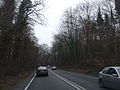
 A21 heading Southbound
 -
Road Bridge at Forest Hill near Sevenoaks
-
 A21 heading towards Hastings.
 -
-
 Lamberhurst bypass.
 -
 A21 at Whatlington.


See also
Great Britain road numbering scheme
References
- ^ Note on turnpike: Sussex Industrial Archaeological Study Group
- ^ [1]
- ^ [2]
- ^ Image from Wikimedia Commons
- ^ Parliamentary speech 2005
- ^ Highways Agency - A21 Tonbridge to Pembury Dualling
- ^ Bbc article on improvements
- ^ http://www.highways.gov.uk/roads/documents/A21_Tonbridge_to_Pembury_AST.pdf
- ^ http://www.southeast-ra.gov.uk/documents/factsheet/39.pdf
- ^ Objections
- ^ Access to Hastings Multi-Model study
- ^ Kippings Cross to Lamberhurst road improvements.
- ^ Economy: Economic Efficiency of the Transport System (TEE)
- ^ SE fact sheet scheme for Kippings Cross to Lamberhurst scheme
- ^ [3]
- ^ [4]
- ^ [http://www.uk-roads.co.uk/gallery/albums/userpics/10259/A21BaldslowJunction.pdf Baldslow-Queensway Link Road Options]
- ^ Baldslow
- ^ A21 Improvements move a step closer
External links
A roads in Zone 2 of the Great Britain road numbering scheme | ||
|---|---|---|