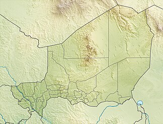
Vein Doutchi
| Vein Doutchi | ||
|---|---|---|
| Highest peak | Touléy ( 746 m ) | |
| location | Tahoua region , Niger | |
|
|
||
| Coordinates | 14 ° 41 ′ N , 5 ° 45 ′ E | |
| rock | Sandstone | |
| surface | 3,500 km² | |
The Ader Doutchi (also: Adar Doutchi , Adar Dutsi , Ader Douchi , Ader Duchi ) is a plateau in Niger .
The name Ader Doutchi refers to the mountains of the Ader landscape in the Tahoua region . In the Hausa language , Doutchi stands for “stone” or “rock”. The name was introduced by the French colonial administration .
The plateau, which extends over approximately 3500 km², is bounded in the north by the upper reaches of the Dallol Maouri , a tributary of the Niger River , known as Tadiss , and in the south by the valley of the Maggia . It is part of the Ader Doutchi Maggia agro-ecological zone . The Doutchi vein reaches heights of around 400 m in the south to around 700 m in the north. The highest point is the 746 m high Touléy hill in the northeast. In the extreme northwest of the plateau is the city center of the regional capital Tahoua . The Doutchi vein also extends over large parts of the municipalities of Allakaye , Badaguichiri , Garhanga , Ibohamane , Illéla , Kalfou , Keita and Tamaské . Other larger villages besides the main towns of the mentioned municipalities are Birni Ader in the center, Bagueye and Sakolé in the north, Laba , Tabofat and Tchimbaba Tané in the east, Angoual Dénia , Dindi and Kaoura Abdou in the south and Toudouni in the west.
In geological terms, sedimentary formations from the Upper Cretaceous , the Eocene and the Pliocene are typical of the Doutchi vein . The sandstone plateau is cut through by deep valleys. The valleys, which are comparatively fertile for the Sahel zone , are predominantly inhabited by Hausa farmers. The two main valleys are the valley of Keita and the valley of Badaguichiri, both of which flow into the Dallol Maouri in the west. Reservoirs are located at the Ibohamane Dam , the Keita Dam and the Tegueleguel Dam .
literature
- Michel Gavaud, Gérard Bocquier: Etude pédologique de l'Ader Doutchi. General report . ORSTOM, Dakar 1964 ( horizon.documentation.ird.fr [PDF]).
- Pierre Jarre, Pierre Chaperon, Pierre Le Duc: Vallées de l'Ader Doutchi. Etude hydrologique: Results de la campagne 1966 . ORSTOM, Paris May 1967 ( horizon.documentation.ird.fr [PDF]).
- Armin Margane: On the hydrogeology of the Ader Doutchi (Département Tahoua, Republic of Niger) . Dissertation. University of Hanover, Hanover 1991.
Individual evidence
- ^ Benedetta Rossi: From Slavery to Aid. Politics, Labor, and Ecology in the Nigerien Sahel, 1800-2000 . Cambridge University Press, New York 2005, ISBN 978-1-107-11905-5 , pp. xxi-xxii .
- ↑ a b c d Pierre Jarre, Pierre Chaperon, Pierre Le Duc: Vallées de l'Ader Doutchi. Etude hydrologique: Results de la campagne 1966 . ORSTOM, Paris May 1967, p. 5–6 ( horizon.documentation.ird.fr [PDF; accessed October 5, 2018]).
- ↑ Ali Laouel Abagana, Issa Mariama Ali Omar: Dallol Maouri. Fiche descriptive Ramsar (FDR). In: Ramsar Sites Information Service. April 26, 2004, pp. 2 and 5 , accessed on July 3, 2019 (French).
- ↑ Le Zonage Agro-écologique du Niger. (PDF) Réseau National des Chambres d'Agriculture (RECA), September 2004, p. 3 , accessed on October 6, 2018 (French).
- ↑ a b c P. Martin: Ader Doutchi Maggia (Niger). Notes on the history of stratégies de lutte anti-erosive . In: Georges De Noni, Eric Roose, Jean-François Nouvelot, Y. Veyret (eds.): Réseau Erosion - Bulletin . Colloque: Journées du Réseau Erosion, 11., Bondy (FRA), 1994/09 / 20-22. No. 15 , p. 266 ( horizon.documentation.ird.fr [PDF; accessed October 4, 2018]).
- ^ Djibo Hamani: L'Adar Précolonial (République du Niger). Contribution à l'étude de l'histoire des États Hausa . L'Harmattan, Paris 2006, ISBN 2-296-00214-5 , pp. 8 (first edition: Institut de Recherches en Sciences Humaines, Niamey 1975).
- ↑ M. Bocquier, M. Gavaud: République du Niger. Carte Pedologique de la Région de l'Ader Doutchi. Localization des observations Pédologiques. ORSTOM, Paris ( esdac.jrc.ec.europa.eu [accessed September 30, 2018]).
- ^ Dams of Africa. (xlsx) Food and Agriculture Organization of the United Nations (FAO), accessed on September 23, 2018 .
- ↑ Moutari Souley: Lancement des travaux de deux barrages in the region of Tahoua . In: Le Sahel . May 13, 2009, p. 5 ( nigerdiaspora.net [PDF; accessed September 29, 2018]).
