
Alt-Oberhausen
|
|||
|---|---|---|---|
| coat of arms | map | ||

|

|
||
| Basic data | |||
| Area : | 24.15 km² | ||
| Residents : | 92,390 (December 31, 2016) | ||
| Population density : | 3.818 inhabitants / km² | ||
| Structure : |

|
||
| Postcodes : | 46045, 46047, 46049, 46117 | ||
| Telephone code : | +49 208 ... | ||
| Distribution of seats for the district council (2014) | |||
| SPD: 7 CDU: 6 GREENS: 2 Left: 2 FDP: 1 BOB: 1 | |||
Alt-Oberhausen is a district of Oberhausen , which, in addition to the original districts of Lirich and the district of Lippern , which fell victim to industrialization, is divided into the districts of Alstaden , Bermensfeld , Borbeck with Dellwig and Frintrop, Dümpten with Vennepoth, Knappenviertel , Neue Mitte with Grafenbusch , Oberhausen -Middle divided with Marienviertel and Brückorviertel , Schlad and Styrum . In the north it borders on the districts of Sterkrade and Osterfeld , in the east on the city of Essen as well as on Mülheim an der Ruhr in the east and south and the city of Duisburg in the west. Its limits correspond to those of the city of Oberhausen from 1929 before the merger with Sterkrade and Osterfeld .
For more see main article Oberhausen .

District Court
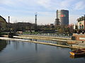
View from the CentrO to the gasometer

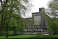
Former lyceum

Town hall branch of the Stadtsparkasse

Police headquarters with Friedensplatz
Town hall with Grillopark

Oberhausen Castle (Small Castle)

Factory inn of the GHH
.jpg)


.jpg)

.jpg)
literature
- Marita Arntz / Dirk-Mario Hampel: Alt-Oberhausen 1900–1930. A photo reading book on the history of the city of Oberhausen . Culturcon-Medien, Berlin 2013. ISBN 978-3-941092-97-6 .
- Achim Nöllenheidt / Andrea Rickers (eds.): 150 years of Alt-Oberhausen . Klartext-Verlag, Essen 2012. ISBN 978-3-8375-0825-3 .
Web links
Individual evidence
Alsfeld | Alstaden | Alt-Oberhausen | Barmingholten | Bermensfeld | Biefang | Borbeck | Brink | Bricktorviertel | Buschhausen | Muffled | Darkfall | Eisenheim | Grafenbusch | Holten | Klosterhardt | Knappenviertel | Königshardt | Lirich | Marienviertel | Neuköln | New center | Osterfeld | Osterfeld-Heide | Rothebusch | Schlad | Schmachtendorf | Black heather | Stemmersberg | Sterkrade | Sterkrader Heide | Styrum | Tackenberg | But rather | Vonderort | Waldhuck | Forest pond | Walsumermark | Weierheide
Coordinates: 51 ° 28 ' N , 6 ° 51' E