
Office Viöl
| coat of arms | Germany map | |
|---|---|---|

|
Coordinates: 54 ° 34 ' N , 9 ° 11' E |
|
| Basic data | ||
| State : | Schleswig-Holstein | |
| Circle : | North Friesland | |
| Area : | 177.75 km 2 | |
| Residents: | 9173 (Dec. 31, 2019) | |
| Population density : | 52 inhabitants per km 2 | |
| License plate : | NF | |
| Office key : | 01 0 54 5453 | |
| Office structure: | 13 municipalities | |
| Office administration address : |
Westerende 41 25884 Viöl |
|
| Website : | ||
| Head of Office : | Thomas Hansen | |
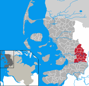
| Location of the Viöl office in the district of North Friesland | ||
  |
||

The Office Viöl is an office in the district of North Friesland in Schleswig-Holstein . It is located in the Viöl municipality of the same name .
Official municipalities
history
In 1889 the county Husum the District Viöl from the Kirchspielslandgemeinde formed Viöl. This consisted of the 16 villages of Behrendorf, Bondelum, Boxlund, Brook, Eckstock, Haselund, Hoxtrup , Kragelund, Kollund, Löwenstedt, Norstedt, Ostenau, Pobüll, Sollwitt, Spinkebüll and Viöl.
In 1934 the parish rural community was dissolved and the village communities formed independent rural communities. In the same year Boxlund and Eckstock were incorporated into Viöl, Brook and Kollund to Haselund, Kragelund to Hoxtrup, Ostenau to Löwenstedt, Pobüll to Sollwitt and Spinkebüll to Norstedt.
In 1948 the district was dissolved and the eight communities formed the parish land municipality Viöl , which changed the name to Amt Viöl in the same year . With the formation of the district of North Friesland, the office was dissolved in 1970 and the municipalities formed with the six municipalities of the office Wester-Ohrstedt (Ahrenviöl, Ahrenviölfeld, Hochviöl , Immenstedt, Oster-Ohrstedt, Schwesing and Wester-Ohrstedt) the office Obere Arlau, which is his name 1978 changed in the office Viöl.
In 1976, Hochviöl and Hoxtrup were incorporated into Viöl.
coat of arms
Blazon : “In silver, a blue wave pole tapering towards the top, covered with the red catwalk of a wooden bridge consisting of thirteen planks. Two isosceles, floating red crosses in the upper corners. "
The two crosses symbolize the two parishes Schwesing and Viöl, from which the official area arose. These are separated by the arlau , which is represented by the wave pile. With its planks, the bridge represents the thirteen official municipalities and is intended to emphasize the opportunity and willingness to meet the residents on the other side.
Web links
Individual evidence
- ↑ North Statistics Office - Population of the municipalities in Schleswig-Holstein 4th quarter 2019 (XLSX file) (update based on the 2011 census) ( help on this ).
- ↑ Schleswig-Holstein's municipal coat of arms