
Viöl
| coat of arms | Germany map | |
|---|---|---|

|
Coordinates: 54 ° 34 ' N , 9 ° 11' E |
|
| Basic data | ||
| State : | Schleswig-Holstein | |
| Circle : | North Friesland | |
| Office : | Viöl | |
| Height : | 22 m above sea level NHN | |
| Area : | 18.95 km 2 | |
| Residents: | 2223 (Dec. 31, 2019) | |
| Population density : | 117 inhabitants per km 2 | |
| Postal code : | 25884 | |
| Area code : | 04843 | |
| License plate : | NF | |
| Community key : | 01 0 54 144 | |
| Office administration address: | Westerende 41 25884 Viöl |
|
| Website : | ||
| Mayor : | Heinrich Jensen ( CDU ) | |
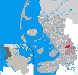
| Location of the municipality Viöl in the district of North Friesland | ||
  |
||


Viöl ( Danish : Fjolde , North Frisian : Fjåål , Low German : Viööl ) is a municipality in the district of North Friesland in Schleswig-Holstein . The municipality is the administrative seat of the Viöl office . The Schleswig-Holstein regional planning classifies the community as a rural central location .
geography
Geographical location
Viöl is located in the Schleswigsche Geest landscape northeast of Husum on the upper reaches of the Arlau and its orographically left tributary Imme in the southern part.
Community structure
In addition to the eponymous capital, Boxlund (Danish: Bokslund ), Eckstock ( Egstok or Ekstok ), Hochviöl ( Højfjolde ), Hoxtrup ( Hokstrup ) and Kragelund are also within the municipality.
Neighboring communities
The municipal areas of Viöl border on:
| Norstedt | Haselund | Sollwitt |
| Ahrenshöft |
.svg)
|
Behrendorf |
| Olderup | Immenstedt |
history
The place was first documented around 1389 and goes back to the old Danish Fialdæ (Mdän. Fjåld ), whereby the old Danish . -ja- in Viöler Danish to -ja- and -jo- has evolved and later, according to the German as Viol was acquired. Furthermore, the / o / was rounded before a / l / in Low German of the 16th century (ndt. Fjöl , ninth. Viöl ), in North Frisian, however, not (North Fr. Fjåål ). The place name is similar to the place name Fjeld in Djursland , which is a forest name. The meaning is outer marrow, uncultivated field (cf. old north. Fjall for highland, mountain ) and as such related to the German field . With reference to similar names in the area (such as Ostenfeld ), the name can refer not only to the place, but also to the region.
The place name Eckstock (Egstok) was first documented in 1483 and means oak stick , oak stake in Danish. eg and ndt. eek for oak . Hoxtrup was mentioned in 1483 and means village of * Hok (the latter a subsidiary form of hokki , -trup to old Danish thorp and mndt. Dorp for village, settlement ). Kragelund was mentioned as Kraalund in the 15th century and goes to Danish. krage for crow (cf. old north. kráka ) and lund for grove, wood in the meaning of crow grove or crow grove .
The local stone church was built around 1100 on the Geestrücken as a fortified church. Today, however, only the original portal is still preserved, today's brick building mostly dates from around 1200, the west tower was built in 1450.
In 1713, during the Great Northern War . Tsar Peter the Great led his troops personally and came through Viöl, where he spent the night with the Tsarina in the pastorate.
In 1750, a water mill was built on the Arlau west of today's B 200. The windmill, which was in operation until 1951, had stood on the Husum-Flensburg road built in 1842 since 1870. It was demolished in September 2006 because the building was dilapidated and could no longer be used.
Until around 1900 the place was surrounded by heather and meadows, but with the construction of the railway line from Husum to Bredstedt and Flensburg it grew rapidly. The Husum-Flensburg route was closed in 1959 due to the increasing number of motorized individual traffic.
In the Reichstag election in 1933 Viöl had the highest result for the NSDAP of all municipalities in the German Reich with 93.1 percent .
The Viöl parish was part of the Nordergoesharde , which was administered by the Flensburg Office until 1785, then by the Bredtstedt Office. After the Prussian province of Schleswig-Holstein was founded in 1866, a parish land municipality was formed from the area of the Viöl parish . It comprised the sixteen villages of Behrendorf , Bondelum , Boxlund, Brook, Eckstock, Haselund , Hoxtrup, Kragelund, Kollund, Löwenstedt , Norstedt , Ostenau, Pobüll, Sollwitt , Spinkebüll and Viöl. On April 1, 1934, the parish land parish was dissolved and its villages, including Viöl, became parishes. On December 1, 1934, Viöl was merged with the neighboring communities Boxlund and Eckstock to form a new community Viöl.
In the years after the end of the Second World War , the town grew mainly due to the influx of people who were displaced , and the structural change away from agriculture changed its character.
On July 1, 1976, the former communities of Hochviöl and Hoxtrup were incorporated.
languages
Until the 20th century, a separate variant of the South Jutian dialect was spoken in Viöl and the surrounding area . The last female speaker of this dialect, Viöl-Danish, Viölsch or Fjoldemål , died in 1937. Other forms of South Jutian are still spoken in Northern Schleswig and in communities near the border between Flensburg and Niebüll .
religion
There is an Evangelical Lutheran parish in Viöl. Their church is the St. Christophorus Church, in whose attic the Viöl Madonna was discovered by chance . This is now in the city museum of Flensburg, in the Viöler church there is a copy. The church was built in the 12th century, initially as a stone church, as Kurt Peter wrote in the church chronicle “St. Christophorus - Geschichte einer Kirche ”, published in 2002, proved.
politics
Local council, mayor
Of the 13 seats in the municipal council, the CDU had seven seats since the 2008 local elections, the SPD and the WGV electoral community each had three seats.
In the local elections on May 26, 2013, the CDU had seven, the SPD three and the WGV four seats. 14 seats were available through an overhang mandate. Heinrich Jensen (CDU) was elected mayor for the 2013–2018 election period. He succeeded Hans Jes Hansen (CDU), who held the office for 31 years.
The local elections on May 6, 2018 led to the following result:
| Political party | Share of votes * | Seats |
| CDU | 54.7% | 7th |
| Active voter community Viöl eV | 45.3% | 6th |
* rounded
The turnout was 53.2%.
coat of arms
Blazon : “Divided by silver and gold by a blue wavy bar on the left. Above a red paw cross, below six red six-pointed stars. "
Culture and sights
Economy and Infrastructure
General
As a rural central location, Viöl has an extensive range of service and retail businesses.
Public institution
The Viöl community fire brigade is divided into two local brigades. These are the Viöl volunteer fire brigade and those from Hoxtrup . There is also a youth fire brigade . The community defense is an important part of the fire services in the Viöl district. In addition to the "normal" tasks, basic training for fire service members is also carried out in Viöl. The police officer and a platoon leader as well as the deputy on-call officer of the fire department are provided.
education
The community is the seat of the school association of the same name. This is the school owner of the primary and community school Viöl - Ohrstedt - Haselund .
traffic
The federal road 200 runs from Husum to Flensburg through the village's location . In Viöl it is crossed (laterally offset) by the Schleswig-Holstein state road 28 from Bredstedt to Böel near Süderbrarup .
In public transport Viöl is connected via the bus line R14 to Husum and Flensburg. The line to Husum runs every hour from Monday to Friday during the day ; to Flensburg this is reduced to a two-hour service in the morning. The on-call bus runs from the central Viöl ZOB transfer station to the neighboring municipalities of the Viöl Office .
Personalities
- Sons and daughters of the church
- Hermann Hansen (1898–1973), politician (NSDAP)
Web links
Individual evidence
- ↑ North Statistics Office - Population of the municipalities in Schleswig-Holstein 4th quarter 2019 (XLSX file) (update based on the 2011 census) ( help on this ).
- ^ Johannes Kok: Det danske folkesprog i Sønderjylland , Volume 2, København 1867, p. 118
- ^ Poul Kürstein: Nørre og Sønder Gøs Herred , Flensburg 1969, p. 246
- ↑ Schleswig-Holstein topography. Vol. 10: Timmaspe - Ziethen . 1st edition Flying-Kiwi-Verl. Junge, Flensburg 2008, ISBN 978-3-926055-92-7 , p. 98 ( dnb.de [accessed on August 9, 2020]).
- ↑ Johannes Kok: Det danske folkesprog i Sønderjylland , Volume 2, København 1867, p. 131
- ^ Wolfgang Laur: Historical place-name dictionary of Schleswig-Holstein. 2nd edition, Neumünster 1992, pp. 251 and 668
- ^ Wolfgang Laur: Historical place-name dictionary of Schleswig-Holstein. 2nd edition, Neumünster 1992, p. 504
- ^ Wolfgang Laur: Historical place-name dictionary of Schleswig-Holstein. 2nd edition, Neumünster 1992, p. 226
- ^ Wolfgang Laur: Historical place-name dictionary of Schleswig-Holstein. 2nd edition, Neumünster 1992, p. 350
- ^ Wolfgang Laur: Historical place-name dictionary of Schleswig-Holstein. 2nd edition, Neumünster 1992, p. 405
- ↑ Working group for research on National Socialism in Schleswig-Holstein e. V.
- ↑ State Statistical Office Schleswig-Holstein (ed.): The population of the communities in Schleswig-Holstein 1867 - 1970 . State Statistical Office Schleswig-Holstein, Kiel 1972, p. 251 .
- ↑ Historical municipality register Schleswig-Holstein: Notes on the municipality Viöl (footnote) . ( Digitized version ).
- ^ Federal Statistical Office (ed.): Historical municipality directory for the Federal Republic of Germany. Name, border and key number changes in municipalities, counties and administrative districts from May 27, 1970 to December 31, 1982 . W. Kohlhammer GmbH, Stuttgart / Mainz 1983, ISBN 3-17-003263-1 , p. 183 .
- ^ Office Viöl aktuell, issue 04-2013
- ↑ Changing of the guard after 31 years , Husumer Nachrichten of July 9, 2013
- ↑ Schleswig-Holstein's municipal coat of arms
- ↑ Home: Viöl municipal fire brigade. Retrieved October 15, 2019 .
- ↑ About the Viöl Voluntary Fire Brigade: Viöl Fire Brigade. Retrieved October 15, 2019 .
- ^ Hoxtrup volunteer fire brigade: Hoxtrup fire brigade. Retrieved October 15, 2019 .
- ↑ About Us: Viöl Youth Fire Brigade. Retrieved October 15, 2019 .
- ^ Training of the Viöl volunteer fire brigade
- ^ Homepage of the community school. Retrieved October 15, 2019 .
- ↑ Timetable for bus route R14. Retrieved October 15, 2019 .
- ↑ Flyer on-call bus area Viöl. (pdf) Retrieved November 13, 2019 .
Achtrup | Ahrenshöft | Ahrenviöl | Ahrenviölfeld | Alkersum | Almdorf | Arlewatt | Aventoft | Bargum | Behrendorf | Bohmstedt | Bondelum | Bordelum | Borgsum | Bosbull | Braderup | Bramstedtlund | Bredstedt | Breklum | Dagebüll | Drage | Drelsdorf | Dunsum | Elisabeth-Sophien-Koog | Ellhöft | Emmelsbüll-Horsbüll | Narrow Sands | Fresendelf | Friedrich-Wilhelm-Lübke-Koog | Friedrichstadt | Galmsbüll | Garding | Garding, parish | Goldebek | Goldelund | Gröde | Grothusenkoog | Haselund | Hattstedt | Hattstedtermarsch | Högel | Spar | Hooge | Hörnum (Sylt) | Horstedt | Hude | Humptrup | Husum | Immenstedt | Joldelund | Kampen (Sylt) | Karlum | Katharinenheerd | Klanxbüll | Klixbull | Koldenbüttel | Kolkerheide | Kotzenbüll | Ladelund | Langeneß | Langenhorn | Leak | Lexgaard | List on Sylt | Löwenstedt | Lütjenholm | Midlum | Mildstedt | Fog | Neukirchen | Nieblum | Niebüll | Norddorf on Amrum | Norderfriedrichskoog | North beach | Norstedt | Ockholm | Oevenum | Oldenswort | Oldersbek | Olderup | Oldsum | Ostenfeld (Husum) | Oster-Ohrstedt | Osterhever | Pellworm | Poppenbüll | Ramstedt | Rantrum | Reußenköge | Risum-Lindholm | Rodenäs | Sankt Peter-Ording | Schwabstedt | Schwesing | Seeth | Simonsberg | Sollwitt | Sönnebüll | Sprakebull | Stadum | Stedesand | Struckum | South end | Süderhöft | Süderlügum | South March | Sylt | Tating | Tetenbull | Tinningstedt | Tönning | Tümlauer-Koog | Uelvesbüll | Uphusum | Utersum | Viöl | Vollerwiek | Vollstedt | World | Wenningstedt-Braderup (Sylt) | Wester-Ohrstedt | Westerhever | Westre | Winnert | Wipe | Witsum | Wittbek | Wittdün on Amrum | Joke word | Wobbenbüll | Wrixum | Wyk on Föhr