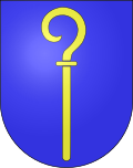
Biel VS
| VS is the abbreviation for the canton of Valais in Switzerland and is used to avoid confusion with other entries of the name Biel (disambiguation) . |
| Biel VS | ||
|---|---|---|
| State : |
|
|
| Canton : |
|
|
| District : | Goms | |
| Municipal municipality : | county | |
| Postal code : | 3989 | |
| Coordinates : | 659 837 / 145222 | |
| Height : | 1312 m above sea level M. | |
|
View of Biel |
||
| map | ||
|
|
||
Biel is a village in the Goms district in the German-speaking part of the canton of Valais .
Community merger
It was a separate municipality until January 1, 2001, when it merged with Ritzingen and Selkingen to form the municipality of Grafschaft . It has belonged to the municipality of Goms since 2017 .
history
Biel was first mentioned in 1277 under Buele. In 1980 a Celtic grave was discovered in Ritzingen . Biel forms the historical center of the so-called Grafschaft (first documented mention in 1344), which stretched from the Walibach near Selkingen to the Reckingerbach and included the former communities of Gluringen , Selkingen, Biel and Ritzingen. The name Grafschaft possibly goes back to the Counts of Mörel, who administered the episcopal fiefdom of Mörel after 1224 and whose history was linked to that of the county . In 1277, Marquard, the knight of Mörel, declared the people of Biel to be free "freelancers" (allod owners). With an Ammann elected by the people and appointed by the bishop (occupied from 1367), the county formed its own judicial association, independent of the episcopal victum or later of the Meier in Goms.
The county administration was incorporated into the upper Zenden Goms (parish of Münster) until the fall of the free court in 1799. Ecclesiastically, Biel belonged to the Münster mother church until the parish was founded in 1678 , but had a chapel and a rectorate since 1322 . After the parish was founded, Gluringen (independent parish since 1920), Selkingen and Ritzingen were detached from Münster and placed under Biel. In 1827 an avalanche destroyed almost half of the village. A station on the Furka-Oberalp Railway has existed since 1915 . In the post-war period, the number of full-time farms fell sharply (13 in 1955; 2 in 1990). Selkingen is merged with Biel in the cattle breeding and dairy cooperative, and in 1958 the Burger Alps of Biel and Ritzingen were united. From the 1970s, Biel benefited from cross-country skiing and hiking tourism in Goms.
population
| Population development | ||||
|---|---|---|---|---|
| year | 1850 | 1900 | 1950 | 1990 |
| Residents | 124 | 94 | 101 | 58 |
Attractions
literature
- Walter Ruppen: Biel . In: Society for Swiss Art History (Hrsg.): Kunstdenkmäler der Schweiz (= vol. 64 ). Das Obergoms vol. 1. Birkhäuser Verlag, Basel 1976, ISBN 3-7643-0728-5 , p. 382-407 .
- Alma Treyer: Biel VS. In: Historical Lexicon of Switzerland . 2017 .
Web links
- Biel VS on the ETHorama platform
|
|
This version of the article is based on the entry in the Historical Lexicon of Switzerland (HLS), which, according to the HLS's usage instructions, is under the Creative Commons license - Attribution - Distribution under the same conditions 4.0 International (CC BY-SA 4.0). If the article has been revised and expanded to such an extent that it differs significantly from the HLS article, this module will be removed. The original text and a reference to the license can also be found in the version history of the article. |


