Burgstall Kirchberg (Lützelburg)
| Burgstall Kirchberg | ||
|---|---|---|
| Alternative name (s): | Luzelunburg | |
| Creation time : | probably 11th century | |
| Castle type : | Höhenburg, spur location | |
| Conservation status: | Left, trenches preserved | |
| Standing position : | Ministerial seat of the Lords of Lützelburg | |
| Place: | Lützelburg (Gablingen) - "Kirchberg" | |
| Geographical location | 48 ° 27 '48.9 " N , 10 ° 46' 23.6" E | |
|
|
||
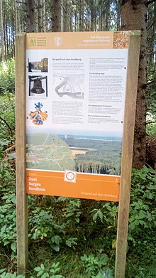
The lost castle stable on the Kirchberg is located on a branch of the forest of the same name between the villages of Lützelburg and Heretsried in the Swabian district of Augsburg in Bavaria . Only features of the terrain and moats have survived from the former Ministerialenburg .
history
Found ceramics prove that the Kirchberg was settled at the beginning of the 13th to the middle of the 14th century. However, it is believed that the castle was built in the 11th century. It was probably the former seat of the ministerial family of the Lords of Lützelburg , who were bailiffs of the Augsburg bishopric . As early as 1100, an Adelgoz de Luzelunburg appears as a witness in a document when the Ochsenhausen monastery was founded .
At the foot of the castle, the abandoned hamlet of Hausen was built in the 11th century . Excavations of a bell also show a parish church with a rectory that existed there until the 15th century . Until then, Hausen had formed its own parish with Heretsried. Allegedly, the village of Heretsried is said to have been settled by residents from Hausen in 1242. Near the castle stables also was a Franciscan nuns - monastery that by founding the monastery Salmannshofen was abandoned, according to deed on 23 December 1282nd
description
The access to the north leads to a triangular outer bailey and from there to the elevated main bailey. The plateau is surrounded by a shield wall with a ditch and secured by a section ditch. Holes and earth walls indicate buildings and a tower. The system measures 135 m in the main axis. During excavations on the hill, bricks and sandstones as well as roof panels were found, which were covered with a layer of fire. This suggests that the main castle was probably destroyed by a fire.
legend
The so-called Kirchberg sage tells of a widowed knight who once lived in the castle with his three daughters. In the absence of their father, who was going on the crusade , the damsels led a dissolute life with neighboring knights. The chaplain warned the ladies who eventually had him killed. As a punishment, a thunderstorm destroyed the castle and the mistresses. Since then, the souls of the damsels have found no rest and wander around the Kirchberg hill on stormy nights.
literature
- Heinrich Habel and Helga Hirmen: Monuments in Bavaria - ensembles, architectural monuments, archaeological site monuments: Volume VII. Swabia , Bavarian State Office for Monument Preservation (ed.), Munich 1985
- Michael Petzet: Monuments in Bavaria: Swabia , Oldenbourg 1986
Web links
- Further information at www.heretsried.de


